How to Get a Drone License: Tips to Save Money & Time

drone-pilot-license-part-107-checklist

Are you interested in obtaining your “drone license” so you can fly your drone and not get in trouble? Are you tired of reading articles written by people with little to no experience in aviation and just want to have an experienced professional tell you what to do?

If so, you are in the right place.

This page is the ultimate guide to educating you on what you need to do to obtain your drone license. This article was not written by some content writer like many of the other websites but by me. I’m a practicing drone attorney and current FAA-certificated flight instructor. I’m going to leverage this knowledge and experience to help you so you can confidently fly your drone without having to wonder if some government inspector would find your drone flying in violation of the law.


Background (How We Got Here)

Drones have been flown for years but the Federal Aviation Administration (“FAA”)  really didn’t start doing much till around 2005. The FAA then published the infamous 2007 policy statement which declared “that people and companies other than modelers might be flying UAS with the mistaken understanding that they are legally operating under the authority of [Advisory Circular] 91-57. AC 91-57 only  applies to modelers, and thus specifically excludes its use by persons or companies for business purposes.” This is where the line started being drawn very deeply in the sand between recreational flyers and non-recreational flyers. The by-product of this policy statement was it essentially made commercial drone flying financially unreasonable if you wanted to do it legally, because you would have to comply with all the Federal Aviation Regulations which were originally designed for manned aircraft.

In February 2012, the FAA Modernization and Reform Act of 2012 was passed. This had beneficial provisions for recreational and non-recreational flyers.

Later in September of 2014, the FAA issued some exemptions under the FRMA’s Section 333 (now called Section 44807). These exemptions at least made commercial drone operations somewhat workable to do but were still plagued with the requirement to have a sport pilot license which could cost $$$ to obtain and the requirement to stay at least 500 feet away from the property you didn’t own and people not participating in your operation. Recreational flying remained largely unchanged during this time.

In May 2016, the FAA issued an interpretation that educational institutions could fly under the recreational category.

The FAA had been working on some commercial drone regulations since 2009 but didn’t make it a priority. Eventually, in 2015 a notice of proposed rule-making was published and on August 29, 2016, Part 101 and Part 107 became law. Part 107 explains how to obtain a drone license for non-recreational flying while Part 101 was for recreational flyers. There was no drone license requirement for recreational drone flyers at this time.

The FAA Re-Authorization Act of 2018 unfortunately repealed the law that allowed recreational drones to be very unregulated but made it law that institutions of higher education could fly under recreational drone laws for educational or research purposes. On 12/11/2020, the FAA withdrew Part 101 subpart E as a regulation because it caused confusion and was overruled by 49 USC 44809 which came from the FAA Reauthorization Act of 2018.


Overview of the Laws

Recreational Drone Test

The recreational drone laws have been in flux where the regulations were created, and the law changed, but the old regulations stayed on the books. Recreational pilots used to fly under 14 CFR Part 101 but the laws changed. Do NOT rely on Part 101 as it is no longer valid law. FAA withdrew Part 101 subpart E.

Currently, recreational fly according to 49 U.S.C. Section 44809. I have an in-depth article on recreational drone laws if you really want to understand everything and actually know exactly what are the recreational drone laws.

So do recreational drone pilots need to obtain a license? No, but they need to pass a test.

The FAA Reauthorization Act of 2018 created a new requirement that recreational drone fliers had to pass a knowledge and safety test. So it functionally acts like a license since you have to pass a test and you’ll use evidence of passing the test to prove you are compliant with the recreational drone laws.

You go and take the Recreational UAS Safety Test (TRUST) from a TRUST administrator.

Before you say “this is for me!”, I suggest you read my thoughts below on why I think recreational flyers should just obtain their remote pilot certificate and fly under that.

Commercial Drone License (Remote Pilot Certificate)

Pilots wanting to fly commercially have the option of flying under Part 107 or under Part 61 and Part 91. Each path has its own license requirements.

If you want to fly under Part 61 & 91 (because you are flying a big drone weighing 55 pounds and heavier or you are doing beyond line of sight package delivery), you’ll by default need a manned aircraft commercial pilot certificate. This is extremely burdensome and expensive. For 95% of these Part 91 operations, we just petition to the FAA to obtain an exemption from the regulations and fly instead with a remote pilot certificate. If you are confused by exemptions, waivers, COAs, etc., read my article where I compare the different methods of obtaining approval to fly.

For like 99% of the commercial drone pilots in the U.S., they fly under Part 107 because it is the easiest to fly under. If a pilot flies under Part 107, they will need to obtain a remote pilot certificate. This article will explain how to obtain this certificate. :)


Which One Is Right for Me?

Recreational drone laws are less burdensome than the non-commercial drone laws. To be in this special less regulated are, the flight must be for recreational purposes which includes educational institutions flying for education and research.

The FAA put out an interpretation memo in 2014 explaining the difference between recreational and non-recreational flights. Important: This interpretation was retracted but you can learn a lot about the FAA’s thoughts on this from this outdated memo because it gave examples.

  • Recreational
    • “Flying a model aircraft at the local model aircraft club.”
    • “Taking photographs with a model aircraft for personal use.”
    • “Using a model aircraft to move a box from point to point without any kind of compensation.”
    • “Viewing a field to determine whether crops need water when they are grown for personal enjoyment.”
  • Not Recreational
    • “Receiving money for demonstrating aerobatics with a model aircraft.”
    • “A realtor using a model aircraft to photograph a property that he is trying to sell and using the photos in the property’s real estate listing. A person photographing a property or event and selling the photos to someone else.”
    • “Delivering packages to people for a fee.”
    • “Determining whether crops need to be watered that are grown as part of commercial farming operation.”

The FAA provided more information on this webpage:

Many people assume that a recreational flight is one that is not operated for a business or any form of compensation. But, that’s not always the case. Financial compensation, or the lack of it, is not what determines if the flight is recreational or commercial. The following information can be used to help you determine what rules you should be operating under. Remember, the default regulation for drones weighing under 55 pounds is Part 107. The exception for recreational flyers only applies to flights that are purely for fun or personal enjoyment. When in doubt, fly under Part 107.

Note: Non-recreational purposes include things like taking photos to help sell a property or service, roof inspections, or taking pictures of a high school football game for the school’s website. Goodwill or other non-monetary value can also be considered indirect compensation. This would include things like volunteering to use your drone to survey coastlines on behalf of a non-profit organization. Recreational flight is simply flying for fun or personal enjoyment.

There are still scenarios that I’m not sure of. Read my section on my thoughts on why you should obtain a remote pilot certificate.

Also, if you are flying in furtherance of your job, even if you are not getting paid for the flight, you are definitely not recreational. So government employees like police and fire will not be eligible for flying as recreational.

At this point, you should have a really good idea of which category you fall into.


What Recreational Drone Flyers Need to Obtain

Recreational UAS Safety Test (TRUST)

You pass the TRUST at one of the Trust Test Administrators.  Here is the list.

What to Study to Prepare for the Recreational Drone Test

The test will be on:

“(A) understanding of aeronautical safety knowledge; and

(B) knowledge of Federal Aviation Administration regulations and requirements pertaining to the operation of an unmanned aircraft system in the national airspace system.”

AC 91-57B compiled a list of study materials. You can study for (B) by reading my recreational drone law article.


Why A Recreational Pilot Should Obtain a Commercial Drone License

I’ve been adamant about recreational flyers obtaining a remote pilot certificate for some years now. You can fly recreationally under Part 107. It doesn’t prohibit you. It’s actually better in multiple ways. Here are 3 ways:

Recreational Pilots Have a Bigger Downside.

I’ve been helping clients navigate responding to FAA investigations. I’ve seen how situations can go south really bad for the recreational guys. Here is the big gotcha……when you violate one of the recreational restrictions, you are no longer seen as recreational but as non-recreational and the rest of the regulations apply. Instead of just a violation for one thing, the violation makes all the Part 107 regulations apply which means you end up getting more violations.

Consider the outcome of these two flyers who both flew over people:

Recreational Flyer Under Section 44809 Recreational Under Part 107
Both Non-Compliant – Flying Over People 107.39
Both Non-Compliant – Flying in a way to cause an undue hazard to people 107.19(c)
Both Non-Compliant – Flying in a careless reckless manner. 107.23
Fail to turn over documents to FAA or law enforcement upon request (because they don’t have a remote pilot certificate). 107.7(b) Compliant
Flying a drone without a remote pilot certificate. 107.12(a) Compliant
Acting as PIC without remote pilot certificate or current knowledge test. 107.12(b) Compliant
Flying without aeronautical currency (passed remote pilot knowledge text) 107.65 Compliant
7 Possible Charges 3 Possible Charges

You have less downside flying under Part 107.

Also, flying around people is problematic recreationally since an FAA safety inspector can have a hard time determining the depth and might misjudge you flying over a person. The same goes for commercial pilots flying under Part 107. This is one reason I’ve suggested that if you are going to be flying near people, just go obtain the over-people waiver. An over-people waiver from me will most likely cost less than a civil penalty from an enforcement action from the FAA. If you need an over-people waiver, contact me because I have obtained some.

More Protections

Here’s what the FAA’s own order on how to do enforcement actions says:

“The Pilot’s Bill of Rights (PBR), Public Law 112-153 (Aug. 3, 2012), as amended by Public Law 115-254 (Oct. 5, 2018), requires investigative personnel to provide airmen who are the subject of an investigation with timely PBR notification, i.e., written notice of the investigation, unless the notification would threaten the integrity of the investigation[.]”

It’s the pilot’s version of a Miranda warning.  Sweet huh? But it’s not required for recreational pilots. The same FAA order says,

“PBR notification is not required to be provided when the apparent violator is not the holder of an airman certificate (or the apparent violation cannot result in legal enforcement action against an airman certificate)”

Clarity and Predictability

People ask me questions about whether can they do such-n-such operations. Here are some examples:

  • Using your drone to take pictures to submit with your home insurance claim.
  • Volunteer fire rescue.
  • Volunteer search and rescue for missing people.
  • OOOOO and the most frequent of all-time question……”I took a picture for fun last month. Turns out people want to buy it. Can I sell it now?”

There are all sorts of arguments and important points that can be made in these scenarios. And I’m sure you have arguments back. Or facts. Whatever. At the end of the day, it’s unpredictable as to how some FAA safety inspector is going to handle your unique factual scenario.

If you have a remote pilot certificate, the answer to all of the scenarios above is really simple.

People Are More Familiar With It.

This is just a practical one. Who in the world actually knows the current state of recreational drone laws? Most cops fly under Part 107. If you get stopped and are complying with Part 107 (something they might be somewhat semi-proficient with), you could have fewer issues during a stop.


Who Can Obtain a Commercial Drone License?

To obtain your commercial drone license you must:

  • Be at least 16 years old
  • Be able to read, speak, write, and understand English (exceptions may be made if the person is unable to meet one of these requirements for a medical reason, such as hearing impairment)
  • Be in a physical and mental condition to safely operate a small UAS
  • For brand new pilots and non-current manned pilots, pass the initial aeronautical knowledge exam at an FAA-approved knowledge testing center which is $175 but some military guys can get it for $0. For current manned pilots, they can take a free online course.

General FAQ’s Surrounding the “Commercial Drone License”

Why do you use the term “commercial drone license” in the title of one of your blog posts when the correct term is a remote pilot certificate?

I know the correct term is remote pilot certificate; however, when writing a blog post, it is important to write a title that would be understood by new individuals or the term used by newbies when searching on Google.  If you were new to this area, what would you type in Google?  Commercial drone license or remote pilot certificate? A simple search on Google search volume shows that “drone license” is more than twice the volume of “remote pilot certificate.” I wrote the articles for first-time pilots, not existing pilots who know how to speak “aviationese.” I also wrote the article to rank high in Google so high-quality information could be found on the drone license.

Do I Need a Pilot License’s to Fly a Drone Commercially?

Yes, but it is NOT one of the expensive manned aircraft pilot licenses most people think about. You only need the Part 107 remote pilot certificate (also informally known as a “commercial drone license”) to operate your drone commercially. This commercial drone license allows you to fly your drone for profit. Keep in mind that you are not limited to profit-making flights. You can fly recreationally under Part 107 or as a government employee (police, fire, etc.).

Does My Business Have to Obtain a Commercial Drone License to Use Drones?

No, only individuals can obtain a drone license. However, businesses can obtain waivers or authorizations and allow their remote pilots to fly under those. There must be a remote pilot in command for each non-recreational flight and they must possess a current drone license.

Why Is It Called a Remote Pilot Certificate and Not a Commercial Drone Pilot License?

The term “pilot license” is what is used commonly to describe FAA airmen certificates. The FAA certificates aircraft, mechanics, airmen, remote pilots, etc., they don’t license.  For non-recreational drone operators, the proper term is a remote pilot certificate. These certificates are being issued with a small unmanned aircraft rating which means the pilot could only operate a drone that is under 55 pounds. I foresee the FAA adding ratings onto the remote pilot certificate for certain types of operations such as over 55-pound operations, night, beyond visual line of sight, etc.

What Happens If I Fly the Drone Commercially Without a Drone License?

You could get fined for each regulation you are violating under Part 107. The FAA has been prosecuting drone operators. You could be violating multiple regulations per flight. If you land and then take off again, that is 2x the number of fines since you are breaking the same regulations again on the second flight. Now you understand why Skypan ended up with a $1.9 million aggregate fine. They later however settled with the FAA for $200,000.

How Can I Obtain the Commercial Drone License?

You have two ways to obtain your commercial drone license:

(1) Pass the remote pilot initial knowledge exam, submit the information onto IACRA,  pass the TSA background check, & receive your remote pilot certificate electronically; or

(2) If you are a current manned aircraft pilot, take the free online training course from the FAA, submit your application on IACRA, and receive your remote pilot certificate electronically.

Each method for obtaining a commercial drone license has different steps from the other. Keep reading below for super detailed step-by-step instructions for EACH of these methods.

I’m Brand New. What Are the Steps to Obtaining a the Drone License?

I have step-by-step instructions here.

What if I Have a Manned Aircraft Pilot Certificate Already?

You still have to obtain the remote pilot certificate (“drone license”). If you have a current biannual flight review and a manned pilot certificate, other than a student pilot certificate, your instructions are located here on how to obtain it.

Is it Harder to Obtain a Commercial Drone License than a Manned Pilot License? 

Any of the manned aircraft pilot licenses require actual flight experience while the remote pilot certificate a.k.a. “drone license” does not have any requirement for the person to have any flight experience.

The 2015 statistics for those taking their remote pilot knowledge exam had a passage rate of 88.29% and those taking the private pilot knowledge exam had a passage rate of 89.44%. Another interesting thing was that the majority of those obtaining their drone license early on were those with manned aircraft pilot licenses. They had the ability to take a free online training course and then apply on IACRA to obtain their drone license. They had to do very little studying to pass the free online training course which explains why the high rates.

Are there any discounts or coupons for the remote pilot knowledge test?

  • AOPA members were able to get a discount. Check to see if that is still the case.
  • JSAMTCC  “In November 2011, the JSAMTCC entered into an MOA with the FAA to provide the full array of airman knowledge tests to select groups of individuals associated with the five branches of the U.S. Military, the DOD, and the Department of Homeland Security (DHS).” Read Chapter 6 for complete info.
    • Active-duty, guard, and reserve component personnel of the U.S. Air Force, U.S. Army, U.S. Coast Guard, U.S. Marine Corps, and U.S. Navy
    • U.S. Military retirees;
    • U.S. Military dependents;
    • Department of Defense (DOD) civilians; and
    • Department of Homeland Security (DHS) civilians.

New Pilot Step-by-Step Guide to Obtain the Drone License.

To prevent any problems with obtaining the drone license, do these steps in the exact order of how they appear in this list.

Step 1. Figure When to Schedule the Test.

  • Take an honest inventory of the hours you have PER DAY to study for the test.
  • Multiply the hours by 5. (You are most likely going have things that pop up during the week and you’ll need a day to rest.)
  • Now you have an idea of how many hours per week you can dedicate to studying.
  • The free study guide I created has a bunch of pages. It’s fluctuating over time as I try and keep it current. Use the total number of pages in that free study guide to estimate how much time it will take to study.  For example, say it is a total of 538 pages to read. 538 pages x 2 minutes = 1,076 minutes of reading (17.93 hours). Keep in mind you are not a robot so you are going to have to go back over and study certain areas to retain the information. If you can set aside 5 hours a week to study, in roughly 3.5 weeks you could have completed all of the reading. I would add on 2 additional weeks for extra studying after you have completed all of the reading to go over the areas that you are having a hard time understanding.

Step 2. Schedule Test Quickly

Immediately schedule a time to take the FAA Part 107 knowledge test at one of the testing sites. Figure out which test site you want to take the test at.

Step 3.  Start Studying

I created free 100+ page Part 107 test study guide. The study guide has the material the FAA suggested you study, but I added essential material they left out. It also comes with 65 sample Part 107 exam questions that are answered and explained. Think of it as your “personal trainer” for Part 107 to get you into a lean mean testing machine. You can read the Part 107 test study guide online or you can sign up for the free drone law newsletter and be able to download the PDF to study on the go. Keep in mind the study guide was for initial test takers. 

Step 4. Make a Business Plan.

Now that you know what the rules are, make a business plan for operations under Part 107 once you obtain the drone license. Go back and skim over the Part 107 Summary and read about Part 107 waivers (COAs). You might want to branch out into non-107 types of operations.

Step 5. Figure Out Peripheral Issues

Once you have figured out what types of industries and operations you plan on doing, you should spend this time:

  • Building or updating your website.
  • Buying the aircraft or practicing flying your current aircraft.
  • Obtaining drone insurance for the aircraft that will perform the operations.
  • Finding an attorney for each of the particular areas of law listed below. You may not need the lawyer right away but you have time to calmly make decisions now as opposed to rapidly making decisions in the future when your business is growing. You won’t have time in the future as you do now. Put their numbers in your phone. Ideally, you should have a retainer/ billing relationship set up to get answers rapidly.
    • Business / tax – (Preferably both)
    • Aviation
    • Criminal – (in case you get arrested because of some drone ordinance you stumbled upon).

Step 6. Take and Pass the Part 107 Knowledge Test.

You will NEED to obtain a FAA Tracking Number (FTN) from Integrated Airman Certificate and/or Rating Application system (IACRA) to take the test. 

Go there and register to obtain your FTN.

Step 7. Complete FAA Form 8710-13:

  1. By filling out the paper-based version of FAA Form 8710-13 and mailing it off  OR  
  2. Online for a remote pilot certificate (FAA Airman Certificate and/or Rating Application) using the electronic FAA Integrated Airman Certificate and/or Rating Application system (IACRA).
      • Login to IACRA with your username and password. If you don’t remember them, follow the “Forgot Username or Password” link.
      • Applicant Console
        • From the Applicant Console, you can start new applications and view any existing applications. Click Start New Application
        • Select ‘Pilot’ from the Application Type drop-down list. This will now show the different types of pilot certificates IACRA has available.
        • Click on Remote Pilot. Starting a Remote Pilot Application
      • The Application Process page will open, and the Personal Information section will be open. This section will be prepopulated with the information you entered when you registered. If no changes are needed, click the green Save & Continue button at the bottom of this section.
      • The Supplementary Data section will open. Answer the English Language and Drug Conviction questions. If you would like to add comments to your application, you can do so here. Click Save & Continue.
      • The Basis of Issuance section will open.
        • Enter all the information related to your photo ID. A US passport or US driver’s license is preferred.
        • Enter the knowledge test ID in the Search box. PLEASE NOTE: It can take up to 72 hours after you take your knowledge test before it is available in IACRA. When you find the test, click the green Associate Test button. Now click Save & Continue.
      • The Review and Submit section will open.
        • Answer the Denied Certificate question.
        • Summary information info will be displayed.
        • You must view the Pilots Bill of Rights, Privacy Act and Review your application before you can continue.
      • Sign and Complete
        • You should now sign the Pilots Bill of Rights Acknowledgement form.
        • Sign and complete your application.
        • Your application is now complete and will be automatically sent to the Airman Registry.
        • After 2-4 days, your temporary certificate will be available in IACRA. You will also receive an email reminder.
        • Your permanent certificate (“drone license”) will arrive by mail.

New Pilot FAQs About the Drone License

If I pass this Part 107 remote pilot exam, can I charge for the flight?

Yes, provided you fly within the requirements of Part 107 and have your drone license.

Part 107 isn’t for model aircraft people but just commercial people, right?

Part 107 has incorrectly been understood to be for commercial flyers.  It isn’t. It is for everyone that can fly under its operational parameters. It is just that non-recreational aircraft flyers can only fly in Part 107 which lead to everyone incorrectly thinking Part 107 is for commercial. This caused confusion because some entities are not recreational or commercial! Non-profit environmental organizations or fire departments are two good situations where they aren’t charging for the flight and cannot fall into model aircraft operations yet they aren’t commercial. Commercial, recreational, government employees, non-profits, etc. can all fly under Part 107.

How much does the remote pilot initial knowledge exam cost?

First-time pilots have to take the initial knowledge exam which is estimated at $175[1] Current manned pilots can either take the initial knowledge exam for $175 or take an initial online training course for free. Either of those are prerequisites to submitting an application to obtain the drone license.

When does Part 107 go into effect?

August 29, 2016.

Where can I take the 107 knowledge exam?

You take it at a knowledge exam testing center. A complete list is located here.

How can I Study for the Part 107 Knowledge Test to Get My Drone License?

I created a FREE 100+ page Part 107 test study guide which includes all the information you need to pass the exam. Let me repeat. ALL the information needed to pass the test is in this study guide. Additionally, the study guide comes with  6 “cram” summary pages, 65 sample Part 107 exam questions that are answered and explained, and 24 super hard brand-new practice questions NO ONE ELSE HAS.

I have been creating online paid video courses which are being sold through a separate company called Rupprecht Drones.

There are many paid training sources out there. But I do not know of any of them that are FAA certificated flight instructors AND also practicing aviation attorneys. Be skeptical of most of the 107 courses out there as some of them had to hire FAA certificated flight instructors to teach the material. This implicitly means they do NOT know the subject. Did the flight instructor they hire edit the material or just merely be recorded. In other words, what quality assurance do you have that the paid 107-course creators didn’t botch something up in the post-production?

Additionally, here is a list of Part 107 articles for you to study further:

How Long Does It Take to Receive My Drone License After I Submit on IACRA?

If you have a pilot certificate and took the initial knowledge exam, you have already passed a TSA security threat assessment background check when you obtained your manned aircraft pilot certificate. This means you will have your drone license faster than someone brand new going through the process.

If you are brand-new, I canNOT estimate because (1) the TSA’s backlog of pending IACRA applications and (2) I don’t know all the factors the FAA and TSA are looking at now.

I saw some link on the Facebook forums about a Part 107 test. I took it and received a certificate. Is this my drone license?

That FAA online test is NOT the Part 107 initial knowledge exam you need to take to obtain your drone license. That test is ONLY for the current manned aircraft pilots who wish to obtain their drone license. That online test by itself isn’t ALL they need to do to obtain the drone license. They still need to do a few additional things.  See Current Manned Aircraft Pilots Step-by-Step Instructions to Obtain the Drone License for more information.

How many different exams are there?

The current manned aircraft pilots can take either the initial online training course or the Part 107 initial knowledge exam while the first time pilots can ONLY take the initial Part 107 knowledge exam. After you receive your drone license, you’ll have to pass recurrent training within 24 calendar-months to keep your currency.

I read some people on Facebook telling me about the law and the drone license……

Let me stop you right there. Getting aviation law advice off Facebook forums is like getting medical help off Craigslist – it’s dumb. Yes, I know there are a few good attorneys online that do help, but there are also a ton of posers. Friends don’t let friends drive drunk or get aviation law info off Facebook. It is stupid to get advice on the internet. If the person on the internet goofs up, what happens is your drone license is on the line and potentially a fine or arrest. They have little downside while you could lose your ability to make money from your drone license.


What happens if I fail the Part 107 initial knowledge test? Am I forever prevented from obtaining the drone license? 

The FAA’s Advisory Circular says on page 27, “Retaking the UAS knowledge test after a failure:

  • 14 CFR part 107, section 107.71 specifies that an applicant who fails the knowledge test may not retake the knowledge test for 14 calendar days from the date of the previous failure.
  • An applicant retesting after failure is required to submit the applicable AKTR indicating failure to the testing center prior to retesting.
  • No instructor endorsement or other form of written authorization is required to retest after failure.
  • The original failed AKTR must be retained by the proctor and attached to the applicable daily log.”

TSA Background Check for the Drone License Questions

I Made Some Mistakes in My Past. What Do the TSA and FAA Look For? What Disqualified Me from Receiving a Drone License?

I don’t know all the factors. I can say the FAA really does not like alcohol and drug related crimes.  They also don’t like a breath refusal.

§107.57   Offenses involving alcohol or drugs.

(a) A conviction for the violation of any Federal or State statute relating to the growing, processing, manufacture, sale, disposition, possession, transportation, or importation of narcotic drugs, marijuana, or depressant or stimulant drugs or substances is grounds for:

(1) Denial of an application for a remote pilot certificate with a small UAS rating for a period of up to 1 year after the date of final conviction; or

(2) Suspension or revocation of a remote pilot certificate with a small UAS rating.

(b) Committing an act prohibited by §91.17(a) or §91.19(a) of this chapter is grounds for:

(1) Denial of an application for a remote pilot certificate with a small UAS rating for a period of up to 1 year after the date of that act; or

(2) Suspension or revocation of a remote pilot certificate with a small UAS rating.

§107.59   Refusal to submit to an alcohol test or to furnish test results.

A refusal to submit to a test to indicate the percentage by weight of alcohol in the blood, when requested by a law enforcement officer in accordance with §91.17(c) of this chapter, or a refusal to furnish or authorize the release of the test results requested by the Administrator in accordance with §91.17(c) or (d) of this chapter, is grounds for:

(a) Denial of an application for a remote pilot certificate with a small UAS rating for a period of up to 1 year after the date of that refusal; or

(b) Suspension or revocation of a remote pilot certificate with a small UAS rating.

I’m a new pilot, does TSA pre-check or global entry count? I want to get my drone license as quick as possible.

Don’t know.

I’m a part 61 pilot trying to obtain my remote pilot certificate, do I have to get TSA background checked?

No, you already had your check when you obtained your Part 61 certificate.

I’m a fire fighter, law enforcement officer, government agency employee, etc……can I get my 107 certificate and then go do government stuff?  

Sure. But keep in mind that sometimes it might be beneficial to get a Public COA to accomplish the mission as there are certain restrictions with Part 107. However, there are Part 107 waivers that can be obtained. Contact me as each situation is different. See my article on public COA vs Part 107. 

 I did a drone certification course with some company, does that count? Is that the same as a drone license?

No, your “certification” is worth nothing. A bunch of these drone courses popped up being taught by unqualified individuals who were far more proficient at WordPress and Mailchimp than they were at teaching weather and manuals. Only the FAA can certify you.

Do you have to have a pilot’s license to fly a drone?

It depends. If you are flying recreationally according to Part 101, you do NOT need to have a pilot license. If you are flying non-recreationally (commercial, etc.), then you would need a pilot certificate.


Current Manned Aircraft Pilots Step-by-Step Instructions to Obtain the Drone License

You may be either a sport, recreational, private, commercial, or air transport pilot. You CANNOT be a student pilot. Additionally, the pilot must be current according to 14 C.F.R. § 61.56. This can be done multiple ways but the most popular is they have a sign off in their logbook saying they have completed their bi-annual flight review (BFR).

For some, getting a BFR can be much more expensive than taking the Part 107 initial knowledge exam which costs $175. You can be a non-current pilot and take the initial knowledge exam, then submit your application on IACRA. You’ll receive your temporary drone pilot license (remote pilot certificate) electronically so many days later. If this is your situation, then do the “first-time pilot” steps above.

From the FAA 2020-2040 Forecast, the FAA stated that 31.36% of the remote pilots ALSO had a Part 61 manned aircraft certificate while 68.64% were only Part 107 airmen.

Step 1. Start Studying

Step 2. Complete the Online Training Course

Look for the “Part 107 small Unmanned Aircraft Systems (sUAS) ALC-451” available on the FAA FAASTeam website.

Step 3. Fill Out Your Application

Complete FAA Form 8710-13 (FAA Airman Certificate and/or Rating Application for a remote pilot certificate)

A. Figure out if you want to do it online at IACRA or by paper (the paper form you print out is located here).

B. Either way, you are going to need to validate applicant identity on IACRA or 8710-13.

    • Contact an FSDO, an FAA-designated pilot examiner (DPE), an airman certification representative (ACR), or an FAA-certificated flight instructor (CFI) to make an appointment to validate your identity. I would suggest doing this with the FSDO because the inspector can give you a temporary certificate at the same time! Look up your local FSDO and make an appointment. Note: FSDO’s almost always do not take walk-ins.  You can also go to a DPE but I think it is better to meet your local FSDO employees because they are the ones that will be doing the investigations in your area.
    • Present the completed FAA Form 8710-13 along with the online course completion certificate or knowledge test report (as applicable) and proof of a current flight review.
    • The completed FAA Form 8710-13 application will be signed by the applicant after the FSDO, DPE, ACR, or CFI examines the applicant’s photo identification and verifies the applicant’s identity. If you are using a CFI to help you process your application, make sure you and they read FAA article below called Tips for CFIs Processing Remote Pilot & Student Pilot Applications.
      • The identification presented must include a photograph of the applicant, the applicant’s signature, and the applicant’s actual residential address (if different from the mailing address). This information may be presented in more than one form of identification.
      • Acceptable methods of identification include, but are not limited to U.S. drivers’ licenses, government identification cards, passports, and military identification cards (see AC 61-65 Certification: Pilots and Flight and Ground Instructors)
    • The FAA representative will then sign the application.

Step 4. Obtain Temporary Certificate 

Find an appropriate FSDO representative, a FAA designated pilot examiner (DPE), or an airman certification representative (ACR) who can issue the applicant a temporary airman certificate. A CFI is not authorized to issue a temporary certificate. CFIs can process applications for applicants who want a temporary certificate and submit the information on IACRA so that the applicate will receive the temporary electronically so many days later.

Step 5.  Receive Permanent Certificate

A permanent remote pilot certificate (drone pilot license) will be sent via mail once all other FAA internal processing is complete.

Step 6. Set a reminder on your calendar to stay current.

The currency is limited so make sure you set a calendar reminder for about 2 months before it runs out. This is discussed more down below.

If you need legal services or want to set up enterprise operations to get all your in-house pilots certified, fleet and pilot management, or crew training, contact me at to help with those needs. I work with many other certified aviation professionals to help large companies integrate drones into their operations to be profitable and legal. When looking for aviation law help, don’t hire a poser – hire an attorney who is a pilot. 


Current Pilot FAQs Regarding the Drone License

How long does my temporary certificate last? 

Section 107.64(a) says, “A temporary remote pilot certificate with a small UAS rating is issued for up to 120 calendar days, at which time a permanent certificate will be issued to a person whom the Administrator finds qualified under this part.”

Do I Have to Get Another Medical Exam Before I Fly Under My Drone License?

No, a remote pilot certificate does NOT require a medical certificate. However, section 107.17 says, “No person may manipulate the flight controls of a small unmanned aircraft system or act as a remote pilot in command, visual observer, or direct participant in the operation of the small unmanned aircraft if he or she knows or has reason to know that he or she has a physical or mental condition that would interfere with the safe operation of the small unmanned aircraft system.”

I’m a current part 61 pilot trying to obtain my remote pilot certificate, do I have to get TSA background checked?

No, you already had your check when you obtained your Part 61 certificate. This means you’ll receive your remote pilot certificate faster than a new pilot.


Currency (Every 24 Months You Have to Prove Your Aeronautical Knowledge) 

Section 107.65 says, a “person may not operate a small unmanned aircraft system unless that person has completed one of the following, within the previous 24 calendar months:

(a) Passed an initial aeronautical knowledge test covering the areas of knowledge specified in §107.73(a);

(b) Passed a recurrent training covering the areas of knowledge specified in §107.73(b); or

(c) If a person holds a pilot certificate (other than a student pilot certificate) issued under part 61 of this chapter and meets the flight review requirements specified in §61.56, passed either an initial or recurrent training course covering the areas of knowledge specified in §107.74(a) or (b) in a manner acceptable to the Administrator.”

You need 1 of the following within the previous 24 calendar months to operate under Part 107; however, if you don’t meet this, you are grounded from flying under Part 107 but you still could fly recreationally under Part 101.

After I take my recurrent training, do I have to do anything else like IACRA?

If you already have your remote pilot certificate, you just need to keep the documentation to prove you did recurrent training. The IACRA thing was for getting the remote pilot certificate but you already have that.

Does your remote pilot certificate expire?

No, you don’t lose your remote pilot certificate. It really shouldn’t be termed recertification as you are NOT getting a certificate again or have to worry about losing the certificate. You just cannot exercise the privileges of the remote pilot certificate.

Everyone typically gets confused by what I just said. I’ll give you some examples.

  • Bob passes an initial aeronautical knowledge test on September 15, 2016 and received his remote pilot certificate. This means Bob needs to do (a),(b), or (c) no later than September 30, 2018. Otherwise, he’ll have to stop flying under Part 107 until he does (a), (b), or (c).
  • Tony passed the exam with Bob on September 15, 2016.   He received his remote pilot certificate. He did not take the recurrent training until October 10, 2018 and passed in the afternoon at 1:34PM. Tony could not fly from October 1-10 up till he passed the test around 1:33-34PM. Once he passed, he was good to go for another 24 months (October 31st, 2020 @ 11:59 PM).
  • Sam, who also passed with Bob and Tony on September 15, 2016, received his remote pilot certificate but didn’t really do much drone flying because of life circumstances. He managed to pass the recurrent training on December 14, 2019. He is good until December 31st, 2021.

Important point.  Please note that when calculating currency, you are going off of when you did (a), (b), or (c) above, NOT when you received your remote pilot certificate or what is dated on your certificate.

How do I check if someone else is current?

You would think the FAA would have just put expiration dates on the remote pilot certificates like they do with my flight instructor certificate but no. If you search the FAA airmen registry, you’ll just see date of issue but not when currency expires.

If you are checking a person’s currency (like if you are hiring a person or if you are a police officer stopping a drone flyer) you need to ask them for:

  • Method 1: their remote pilot certificate AND initial knowledge exam test report or recurrent training documentation or
  • Method 2: their Part 61 pilot certificate (but not student pilot certificate), how they meet the flight review requirements of 61.56, AND their initial or recurrent online training course certificate.

You find the date in method 1 or 2. You add two years and then find the last day of the month. It is important to know this as there might be some scam artists out there trying to save $175 by not taking a knowledge exam and hoping people don’t check.

Dude, are you saying I should bring along my knowledge exam with my remote pilot certificate with me when I fly?

Well, it is a good idea in case that someone you are dealing with also read my article and wonders if you really are current.

Additionally, the FAA said this, “The FAA does not specify the method by which the certificate holder stores and displays his or her knowledge test report or course completion certificate; however, the certificate holder must provide the documents to the FAA upon request.” So a second reason to keep it with you is in case the FAA stops you.


Where can I get some study material?

I have multiple courses over at www.rupprechtdrones.com on particular topics. They are designed to be inch-wide and a mile-deep as opposed to what’s generally available for 107 training. The courses cover many things not covered elsewhere. Just try it out.  You can sign up for a free trial and watch some of the videos.

Ok ok. So you still want the free stuff.

You have two methods:

(1) Click here to be taken to the free knowledge test study guide with everything located in it.

(2) Sign up for the PDF study guide. :) It’s a pop-up you might have ignored on the website.

You can use these articles to study for your drone license or use them to brush up on the material so you can stay proficient and safe.


Conclusion

It looks like we are off to a good start. You have the steps you need to take to achieve your goals and the study materials to assist. If you are trying to figure out next steps after you obtain the certificate, one way to set yourself apart from the typical 107 competition is to obtain waivers or authorizations.  If you are interested in any of the waivers to stand out from the crowd, don’t hesitate to contact me.

[1] https://www.faa.gov/data_research/aviation_data_statistics/test_statistics/media/2015/annual/2015_Airman_Knowledge_Tests.pdf

[2] Id. on Page 2.

[3] https://www.faa.gov/data_research/aviation_data_statistics/civil_airmen_statistics/media/2015-civil-airmen-stats.xlsx


Section 44807 Exemption vs. Part 107 vs. Public COA vs. Blanket Public COA

section-333-exemption-vs-part-107-public-COA-toolbox.jpg

A common issue many people face is comparing the Section 44807 exemption vs. Part 107. On top of that, depending on if you are recreational or government, this throws extra additional problems into the mix.

There are so many choices and making the wrong choice does have consequences in that your operations could unnecessarily be limited.

Don’t you wish someone put them all into an easy-to-figure-out table?

Look no further because you are in the right place.

Let’s start clearing things up.

There is much confusion on this issue because of the different terms, their locations in the law, and the reasons why the different methods of getting a drone airborne legally were created. You need to think of each of these different methods of getting airborne like it was a tool. Each tool was designed to fix certain problems at a certain point in time. Some people can have more than one tool. Wisdom is to know when to use which tool for the job.

Keep in mind that the different methods listed below are only SOME of the methods. I picked the most popular methods of getting airborne legally but there are other alternatives to the ones listed.

Please keep in mind that this article is designed to compare and contrast SOME of the major provisions and is NOT an exhaustive study of all the issues.  In other words, you should not rely on this article for legal advice because there are many issues in play. This is for educational purposes only.


Table Comparing Aircraft, Pilot, Airspace, and Operational Requirements

Please keep in mind these are the major points and not ALL of the points in contrast. If I put everything down, the table would get messy and hard to read.

Aircraft Requirements Pilot Requirements Airspace Requirements Types of Operations
Part 107 Under 55 lbs only. Remote Pilot Certificate with SUAS Rating 
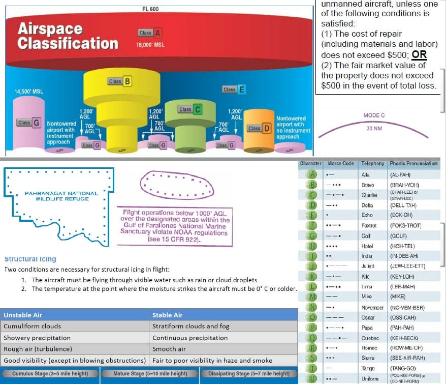
Class G, unless authorized or waived. See 107.41. Day & night, visual line of sight, 400ft AGL(unless within 400ft of a structure), not over people, etc.
Section 44807 (Formerly Section 333) As Required in the Exemption Part 61 Certificate or a Remote Pilot Certificate with the exemption. Driver’s license or 3rd class medical. Most exemptions say to follow the “Blanket COA” which comes with the exemption. It has airspace restrictions. As defined by the exemption. Typically over 55lb+. Can be beyond line of sight or under 55 pounds.
Special Airworthiness Certificate (Experimental Category) Experimental Special Airworthiness Certificate. Part 61 Certificate (Sport, Recreational, Private, Commercial, ATP, but not Student). Follow the terms of the SAC. R&D, Showing Compliance with Regulations, Crew Training, Exhibition, Air Racing, Market Surveys. See Section 21.191.
Special Airworthiness Certificate (Restricted Category) Previously type certificated or manufactured & accepted by an Armed Force of the United States. Part 61 Certificate (Sport, Recreational, Private, Commercial, ATP, but not Student). Follow the terms of the SAC. Agriculture, forest and wildlife conservation, aerial surveying patrolling, weather control, aerial advertising,  or any other operation specified by the FAA. See Section 21.25.
Standard Airworthiness Certificate (21.17(b) Process) Will have all sorts of restrictions. May need extra exemptions and waivers to fix regulatory problems. It is not a complete fix.
Public “Blanket” COA (Version 1.2) Under 55lbs public aircraft only. Self-Certify Class G & at or below 400ft AGL. Beyond 5/3/2 airport distance requirements. Section 40102(a)(41) & 40125(a)(2) and within public “blanket” COA limitations.
Public COA Public aircraft only. Self-Certify Self-Certify 49 USC §§ 40102(a)(41);  40125


Part 107

This part of the regulations went into effect on August 29, 2016. Prior to 107, we were operating predominately under a Section 333 exemptions (now called a 44807 exemption).

For many, Part 107 is the best solution; however, there are particular operations that cannot be done under just Part 107 or a Part 107 waiver such as over 55-pound and heavier operations, crop dusting operations, beyond visual line of sight property transport or moving vehicle in a congested area property transport, etc.   If you are needing help with any of those, contact me.

For operations, that cannot be completed under Part 107, a Section 44807 exemption could be a good alternative, but not always the best. The idea I want to take away is that there are different tools for different problems. Some operators can have multiple tools in their toolbox to accomplish their missions depending on the particular facts. For example, a fire department could have 107 remote pilots, a Section 44807 exemption, and a public COA all at the same time. The problem at hand determines which tool you would pull out of the toolbox.


Section 44807 Exemption (Formerly Called a Section 333 Exemption)

This basically is a legal Frankenstein created using the FAA’s authority given in 49 USC Section 44807, Part 11’s exemption process, and the Part 91 waiver process. The first exemptions came out in September 2014 and were the backbone of the commercial drone industry till Part 107 came out which had far less restrictive requirements.

From September 2014 -November 2016, we saw multiple versions of the exemptions which morphed and changed over time. For example, the early exemptions had restrictions requiring the pilot to keep a 25% battery reserve, it then changed to 30%, and then a 5 minute reserve which goofed over the cinematographers who originally worked with the FAA to craft the exemptions! Why did it hurt cinematographers? Because if their large heavy lift drones had a flight time of 15 minutes, under the original exemptions they would be required to keep a 25% battery reserve (3.75 minutes) while under the newer restrictions it is 5 minutes which results in a loss of available flight time.

In November 2016, the FAA unilaterally updated over 5,000 to all have the same set of restrictions. One wonders how that was not arbitrary and capricious.

The two most problematic restrictions for the exemption operators were the 500ft “bubble” around the drone which non-participating people and property must stay out of and the requirement to operate under a certificate of authorization.

Early on, the exemptions did not come with COAs and people had to apply for them. The FAA quickly learned the error of that and created the “blanket” COA which was issued to all the exemption holders upon approval. The FAA updated the “blanket” COA over time from 200ft AGL to 400ft AGL.  But here is the problem why the certificate of authorization was the second biggest problem, the “blanket” COA is good for operations outside of 5 NM from a towered airport, 3NM from an airport with an instrument approach procedure, or 2NM from an airport, heliport, glider port, etc.  This made operations in cities or near them almost impossible because you would have to apply for a new COA, because the “blanket” COA would not work. People could not obtain a COA in time. The jobs would go to the illegal operators.

The FESSA of 2016 extended the powers to night and beyond the line of sight flying.

The FAA Reauthorization Act of 2018 officially codified the provision into 49 USC Section 44807. These are still being issued but much more rarely. They are for 55-pound and heavier aircraft. The aircraft that need exemptions without any airworthiness issues just do a straight Part 11 exemption (like crop spraying drones flying under Part 107 carrying hazmat which is prohibited by 107).


Airworthiness Certificates

The FAA has been charged with maintaining the safety of the national airspace system and protecting people on the ground. One of the ways the FAA ensures safety is by certifying the aircraft to make sure it is airworthy (it won’t fall out of the sky and kill people). This process which was originally designed for manned aircraft has been used for unmanned aircraft successfully.

There are two types of airworthiness certificates: (1) standard and (2) special.

There has been at least one standard type certificate issued for an unmanned aircraft, two special airworthiness certificates in the restricted category, and multiple special airworthiness certificates in the experimental category.

Obtaining an airworthiness certificate is time-consuming. A major reason it is rarely used today is an operator could just go the Section 44807 exemption route or the Part 107 route. However, there are some instances where a special airworthiness certificate could be more beneficial than the 44807 exemption or Part 107. It just depends on the facts of the intended operations. Different tools in the toolbox.

One point to mention is that an unmanned aircraft would not just need an airworthiness certificate but may also need additional approvals (exemptions and/or waivers)  to be in compliance with the regulations.


Public COA

This method is only available for government agencies. The agency has to be fulfilling certain specific governmental functions under certain conditions for the operator to get the ability to self-certify their own pilot, aircraft, maintenance, and medical standards. The FAA is very strict on the missions and requirements because it does not want government agencies to run commercial types of missions or non-government missions under a public COA which is far less restrictive than other methods.

A government operator obtains a public COA by first sending the FAA a declaration letter outlining the agency and its intended missions fall within the public aircraft statutes, the FAA reviews the declaration letter to determine if it is sufficient, the FAA gives the agency access to the COA portal to file a COA application, the government agency files the COA application, the FAA reviews the COA application and either approves, denies, or asks for more information.  The agency then operates under the public COA and the Federal Aviation Regulations.

When the exemption method was getting into full swing,  public aircraft operators noticed that the exemption process seemed quicker and the “blanket” COAs that were being given out were for the entire United States, except for certain areas, while the public COAs were mission, aircraft, and location specific. This was a no-brainer so government agencies started obtaining exemptions because they were less restrictive than the public COAs.

Other government agencies were upset and wanted a similar deal to the exemption’s blanket COA so the FAA created the “blanket” public COA which is basically a frankensteined version of a public COA, an exemption, and the blanket COA.

Agencies were happy for a while but caught on that the exemptions were evolving to be less restrictive while the blanket public COA stayed the same. For example, the blanket public COA requires the pilot to have a private, commercial, or ATP certificate to operate near certain types of airports while the exemptions required as little as a sport certificate. Additionally, when Part 107 came out, the public blanket COAs still said that the pilot had to have passed the private pilot knowledge exam to fly in most of Class G airspace while a government operator could have their pilots obtain a remote pilot certificate by passing a remote pilot knowledge exam which is easier than a private pilot knowledge exam!

This is why few government agencies today go for a public COA or public blanket COA; however, there are sometimes when a public COA is the best solution for the mission but that is fact specific. Different tools for different problems.


Conclusion

I outlined a brief summation of some of the major points above. There are all sorts of little contrasts between each of the different methods. If you are needing help with obtaining a tool to put in your toolbox (waiver, authorization, exemption, public COA, etc.), contact me.

Paying for 30 minutes of my time can save you lots and lots of headaches, time, and money. We can outline a game plan for your operations in  30 minutes so you can stop wasting time reading and focus on achieving your goals of operating a drone to save time, money, or lives.

Stop wasting time and contact me to schedule a phone call. :)

If you are interested in learning more, I have put below:

Example of a New 44807 Exemption

Example of an Older 333 Exemption

Example of a Blanket COA

Example of a Public “Blanket” COA (Version 1.0)

Example of a Public “Blanket” COA (Version 1.2)


Example of a New 44807 Exemption

Conditions and Limitations
In this grant of exemption, Victor Lee & Associates Inc. is hereinafter referred to as the operator:
1. Operations authorized by this exemption are limited to Shotover U1 conducted by Victor Lee and are limited to the operations described in the petition for exemption and the operating documents. The aircraft’s maximum takeoff weight must not exceed 88 lbs. Proposed operations of any other UAS requires a new petition or a petition to amend this decision.

2. The operator must petition for an amendment to this decision if the operator makes any update or revision to the operating documents, aircraft systems, operating parameters, or other supporting documents that would affect the basis upon which the FAA granted this exemption. The documents on which the FAA relied for granting this petition for exemption are listed above, within the section titled, “Petitioner supports its request with the following information.”

3. Air Traffic Organization (ATO) Certificate of Waiver or Authorization (COA). All operations that occur pursuant to this exemption must be conducted in accordance with an ATO-issued COA. The exemption holder must apply for a new or amended COA if it intends to conduct operations that the terms of the COA do not permit. If a conflict between the COA and this condition exists, the more restrictive provision will apply. In the absence of any express altitude restriction in a COA or any other document the FAA provides that applies to operations under this exemption, the maximum altitude shall be 400 feet above ground level (AGL). Altitude must be reported in feet AGL.

4. The UA must be operated within visual line of sight (VLOS) of the PIC at all times. This requires the PIC to be able to use human vision unaided by any device other than corrective lenses, as specified on the PIC’s FAA-issued airman medical certificate or U.S. driver’s license.

5. All operations must utilize a visual observer (VO). The VO and PIC must be able to communicate orally at all times; electronic messaging or texting is not permitted during flight operations. The PIC must ensure that the VO can perform the duties required of the VO.

6. This exemption does not excuse petitioner from complying with 14 CFR part 375. If operations under this exemption involve the use of foreign civil aircraft, the operator must obtain a Foreign Aircraft Permit pursuant to 14 CFR § 375.41 prior to conducting any commercial air operations under the authority of this exemption. Application instructions are specified in 14 CFR § 375.43.

7. The PIC must be designated before the flight and cannot transfer his or her designation for the duration of the flight. In all situations, the PIC is responsible for the safety of the operation. The PIC is also responsible for meeting all applicable conditions and limitations as prescribed in this exemption and ATO-issued COA, when conducting operations, and operating in accordance with the operating documents.

8. PIC certification. Under this exemption, a PIC must hold at least a Private, Sport, or Recreational Pilot Certificate with a current FAA medical certificate or current U.S. driver’s license issued by a state, the District of Columbia, Puerto Rico, a territory, a possession, or the Federal government. The PIC must also meet the flight review requirements specified in 14 CFR § 61.56 in an aircraft in which the PIC is rated on his or her pilot certificate.

9. PIC qualifications. The PIC must be qualified in accordance with operator and OEM training programs and manuals to operate the Shotover U1 safely and in a manner consistent with how it will be operated under this exemption. The PIC, therefore, must make evasive and emergency maneuvers, and maintain appropriate distances from persons, vessels, vehicles and structures before operating non-training, proficiency, or experience-building flights under this exemption. PICs must remain current and qualified before conducting operations under this exemption. Moreover, PICs must immediately inform the petitioner of any deviations or exemptions they obtain that might affect their compliance with the PIC requirements under this exemption.

10. Prior to each flight, the PIC must conduct a pre-flight inspection, become familiar with all information concerning that flight, pursuant to 14 CFR § 91.103, and determine the UAS is in a condition for safe operation. The pre-flight inspection must account for all potential discrepancies, e.g., inoperable components, items, or equipment. The UA may not operate if the inspection reveals a condition that affects the safe operation of the UAS, until the PIC determines the UAS is in a condition for safe flight.

11. The PIC is prohibited from beginning a flight unless, considering wind and forecast weather conditions, there is enough available fuel for the UA to conduct the intended operation with sufficient reserves such that the PIC can land the UA without posing an undue risk to aircraft or people and property on the ground, o rthe reserve fuel recommended by the manufacturer, if greater, is satisifed.

12. All crewmembers, including PIC and ground personnel used for takeoff and landing, must maintain two-way voice communications with each other during operations. If unable to maintain two-way voice communication, the PIC will land the UA in a safe location as soon as the PIC determines it is practicable to do so. For the purpose of compliance with all conditions and limitations in this exemption, the term “crew member” includes the PIC, the person manipulating the controls, the visual observers (VO), Camera Operator, and a Telemetry Operator and any other personnel required for the safety of the flight operation.

13. No required crewmember may engage in electronic messaging, texting, or other communication using any personal electronic device during flight operations which could distract any crewmember from the performance of his or her duties or which could interfere in any way with the proper conduct of those duties.

14. Each UA must be controlled by only a single control station and one PIC at a time. A PIC may not operate multiple UA at the same time.

15. All operations must be conducted under visual meteorological conditions (VMC). Flights under special visual flight rules (SVFR) are not authorized.

a. The PIC must obtain and use real-time weather information as described in the operating documents.

b. Each operation may only occur when weather in the area of the operation is reported and forecast to be at least 1,000-foot ceiling and 3 statute mile visibility within 1 hour before and 1 hour after takeoff and landing.

c. The PIC must land the Shotover U1 as soon as possible if the PIC is unable to comply with the required ceiling and visibility requirements.

16. Operations under this exemption may not be conducted during night, as defined in 14 CFR § 1.1.

17. The distance between the ground control station and the Shotover U1 must not exceed radio line of sight through the entirety of the proposed flight path during all operations. Operations using multiple ground control stations and/or command and control link relays along the flight path for handoff between ground control stations are prohibited.

18. Any maintenance or alterations that affect the operation of the Shotover U1 or its flight characteristics, such as replacement of a flight critical component, must undergo a functional test flight prior to conducting further operations under this exemption. Functional test flights must be conducted within VLOS by a PIC with the assistance of a VO, and other personnel required to conduct the functional flight test (such as a mechanic or technician) and must remain at least 500 feet from all other people. The functional test flight must be conducted in such a manner to not pose an undue hazard to persons and property. The petitioner must permit the Administrator to observe functional test flights upon the request.

19. The operator must follow the OEM’s operating limitations, maintenance, service bulletins, overhaul, replacement, inspection, and life limit requirements for the Shotover U1 and its components. Each UAS operated under this exemption must comply with all OEM safety bulletins.

20. A copy of the Victor Lee Flight Operations Manual, Aircraft Maintenance Manual/Service Manual, FCC Grant of Equipment Authorization, and a copy of this Manual/Service Manual, FCC Grant of Equipment Authorization, and a copy of this exemption must be accessible to the PIC at the control station during all operations that occur under this exemption, and made available to the Administrator upon request. If a discrepancy exists between the conditions and limitations in this exemption and the procedures outlined in the aforementioned documents, the conditions and limitations herein take precedence and must be followed. Otherwise, the petitioner must follow the procedures as outlined in its operating documents. The petitioner may update or revise its operating documents. The petitioner must track such revisions and present updated and revised documents to the Administrator or any law enforcement official upon request. If the petitioner determines that any update or revision would affect the bases upon which the FAA granted this exemption, then the petitioner must petition for an amendment to its grant of exemption. In this regard, this document describes all such bases. The petitioner must also present updated and revised documents if it petitions for extension or amendment to this grant of exemption. The petitioner must submit such updates by contacting the FAA’s Flight Standards Service, General Aviation and Commercial Division.

21. All flight operations must be conducted at least 500 feet from all persons who are not directly participating in the operation, and from vessels, vehicles, and structures, unless when operating:

a. Over or near people directly participating in the operation. People directly participating in the operation of the Shotover U1 include the PIC, crewmembers, and other consenting personnel whose presence is necessary to ensure the safety of the operation.

b. Near nonparticipating persons. The Shotover U1 may be operated closer than 500 feet to a person who is not directly participating in the operation only when barriers or structures are present. Such barriers must sufficiently protect the person from the aircraft and from debris or hazardous materials from the aircraft. Under these conditions, the petitioner must ensure the person remains under such protection for the duration of the operation. If a situation arises in which the person leaves such protection and is within 500 feet of the Shotover U1, flight operations must cease immediately in a manner that does not cause undue hazard to any person.

c. Near vessels, vehicles and structures. Prior to conducting operations within 500 feet of any vessels, vehicles, or structures, the petitioner must obtain permission to proceed within 500 feet from a person with authority over such vessels, vehicles or structures. The PIC must first assess the risk of operating closer to those objects and determine that it does not present an undue hazard.

22. The UA may not be operated less than 500 feet below or less than 2,000 feet horizontally from a cloud or when visibility is less than 3 statute miles from the PIC.

23. The UA must remain clear and give way to all manned aviation operations and activities at all times.

24. Operations under this exemption may not occur from any moving vehicle or aircraft.

25. Frequency spectrum approval is independent of this grant of exemption and the FAA COA process. The FAA encourages the operator to remain aware of all relevant requirements of the Federal Communications Commission (FCC), especially those concerning frequency spectrum use. Please see the appropriate provisions of title 47, Code of Federal Regulations.

26. The PIC may not begin or continue a flight if any GPS outage, signal fault, integrity issue, NOTAM in effect for any part of the planned operational area, or any other condition affects the functionality or validity of the GPS signal.

27. The PIC must abort the flight operation if circumstances or emergencies arise that could degrade the safety of persons or property. In such cases, the PIC’s termination of flight operations must not cause undue hazard to persons or property.

28. Accidents must be reported to the National Transportation Safety Board (NTSB) per instructions contained on the NTSB Web site: www.ntsb.gov.

29. All training operations must be conducted during dedicated training sessions. Training to conduct operations with the Shotover U1 must not occur adjacent to neighborhoods, or near or over people.

30. This exemption is not valid for operations outside of the United States.

Unless otherwise specified in this exemption, the UAS, the UAS PIC, and the UAS operations must comply with all applicable parts of 14 CFR including, but not limited to, parts 45, 47, 61, and 91.


Example of an Older 333 Exemption 

Dear Section 333 Exemption Holder:
This letter is to inform you that we are amending your exemption that authorizes unmanned aircraft operations under Section 333.1 It explains the basis for our decision, describes its effect, and lists the revised Conditions and Limitations.
The Federal Aviation Administration (FAA) has determined that good cause exists for not publishing a summary of the petition in the Federal Register because this amendment to the exemption would not set a precedent, and any delay in acting on this petition would be detrimental to the petitioner. The unmanned aircraft authorized in the original grant are comparable in type, size, weight, speed, and operating capabilities to those in this petition.

Additionally, the FAA has finalized the first operational rules for routine commercial use of small unmanned aircraft systems (sUAS) (part 107, Operation and Certification of Small Unmanned Aircraft Systems). The new rule, which went into effect August 29, 2016, offers safety regulations for sUAS weighing less than 55 pounds that are conducting non-hobbyist operations. The vast majority of operations authorized under previously-issued exemptions under Section 333 have been addressed by part 107; now that part 107 is in effect, these operations do not necessitate an exemption. However, your Section 333 exemption remains valid until it expires. You may continue to fly following the Conditions and Limitations in your exemption and under the terms of a Certificate of Waiver or Authorization (COA). If your operation can be conducted under the requirements in part 107, you may elect to operate under part 107; however, if you wish to operate under part 107, you must obtain a remote pilot certificate and follow the operating rules of part 107. For more information, please visit: http://www.faa.gov/uas/.

The Basis for Our Decision
The FAA has previously issued a grant of exemption for relief from §§ 61.23(a) and (c), 61.101(e)(4) and (5), 61.113(a), 61.315(a), 91.7(a), 91.119(c), 91.121, 91.151(a)(1), 91.405(a), 91.407(a)(1), 91.409(a)(1) and (2), and 91.417(a) and (b) of Title 14, Code of Federal Regulations (14 CFR). That exemption allows the operators to operate UAS to perform aerial data collection or aerial data collection and closed-set filming and television production.
The FAA has revised the Conditions and Limitations issued in exemptions authorizing unmanned aircraft operations under Section 333 since the petitioner’s previous grant of exemption to those found in Exemption No. 15005 to Thomas R. Guilmette (see Docket No. FAA-2015-5829). Also in Exemption Nos. 13465A to Kansas State University (see Docket No. FAA-2014-1088), 11433A to Cape Productions (see Docket No. FAA-2015-0223), 11213 to Aeryon Labs, Inc. (see Docket No. FAA-2014-0642), 11062 to Astraeus Aerial (see Docket No. FAA−2014−0352), 11109 to Clayco, Inc. (see Docket No. FAA−2014−0507), 11112 to VDOS Global, LLC (see Docket No. FAA−2014−0382), the FAA found that the enhanced safety achieved using a sUAS with the specifications described by the petitioner and carrying no passengers or crew, rather than a manned aircraft of significantly greater proportions, carrying crew and flammable fuel, gives the FAA good cause to find that the UAS operation enabled by this exemption is in the public interest.

Our Decision
The FAA has modified the Conditions and Limitations to address aircraft, training, tethered operations, aircraft registration, and flight operations near persons, vessels, vehicles, and structures. Additionally, in previous exemptions, the FAA limited UAS operations to outside 5 nautical miles of an airport reference point (ARP) as denoted in the current FAA Airport/Facility Directory (AFD) or for airports not denoted with an ARP, the center of the airport symbol as denoted on the current FAA-published aeronautical chart unless a letter of agreement (LOA) with that airport’s management is obtained or otherwise permitted by a COA issued to the exemption holder. The FAA has removed that condition. In order to maintain safety in the vicinity of airports in Class B, C, or D airspace, the petitioner must apply to the Air Traffic Organization (ATO) for a new or amended COA. The FAA has determined that the justification for the issuance of Section 333 exemptions remains valid and is in the public interest. Therefore, under the authority contained in 49 U.S.C. 106(f), 40113, and 44701, delegated to me by the Administrator, the operator is granted an amendment to its exemption from 14 CFR §§ 61.23(a) and (c), 61.101(e)(4) and (5), 61.113(a), 61.315(a), 91.7(a), 91.119(c), 91.121, 91.151(a)(1), 91.405(a), 91.407(a)(1), 91.409(a)(1) and (2), and 91.417(a) and (b), to the extent necessary to allow the petitioner to conduct UAS operations. This exemption is subject to the Conditions and Limitations listed below.The list of affected docket numbers is included in Appendix A. The operator shall add this amendment to all previously-issued exemption(s). Without the original exemption and all subsequent amendments, this amendment is not valid.

Conditions and Limitations
The Conditions and Limitations within the previously-issued grant of exemptions have been superseded, and are amended as follows. Failure to comply with any of the Conditions and Limitations of this grant of exemption will be grounds for the immediate suspension or rescission of this exemption.

  1. The operator is authorized by this grant of exemption to use any aircraft identified on the List of Approved Unmanned Aircraft Systems (UAS) under Section 333 at regulatory docket FAA–2007–3330 at www.regulations.gov, when weighing less than 55 pounds including payload. Proposed operations of any aircraft not on the list currently posted to the above docket will require a new petition or a petition to amend this exemption.
  2.  If operations under this exemption involve the use of foreign civil aircraft the operator would need to obtain a Foreign Aircraft Permit pursuant to 14 CFR § 375.41 before conducting any commercial air operations under this authority. Application instructions are specified in 14 CFR §375.43. Applications should be submitted by electronic mail to the DOT Office of International Aviation, Foreign Air Carrier Licensing Division. Additional information can be obtained via https://cms.dot.gov/policy/aviation-policy/licensing/foreign-carriers.
  3. The UA may not be operated at a speed exceeding 87 knots (100 miles per hour). The operator may use either groundspeed or calibrated airspeed to determine compliance with the 87 knot speed restriction. In no case will the UA be operated at airspeeds greater than the maximum UA operating airspeed recommended by the aircraft manufacturer.
  4. The UA must be operated at an altitude of no more than 400 feet above ground level (AGL). Altitude must be reported in feet AGL. This limitation is in addition to any altitude restrictions that may be included in the applicable COA.
  5. Air Traffic Organization (ATO) Certificate of Waiver or Authorization (COA). All operations must be conducted in accordance with an ATO-issued COA. The exemption holder must apply for a new or amended COA if it intends to conduct operations that cannot be conducted under the terms of the enclosed COA.
  6. The Pilot in Command (PIC) must have the capability to maintain visual line of sight (VLOS) at all times. This requires the PIC to be able to use human vision unaided by any device other than corrective lenses, as specified on that individual’s FAA-issued airman medical certificate or valid U.S. driver’s license issued by a state, the District of Columbia, Puerto Rico, a territory, a possession, or the Federal Government, to see the UA.
  7. All operations must utilize a visual observer (VO). The UA must be operated within the visual line of sight (VLOS) of the VO at all times. The VO must use human vision unaided by any device other than corrective lenses to see the UA. The VO, the person manipulating the flight controls of the small UAS, and the PIC must be able to communicate verbally at all times. Electronic messaging or texting is not permitted during flight operations. The PIC must be designated before the flight and cannot transfer his or her designation for the duration of the flight. The PIC must ensure that the VO can perform the duties required of the VO. Students receiving instruction or observing an operation as part of their instruction may not serve as visual observers.
  8. This exemption, the List of Approved Unmanned Aircraft Systems (UAS) under Section 333 at regulatory docket FAA-2007-3330 at www.regulations.gov, all previous grant(s) of exemption, and all documents needed to operate the UAS and conduct its operations in accordance with the Conditions and Limitations stated in this exemption, are hereinafter referred to as the operating documents. The operating documents must be accessible during UAS operations and made available to the Administrator upon request. If a discrepancy exists between the Conditions and Limitations in this exemption, the applicable ATO-issued COA, and the procedures outlined in the operating documents, the most restrictive conditions, limitations, or procedures apply and must be followed. The operator may update or revise its operating documents as necessary. The operator is responsible for tracking revisions and presenting updated and revised documents to the Administrator or any law enforcement official upon request. The operator must also present updated and revised documents if it petitions for extension or amendment to this exemption. If the operator determines that any update or revision would affect the basis upon which the FAA granted this exemption, then the operator must petition for an amendment to its exemption. The FAA’s UAS Integration Office may be contacted if questions arise regarding updates or revisions to the operating documents.
  9. Any UAS that has undergone maintenance or alterations that affect the UAS operation or flight characteristics, e.g. replacement of a flight critical component, must undergo a functional test flight prior to conducting further operations under this exemption. Functional test flights may only be conducted by a PIC with a VO and essential flight personnel only and must remain at least 500 feet from all other people. The functional test flight must be conducted in such a manner so as to not pose an undue hazard to persons and property.
  10. The operator is responsible for maintaining and inspecting the UAS to ensure that it is in a condition for safe operation.
  11. Prior to each flight, the PIC must conduct a pre-flight inspection and determine the UAS is in a condition for safe flight. The pre-flight inspection must account for all potential discrepancies, e.g. inoperable components, items, or equipment. If the inspection reveals a condition that affects the safe operation of the UAS, the aircraft is prohibited from operating until the necessary maintenance has been performed and the UAS is found to be in a condition for safe flight.
  12. The operator must follow the UAS manufacturer’s maintenance, overhaul, replacement, inspection, and life limit requirements for the aircraft and aircraft components. Each UAS operated under this exemption must comply with all manufacturer safety bulletins.
  13. PIC certification: Under this grant of exemption, a PIC must hold either an airline transport, commercial, private, recreational, or sport pilot certificate. The PIC must also hold a current FAA airman medical certificate or a valid U.S. driver’s license issued by a state, the District of Columbia, Puerto Rico, a territory, a possession, or the Federal government. The PIC must also meet the flight review requirements specified in 14 CFR § 61.56 in an aircraft in which the PIC is rated on his or her pilot certificate.
  14. PIC qualifications: The PIC must demonstrate the ability to safely operate the UAS in a manner consistent with how it will be operated under this exemption, including evasive and emergency maneuvers and maintaining appropriate distances from persons, vessels, vehicles, and structures before conducting student training operations. Flights for the pilot’s own training, proficiency, or experience-building under this exemption may be conducted under this exemption. PIC qualification flight hours and currency may be logged in a manner consistent with 14 CFR § 61.51(b), however, UAS pilots must not log this time in the same columns or categories as time accrued during manned flight. UAS flight time must not be recorded as part of total time.
  15. Training: The operator may conduct training operations when the trainer/instructor is qualified as a PIC under this exemption and designated as PIC for the entire duration of the flight operation. Students/trainees are considered direct participants in the flight operation when manipulating the flight controls of a small UAS and are not required to hold any airman certificate. The student/trainees may be the manipulators of the controls; however, the PIC must directly supervise their conduct and the PIC must also have sufficient override capability to immediately take direct control of the small UAS and safely abort the operation if necessary, including taking any action necessary to ensure safety of other aircraft as well as persons and property on the ground in the event of unsafe maneuvers and/or emergencies for example landing in an empty area away from people and property.
  16. Under all situations, the PIC is responsible for the safety of the operation. The PIC is also responsible for meeting all applicable Conditions and Limitations as prescribed in this exemption and ATO-issued COA, and operating in accordance with the operating documents. All training operations must be conducted during dedicated training sessions and may or may not be for compensation or hire. The operation must be conducted with a dedicated VO who has no collateral duties and is not the PIC during the flight. The VO must maintain visual sight of the aircraft at all times during flight operations without distraction in accordance with the Conditions and Limitations below. Furthermore, the PIC must operate the UA not closer than 500 feet to any nonparticipating person without exception.
  17. UAS operations may not be conducted during night, as defined in 14 CFR § 1.1. All operations must be conducted under visual meteorological conditions (VMC). Flights under special visual flight rules (SVFR) are not authorized.
  18. The UA may not be operated less than 500 feet below or less than 2,000 feet horizontally from a cloud or when visibility is less than 3 statute miles from the PIC.
  19.  For tethered UAS operations, the tether line must have colored pennants or streamers attached at not more than 50 foot intervals beginning at 150 feet above the surface of the earth and visible from at least 1 mile. This requirement for pennants or streamers is not applicable when operating exclusively below the top of and within 250 feet of any structure, so long as the UA operation does not obscure the lighting of the structure.
  20. For UAS operations where GPS signal is necessary to safely operate the UA, the PIC must immediately recover/land the UA upon loss of GPS signal.
  21. If the PIC loses command or control link with the UA, the UA must follow a predetermined route to either reestablish link or immediately recover or land.
  22. The PIC must abort the flight operation if unpredicted circumstances or emergencies that could potentially degrade the safety of persons or property arise. The PIC must terminate flight operations without causing undue hazard to persons or property in the air or on the ground.
  23. The PIC is prohibited from beginning a flight unless (considering wind and forecast weather conditions) there is enough available power for the UA to conduct the intended operation and to operate after that for at least five minutes or with the reserve power recommended by the manufacturer if greater.
  24. All aircraft operated in accordance with this exemption must be registered in accordance with 14 CFR part 47 or 48, and have identification markings in accordance with 14 CFR part 45, Subpart C or part 48.
  25. Documents used by the operator to ensure the safe operation and flight of the UAS and any documents required under 14 CFR §§ 91.9 and 91.203 must be available to the PIC at the Ground Control Station of the UAS any time the aircraft is operating. These documents must be made available to the Administrator or any law enforcement official upon request.
  26. The UA must remain clear of and give way to all manned aircraft at all times.
  27. The UAS may not be operated by the PIC from any moving device or vehicle.
  28. All flight operations must be conducted at least 500 feet from all persons, vessels, vehicles, and structures unless when operating:

a. Over or near people directly participating in the operation of the UAS. People directly participating in the operation of the UAS include the student manipulating the controls, PIC, VO, and other consenting personnel that are directly participating in the safe operation of the UA.

b. Near but not over people directly participating in the intended purpose of the UAS operation. People directly participating in the intended purpose of the UAS (including students in a class not manipulating the controls of the UAS), who must be briefed on the potential risks and acknowledge and consent to those risks. Operators must notify the local Flight Standards District Office (FSDO) with a plan of activities at least 72 hours prior to flight operations.

c. Near nonparticipating persons: Except as provided in subsections (a) and (b) of this section, a UA may only be operated closer than 500 feet to a person when barriers or structures are present that sufficiently protect that person from the UA and/or debris or hazardous materials such as fuel or chemicals in the event of an accident. Under these conditions, the operator must ensure that the person remains under such protection for the duration of the operation. If a situation arises where the person leaves such protection and is within 500 feet of the UA, flight operations must cease immediately in a manner that does not cause undue hazard to persons.

d. Near vessels, vehicles, and structures. Prior to conducting operations the operator must obtain permission from a person with the legal authority over any vessels, vehicles or structures that will be within 500 feet of the UA during operations. The PIC must make a safety assessment of the risk of operating closer to those objects and determined that it does not present an undue hazard.

29. All operations shall be conducted over private or controlled-access property with permission from a person with legal authority to grant access. Permission will be obtained for each flight to be conducted.

30. Any incident, accident, or flight operation that transgresses the lateral or vertical boundaries of the operational area as defined by the applicable COA must be reported to the FAA’s UAS Integration Office within 24 hours. Accidents must be reported to the National Transportation Safety Board (NTSB) in accordance with its UAS accident reporting requirements. For operations conducted closer than 500 feet to people directly participating in the intended purpose of the operation, not protected by barriers, the following additional conditions and limitations apply:

31. The operator must have an operations manual that contains at least the following items, although it is not restricted to these items.

a. Operator name, address, and telephone number

b. Distribution and Revision. Procedures for revising and distributing the operations manual to ensure that it is kept current. Revisions must comply with the applicable Conditions and Limitations in this exemption.

c. Persons Authorized. Specify criteria for designating individuals as directly participating in the safe operation of the UAS. The operations manual must include procedures to ensure that all operations are conducted at distances from persons in accordance with the Conditions and Limitations of the exemption.
d. Plan of Activities. The operations manual must include procedures for the submission of a written plan of activities.

e.Permission to Operate. The operations manual shall specify requirements and procedures that the operator will use to obtain permission to operate over property or near vessels, vehicles, and structures in accordance with this exemption.
f. Security. The manual must specify the method of security that will be used to ensure the safety of nonparticipating persons. This should also include procedures that will be used to stop activities when unauthorized persons, vehicles, or aircraft enter the operations area, or for any other reason, in the interest of safety.

g. Briefing of persons directly participating in the intended operation. Procedures must be included to brief personnel and participating persons on the risks involved, emergency procedures, and safeguards to be followed during the operation.

h.Personnel directly participating in the safe operation of the UAS Minimum Requirements. In accordance with this exemption, the operator must specify the minimum requirements for all flight personnel in the operating manual. The PIC at a minimum will be required to meet the certification standards specified in this exemption.
i. Communications. The operations manual must contain procedures to provide communications capability with participants during the operation. The operator can use oral, visual, or radio communications as along as the participants are apprised of the current status of the operation.

j. Accident Notification. The operations manual must contain procedures for notification and reporting of accidents in accordance with this exemption. In accordance with this exemption, the operating manual and all other operating documents must be accessible to the PIC during UAS operations.

32.At least 72 hours prior to operations, the operator must submit a written Plan of Activities to the local FSDO having jurisdiction over the proposed operating area. The Plan of Activities must include at least the following:

a. Dates and times for all flights. For seasonal or long-term operations, this can include the beginning and end dates of the timeframe, the approximate frequency (e.g. daily, every weekend, etc.), and what times of the day operations will occur. A new plan of activities must be submitted prior to each season or period of operations.

b. Name and phone number of the on-site person responsible for the operation.

c. Make, model, and serial or FAA registration number of each UAS to be used.

d.Name and certificate number of each UAS PIC involved in the operations.

e. A statement that the operator has obtained permission from property owners. Upon request, the operator will make available a list of those who gave permission.

f. Signature of exemption holder or representative stating the plan is accurate.

g. A description of the flight activity, including maps or diagrams of the area over which operations will be conducted and the altitudes essential to accomplish the operation.

Unless otherwise specified in this exemption, the UAS, the UAS PIC, and the UAS operations must comply with all applicable parts of 14 CFR including, but not limited to, parts 45, 47, 48, 61, and 91. This exemption terminates on the date provided in the petitioner’s original exemption or amendment most recently granted prior to the date of this amendment, unless sooner superseded or rescinded.


Example of a Blanket COA

A. General.

1. The approval of this COA is effective only with an approved Section 333 FAA Grant of Exemption.
2. A copy of the COA including the special limitations must be immediately available to all operational personnel at each operating location whenever UAS operations are being conducted.
3. This authorization may be canceled at any time by the Administrator, the person authorized to grant the authorization, or the representative designated to monitor a specific operation. As a general rule, this authorization may be canceled when it is no longer required, there is an abuse of its provisions, or when unforeseen safety factors develop. Failure to comply with the authorization is cause for cancellation. The operator will receive written notice of cancellation.

B. Safety of Flight.

1. The operator or pilot in command (PIC) is responsible for halting or canceling activity in the COA area if, at any time, the safety of persons or property on the ground or in the air is in jeopardy, or if there is a failure to comply with the terms or conditions of this authorization.

See-and-Avoid
Unmanned aircraft have no on-board pilot to perform see-and-avoid responsibilities; therefore, when operating outside of active restricted and warning areas approved for aviation activities, provisions must be made to ensure an equivalent level of safety exists for unmanned operations consistent with 14 CFR Part 91 §91.111, §91.113 and §91.115.
a. The pilot in command (PIC) is responsible:

-To remain clear and give way to all manned aviation operations and activities at all times,
-For the safety of persons or property on the surface with respect to the UAS, and
-For compliance with CFR Parts 91.111, 91.113 and 91.115

b. UAS pilots will ensure there is a safe operating distance between aviation activities and unmanned aircraft (UA) at all times.

c. Visual observers must be used at all times and maintain instantaneous communication with the PIC.

d. The PIC is responsible to ensure visual observer(s) are:

-Able to see the UA and the surrounding airspace throughout the entire flight, and
-Able to provide the PIC with the UA’s flight path, and proximity to all aviation activities and other hazards (e.g., terrain, weather, structures) sufficiently for the PIC to exercise effective control of the UA to prevent the UA from creating a collision hazard.

e. Visual observer(s) must be able to communicate clearly to the pilot any instructions required to remain clear of conflicting traffic.

2. Pilots are reminded to follow all federal regulations e.g. remain clear of all Temporary Flight Restrictions, as well as following the exemption granted for their operation.
3. The operator or delegated representative must not operate in Prohibited Areas, Special Flight Rule Areas or, the Washington National Capital Region Flight Restricted Zone,
except operations in the Washington DC Special Flight Rule Area may be approved only with prior coordination with the Security Operations Support Center (SOSC) at 202-267- 8276. Such areas are depicted on charts available at http://www.faa.gov/air_traffic/flight_info/aeronav/. Additionally, aircraft operators should beware of and avoid other areas identified in Notices to Airmen (NOTAMS) which restricts operations in proximity to Power Plants, Electric Substations, Dams, Wind Farms, Oil Refineries, Industrial Complexes, National Parks, The Disney Resorts, Stadiums, Emergency Services, the Washington DC Metro Flight Restricted Zone, Military or other Federal Facilities.
4. The unmanned aircraft will be registered prior to operations in accordance with Title 14 of the Code of Federal Regulations.

C. Reporting Requirements

1. Documentation of all operations associated with UAS activities is required regardless of the airspace in which the UAS operates. NOTE: Negative (zero flights) reports are required.
2. The operator must submit the following information through mailto:[email protected] on a monthly basis:

a. Name of Operator, Exemption number and Aircraft registration number
b. UAS type and model
c. All operating locations, to include location city/name and latitude/longitude
d. Number of flights (per location, per aircraft)
e. Total aircraft operational hours
f. Takeoff or Landing damage
g. Equipment malfunctions. Reportable malfunctions include, but are not limited to the following:

(1) On-board flight control system
(2) Navigation system
(3) Power plant failure in flight
(4) Fuel system failure
(5) Electrical system failure
(6) Control station failure

3. The number and duration of lost link events (control, performance and health monitoring, or communications) per UA per flight.
4. Incident/Accident/Mishap Reporting After an incident or accident that meets the criteria below, and within 24 hours of that incident, accident or event described below, the proponent must provide initial notification of the following to the FAA via email at  [email protected] and via the UAS COA On-Line forms (Incident/Accident).

1. All accidents/mishaps involving UAS operations where any of the following occurs:

a. Fatal injury, where the operation of a UAS results in a death occurring within 30 days of the accident/mishap
b. Serious injury, where the operation of a UAS results in: (1) hospitalization for more than 48 hours, commencing within 7 days from the date of the injury was received; (2) results in a fracture of any bone (except simple fractures of fingers, toes, or nose); (3) causes severe hemorrhages, nerve, muscle, or tendon damage; (4) involves any internal organ; or (5) involves second- or third-degree burns, orany burns affecting more than 5 percent of the body surface.
c. Total unmanned aircraft loss
d. Substantial damage to the unmanned aircraft system where there is damage to the airframe, power plant, or onboard systems that must be repaired prior to further flight
e. Damage to property, other than the unmanned aircraft.

2. Any incident/mishap that results in an unsafe/abnormal operation including but not limited to

a. A malfunction or failure of the unmanned aircraft’s on-board flight control system (including navigation)
b. A malfunction or failure of ground control station flight control hardware or software (other than loss of control link)
c. A power plant failure or malfunction
d. An in-flight fire
e. An aircraft collision involving another aircraft.
f. Any in-flight failure of the unmanned aircraft’s electrical system requiring use of alternate or emergency power to complete the flight
g. A deviation from any provision contained in the COA
h. A deviation from an ATC clearance and/or Letter(s) of Agreement/Procedures
i. A lost control link event resulting in

(1) Fly-away, or
(2) Execution of a pre-planned/unplanned lost link procedure.

3. Initial reports must contain the information identified in the COA On-Line Accident/Incident Report.
4. Follow-on reports describing the accident/incident/mishap(s) must be submitted by providing copies of proponent aviation accident/incident reports upon completion of safety investigations.
5. Civil operators and Public-use agencies (other than those which are part of the Department of Defense) are advised that the above procedures are not a substitute for separate accident/incident reporting required by the National Transportation Safety Board under 49 CFR Part 830 §830.5.
6. For other than Department of Defense operations, this COA is issued with the provision that the FAA be permitted involvement in the proponent’s incident/accident/mishap investigation as prescribed by FAA Order 8020.11, Aircraft Accident and Incident Notification, Investigation, and Reporting.

D. Notice to Airmen (NOTAM). A distant (D) NOTAM must be issued when unmanned aircraft operations are being conducted. This requirement may be accomplished:

a. Through the operator’s local base operations or NOTAM issuing authority, or
b. By contacting the NOTAM Flight Service Station at 1-877-4-US-NTMS (1-877-487- 6867) not more than 72 hours in advance, but not less than 24 hours prior to the operation, unless otherwise authorized as a special provision. The issuing agency will require the:

(1) Name and address of the pilot filing the NOTAM request
(2) Location, altitude, or operating area
(3) Time and nature of the activity.
(4) Number of UAS flying in the operating area.

AIR TRAFFIC CONTROL SPECIAL PROVISIONS
A. Coordination Requirements.

1. Operators and UAS equipment must meet the requirements (communication, equipment and clearance) of the class of airspace they will operate in.
2. Operator filing and the issuance of required distance (D) NOTAM, will serve as advance ATC facility notification of UAS operations in an area.
3. The area of operation defined in the NOTAM must only be for the actual area to be flown for each day defined by a point and the minimum radius required to conduct the operation.
4. Operator must cancel NOTAMs when UAS operations are completed or will not be conducted.
5. Coordination and de-confliction between Military Training Routes (MTRs) is the operator’s responsibility. When identifying an operational area the operator must evaluate whether an MTR will be affected. In the event the UAS operational area overlaps an MTR, the operator will contact the scheduling agency 24 hours in advance to coordinate and de-conflict. Approval from the scheduling agency is not required. Scheduling agencies are listed in the Area Planning AP/1B Military Planning Routes North and South America, if unable to gain access to AP/1B contact the FAA at email address [email protected] with the IR/VR routes affected and the FAA will provide the scheduling agency information. If prior coordination and de-confliction does not take place 24 hours in advance, the operator must remain clear of all MTRs.

B. Communication Requirements. When operating in the vicinity of an airport without an operating control tower, announce your operations in accordance with the FAA Aeronautical Information Manual (AIM) 4-1- 9 Traffic Advisory Practices at Airports without Operating Control Towers.
C. Flight Planning Requirements.

Note: For all UAS requests not covered by the conditions listed below, the exemption holder may apply for a new Air Traffic Organization (ATO) Certificate of Waiver or
Authorization (COA) at https://oeaaa.faa.gov/oeaaa/external/uas/portal.jsp This COA will allow small UAS (55 pounds or less) operations during daytime VFR conditions under the following conditions and limitations:
(1) At or below 400 feet AGL; and
(2) Beyond the following distances from the airport reference point (ARP) of a public use airport, heliport, gliderport, or seaport listed in the Airport/Facility Directory, Alaska Supplement, or Pacific Chart Supplement of the U.S. Government Flight Information Publications.

a) 5 nautical miles (NM) from an airport having an operational control tower; or
b) 3 NM from an airport having a published instrument flight procedure, but not
having an operational control tower; or
c) 2 NM from an airport not having a published instrument flight procedure or an
operational control tower; or
d) 2 NM from a heliport

D. Emergency/Contingency Procedures.

1. Lost Link/Lost Communications Procedures:

a. If the UAS loses communications or loses its GPS signal, the UA must return to a pre-determined location within the private or controlled-access property and land.
b. The PIC must abort the flight in the event of unpredicted obstacles or emergencies.

2. Any incident, accident, or flight operation that transgresses the lateral or vertical boundaries defined in this COA must be reported to the FAA via email at [email protected] within 24 hours. Accidents must be
reported to the National Transportation Safety Board (NTSB) per instructions contained on the NTSB Web site: www.ntsb.gov

AUTHORIZATION
This Certificate of Waiver or Authorization does not, in itself, waive any Title 14 Code of Federal Regulations, nor any state law or local ordinance. Should the proposed operation conflict with any state law or local ordinance, or require permission of local authorities or property owners, it is the responsibility of the operator to resolve the matter. This COA does not authorize flight within Special Use airspace without approval from the scheduling agency. The operator is hereby authorized to operate the small Unmanned Aircraft System in the National Airspace System.


Example of a Public “Blanket” COA  (Version 1.0 ~ Mid-Late 2016)

I. STANDARD PROVISIONS

A. General.

The review of this activity is based upon current understanding of Unmanned Aircraft System (UAS) operations and their impact on the National Airspace System (NAS).This Certificate of Waiver or Authorization (COA) will not be considered a precedent for future operations. As changes in, or understanding of, UAS operations occur, the associated limitations and conditions may be adjusted.

All personnel engaged in the operation of the UAS in accordance with this authorization must read and comply with the conditions, limitations, and provisions of this COA.

A copy of the COA including the special limitations must be immediately available to all operational personnel at each operating location whenever UAS operations are being conducted.

This COA may be canceled at any time by the Administrator, a person authorized to grant the authorization, or a representative designated to monitor a specific operation. As a general rule, this authorization may be canceled when it is no longer required, when there is an abuse of its provisions, or when unforeseen safety factors develop. Failure to comply with the authorization is cause for cancellation. All cancellations will be provided in writing to the proponent.

During the time this COA is approved and active, a site safety evaluation/visit may be accomplished to ensure COA compliance, assess any adverse impact on ATC or airspace, and ensure this COA is not burdensome or ineffective. Deviations, accidents/incidents/mishaps, complaints, etc. will prompt a COA review or site visit to address the issue. Refusal to allow a site safety evaluation/visit may result in cancellation of the COA. Note: This section does not pertain to agencies that have other existing agreements in place with the FAA.

Public Aircraft Operations are defined by statutes Title 49 USC §40102(a)(41) and §40125. All public aircraft operations conducted under a COA must comply with the terms of the statutes.

B. Airworthiness Certification.

The unmanned aircraft must be shown to be airworthy to conduct flight operations in the NAS. The proponent has made its own determination that the unmanned aircraft is airworthy. The unmanned aircraft must be operated in strict compliance with all provisions and conditions contained in the Airworthiness Safety Release (AWR), including all documents and provisions referenced in the COA application.

1. A configuration control program must be in place for hardware and/or software changes made to the UAS to ensure continued airworthiness. If a new or revised Airworthiness Release is generated as a result of changes in the hardware or software affecting the operating characteristics of the UAS, notify the UAS Integration Office via email at 9- [email protected] of the changes as soon as practical.

a. Software and hardware changes should be documented as part of the normal maintenance procedures. Software changes to the aircraft and control station as well as hardware system changes are classified as major changes unless the agency has a formal process accepted by the FAA. These changes should be provided to the UAS Integration Office in summary form at the time of incorporation.

b. Major modifications or changes, performed under the COA, or other authorizations that could potentially affect the safe operation of the system, must be documented and provided to the FAA in the form of a new AWR, unless the agency has a formal process, accepted by the FAA.

c. All previously flight proven systems, to include payloads, may be installed or removed as required and that activity must be recorded in the unmanned aircraft and ground control stations logbooks by persons authorized to conduct UAS maintenance. Describe any payload equipment configurations in the UAS logbook that will result in a weight and balance change, electrical loads, and or flight dynamics, unless the agency has a formal process, accepted by the FAA.

d. For unmanned aircraft system discrepancies, a record entry should be made by an appropriately rated person to document the finding in the logbook. No flights may be conducted following major changes, modifications or new installations unless the party responsible for certifying airworthiness has determined the system is safe to operate in the NAS and a new AWR is generated, unless the agency has a formal process, accepted by the FAA. The successful completion of these major changes, modifications or new installations must be recorded in the appropriate logbook, unless the agency has a formal process, accepted by the FAA.

2. The unmanned aircraft must be operated in strict compliance with all provisions and conditions contained within the spectrum analysis assigned and authorized for use within the defined operations area.

3. All items contained in the application for equipment frequency allocation must be adhered to, including the assigned frequencies and antenna equipment characteristics. A ground operational check to verify that the control station can communicate with the aircraft (frequency integration check) must be conducted prior to the launch of the unmanned aircraft to ensure any electromagnetic interference does not adversely affect control of the aircraft.

C. Safety of Flight.

1. The Proponent or delegated representative is responsible for halting or canceling activity conducted under the provisions of this COA if, at any time, the safety of persons or property on the ground or in the air is in jeopardy, or if there is a failure to comply with the terms or conditions of this authorization.

2. Sterile Cockpit Procedures.

a. No crewmember may perform any duties during a critical phase of flight not required for the safe operation of the aircraft.

b. Critical phases of flight include all ground operations involving:

1) Taxi (movement of an aircraft under its own power on the surface of an airport),

2) Take-off and landing (launch or recovery), and

3) All other flight operations in which safety or mission accomplishment might be compromised by distractions.

c. No crewmember may engage in, nor may any pilot in command (PIC) permit, any activity during a critical phase of flight which could:

1) Distract any crewmember from the performance of his/her duties, or

2) Interfere in any way with the proper conduct of those duties.

d. The pilot and/or the PIC must not engage in any activity not directly related to the operation of the aircraft. Activities include, but are not limited to: operating UAS sensors or other payload systems.

e. The use of cell phones or other electronic devices is restricted to communications pertinent to the operational control of the unmanned aircraft and any required communications with Air Traffic Control.

3. See-and-Avoid.

a. Unmanned aircraft have no on-board pilot to perform see-and-avoid responsibilities; therefore, when operating outside of active restricted and warning areas approved for aviation activities, provisions must be made to ensure that an equivalent level of safety exists for unmanned operations. Adherence to 14 CFR Part 91 §91.111, §91.113 and §91.115, is required.

1) The PIC is responsible: To remain clear and give way to all manned aviation operations and activities at all times, For the safety of persons or property on the surface with respect to the UAS operation, For ensuring that there is a safe operating distance between aviation activities and unmanned aircraft (UA) at all times, and For operating in compliance with CFR Parts 91.111, 91.113 and 91.115

b. The PIC is responsible to ensure that any visual observer (VO):

1) Can perform their required duties,

2) Are able to see the UA and the surrounding airspace throughout the entire flight, and 3) Are able to provide the PIC with the UA’s flight path and proximity to all aviation activities and other hazards (e.g., terrain, weather, structures) sufficiently for the PIC to exercise effective control of the UA to prevent the UA from creating a collision hazard.

c. VO(s) must be used at all times and must maintain instantaneous communication with the PIC. Electronic messaging or texting is not permitted during flight operations. d. The use of multiple successive VO(s) (daisy chaining) is prohibited.

e. VO(s) must be able to communicate clearly to the PIC any instructions required to remain clear of conflicting traffic.

f. All VO(s) must complete sufficient training to communicate to the PIC any information required to remain clear of conflicting traffic, terrain, and obstructions, maintain proper cloud clearances, and provide navigational awareness. This training, at a minimum, must include knowledge of:

1) Their responsibility to assist PICs in complying with the requirements of:  Section 91.111, Operating Near Other Aircraft,  Section 91.113, Right-of-Way Rules: Except Water Operations,  Section 91.115, Right-of-Way Rules: Water Operations,  Section 91.119, Minimum Safe Altitudes: General, and  Section 91.155, Basic VFR Weather Minimums

2) Air traffic and radio communications, including the use of approved air traffic control/pilot phraseology

3) Appropriate sections of the Aeronautical Information Manual (AIM)

g. The Proponent must not operate in Restricted Areas, Prohibited Areas, Special Flight Rule Areas or the Washington DC Flight Restricted Zone. Such areas are depicted on charts available at http://www.faa.gov/air_traffic/flight_info/aeronav/. Additionally, aircraft operators should beware of and avoid other areas identified in Notices to Airmen (NOTAMS) that restrict operations in proximity to Power Plants, Electric Substations, Dams, Wind Farms, Oil Refineries, Industrial Complexes, National Parks, The Disney Resorts, Stadiums, Emergency Services, Military or other Federal Facilities unless approval is received from the appropriate authority prior to the UAS Mission. h. The unmanned aircraft will be registered prior to operations in accordance with Title 14 of the Code of Federal Regulations.

D. Reporting Requirements

1. Documentation of all operations associated with UAS activities is required regardless of the airspace in which the UAS operates. NOTE: Negative (zero flights) reports are required.

2. The Proponent must submit the following information on a monthly basis to [email protected] :

a. Name of Proponent, and aircraft registration number,

b. UAS type and model,

c. All operating locations, to include city name and latitude/longitude,

d. Number of flights (per location, per aircraft),

e. Total aircraft operation hours,

f. Takeoff or landing damage, and

g. Equipment malfunction. Required reports include, but are not limited to, failures or malfunctions to the:

(1) Control station (2) Electrical system (3) Fuel system (4) Navigation system (5) On-board flight control system (6) Powerplant

3. The number and duration of lost link events (control, performance and health monitoring, or communications) per UAS, per flight.

4. Incident/Accident/Mishap Reporting After an incident or accident that meets the criteria below, and within 24 hours of that incident, accident or event described below, the proponent must provide initial notification of the following to the FAA via email at mailto: 9-AJV-115- [email protected] and via the UAS COA On-Line forms (Incident/Accident).

a. All accidents/mishaps involving UAS operations where any of the following occurs:

1) Fatal injury, where the operation of a UAS results in a death occurring within 30 days of the accident/mishap

2) Serious injury, where the operation of a UAS results in:  Hospitalization for more than 48 hours, commencing within 7 days from the date of the injury was received;  A fracture of any bone (except simple fractures of fingers, toes, or nose);  Severe hemorrhages, nerve, muscle, or tendon damage;   Involving any internal organ; or  Involves second- or third-degree burns, or any burns affecting more than 5 percent of the body surface.

3) Total unmanned aircraft loss

4) Substantial damage to the unmanned aircraft system where there is damage to the airframe, power plant, or onboard systems that must be repaired prior to further flight

5) Damage to property, other than the unmanned aircraft.

b. Any incident/mishap that results in an unsafe/abnormal operation including but not limited to

1) A malfunction or failure of the unmanned aircraft’s on-board flight control system (including navigation)

2) A malfunction or failure of ground control station flight control hardware or software (other than loss of control link)

3) A power plant failure or malfunction

4) An in-flight fire

5) An aircraft collision involving another aircraft.

6) Any in-flight failure of the unmanned aircraft’s electrical system requiring use of alternate or emergency power to complete the flight

7) A deviation from any provision contained in the COA

8) A deviation from an ATC clearance and/or Letter(s) of Agreement/Procedures

9) A lost control link event resulting in Fly-away, or Execution of a pre-planned/unplanned lost link procedure. c. Initial reports must contain the information identified in the COA On-Line Accident/Incident Report.

d. Follow-on reports describing the accident/incident/mishap(s) must be submitted by providing copies of proponent aviation accident/incident reports upon completion of safety investigations.

e. Civil operators and Public-use agencies (other than those which are part of the Department of Defense) are advised that the above procedures are not a substitute for separate accident/incident reporting required by the National Transportation Safety Board under 49 CFR Part 830 §830.5.

f. For other than Department of Defense operations, this COA is issued with the provision that the FAA be permitted involvement in the proponent’s incident/accident/mishap investigation as prescribed by FAA Order 8020.11, Aircraft Accident and Incident Notification, Investigation, and Reporting.

E. Notice to Airmen (NOTAM).

1. A distant (D) NOTAM must be issued prior to conducting UAS operations. This requirement may be accomplished:

a. Through the proponent’s local base operations or NOTAM issuing authority, or

b. By contacting the NOTAM Flight Service Station at 1-877-4-US-NTMS (1- 877-487- 6867) not more than 72 hours in advance, but not less than 24 hours for UAS operations prior to the operation. The issuing agency will require the:

1) Name and address of the pilot filing the NOTAM request

2) Location, altitude and operating area

3) Time and nature of the activity. Note: The NOTAM must identify actual coordinates and a Radial/DME fix of a prominent navigational aid, with a radius no larger than that where visual line of sight with the UA can be maintained. The NOTAM must be filed to indicate the defined operations area and periods of UA activity. NOTAMs for generalized, wide-area, or continuous periods are not acceptable.

II. FLIGHT STANDARDS SPECIAL PROVISIONS Failure to comply with any of the conditions and limitations of this COA will be grounds for the immediate suspension or cancellation of this COA.

1. Operations authorized by this COA are limited to UAS weighing less than 55 pounds, including payload. Proposed operations of any UAS weighing more than 55 pounds will require the Proponent to provide the FAA with a new airworthiness Certificate (if necessary), Registration N-Number, Aircraft Description, Control Station, Communication System Description, Picture of UAS and any Certified TSO components. Approval to operate the new UAS is contingent on acknowledgement from FAA of receipt of acceptable documentation.

2. External Load Operations, dropping or spraying aircraft stores, or carrying hazardous materials (including munitions) is prohibited.

3. The UA may not be operated at a speed exceeding 87 knots (100 miles per hour). The COA holder may use either groundspeed or calibrated airspeed to determine compliance with the 87 knot speed restriction. In no case will the UA be operated at airspeeds greater than the maximum operating airspeed recommended by the aircraft manufacturer.

4. The Proponent should conduct and document initial training at a specific training site that will allow for the conduct of scenario-based training exercises. This training should foster a high level of flight proficiency and promote efficient, standardized coordination among pilots, visual observers, and ground crew members. To ensure safety and compliance, the training site should be is well clear of housing areas, roads, nonparticipating persons, and watercraft. When the Proponent has determined that sufficient training scenarios have been completed to achieve an acceptable level of competency, the Proponent is authorized to conduct UAS public aircraft operations in accordance with Title 49 USC §§ Part 40125 at any location within the National Airspace System under the provisions of this COA.

5. The UA must be operated within visual line of sight (VLOS) of the Pilot in Command (PIC) and or the visual observer (VO) at all times. This requires the PIC and VO to be able to use human vision unaided by any device other than corrective lenses, as specified on their FAA-issued airman medical certificate or equivalent medical certification as determined by the government entity conducting the PAO. The VO may be used to satisfy the VLOS requirement as long as the PIC always maintains VLOS capability.

6. This COA and all documents needed to operate the UAS and conduct operations in accordance with the conditions and limitations stated in this COA are hereinafter referred to as the operating documents. The Proponent must follow the procedures as outlined in the operating documents. If a discrepancy exists within the operating documents, the procedures outlined in the approved COA take precedence and must be followed. The Proponent may update or revise the operating documents, excluding the approved COA, as needed. It is the Proponent’s responsibility to track such revisions and present updated and revised operating documents to the Administrator or any law enforcement official upon request. The Proponent must also present updated and revised documents if they petition for extension or amendment to this COA. If the Proponent determines that any update or revision would affect the basis upon which the FAA granted this COA, then the Proponent must petition for an amendment to this COA. The FAA’s UAS Integration Office (AFS−80) may be contacted if questions arise regarding updates or revisions to the operating documents.

7. The operating documents must be accessible during UAS operations and made available to the Administrator and/or law enforcement upon request.

8. Any UAS that has undergone maintenance or alterations that affect the UAS operation or flight characteristics, (e.g., replacement of a flight critical component), must undergo a functional test flight prior to conducting further operations under this COA. Functional test flights may only be conducted by a PIC with a VO and must remain at least 500 feet from other people. The functional test flight must be conducted in such a manner so as to not pose an undue hazard to persons and property.

9. The Proponent is responsible for maintaining and inspecting the UAS to ensure that it is in a condition for safe operation.

10. Prior to each flight, the PIC must conduct a pre-flight inspection and determine the UAS is in a condition for safe flight. The pre-flight inspection must account for all potential discrepancies (e.g. inoperable components, items, or equipment). If the inspection reveals a condition that affects the safe operation of the UAS, the aircraft is prohibited from operating until the necessary maintenance has been performed and the UAS is found to be in a condition for safe flight.

11. The Proponent must follow the UAS manufacturer’s maintenance; overhaul, replacement, inspection, and life limit requirements for the aircraft and aircraft components.

12. Each UAS operated under this COA must comply with all manufacturer safety bulletins.

13. Government entities conducting public aircraft operations (PAO) involve operations for the purpose of fulfilling a government function that meet certain conditions specified under Title 49 United States Code, Section 40102(a)(41) & 40125(a)(2). PAO is limited by the statute to certain government operations within U.S. airspace. These operations must comply with general operating rules including those applicable to all aircraft in the National Airspace System. Government entities may exercise their own internal processes regarding aircraft certification, airworthiness, pilot, aircrew, and maintenance personnel certification and training. If the government entity does not have an internal process for PIC certification, an acceptable equivalent is that PIC shall hold

a. Either an airline transport, commercial or private pilot certificate if UAS operations are within 5 nautical miles (NM) from an airport having an operational control tower, an airport having a published instrument flight procedure, but not having an operational control tower, or 2 NM from an airport not having a published instrument flight procedure or an operational control tower, or 2 NM from a heliport. The PIC must also meet the flight review requirements specified in 14 CFR § Part 61.56 in an aircraft in which the PIC is rated on his or her pilot certificate.

b. For UAS operations outside of these locations the government entity may utilize a ground based training course and successful completion of a FAA written examination at the private pilot level or higher (or an FAA-recognized equivalent). The PIC must also hold a current 2nd Class FAA airman medical certificate or equivalent medical certification as determined by the government entity conducting the PAO.

14. The Proponent may not permit any PIC to operate unless the PIC demonstrates the ability to safely operate the UAS in a manner consistent with how the UAS will be operated under this COA, including evasive and emergency maneuvers and maintaining appropriate distances from persons, vessels, vehicles and structures. PIC qualification flight hours and currency must be logged in a manner consistent with 14 CFR § Part 61.51(b). Flights for the purposes of training the Proponent’s PICs and VOs (training, proficiency, and experience-building) and determining the PIC’s ability to safely operate the UAS in a manner consistent with how the UAS will be operated under this COA are permitted under the terms of this COA. However, training operations may only be conducted during dedicated training sessions. During training, proficiency, and experience-building flights, all persons not essential for flight operations are considered nonparticipants, and the PIC must operate the UA with appropriate distance from nonparticipants in accordance with 14 CFR § Part 91.119.

15. Pilots are reminded to follow all federal regulations (e.g. remain clear of all Temporary Flight Restrictions). Additionally, operations over areas administered by the National Park Service, U.S. Fish and Wildlife Service, or U.S. Forest Service must be conducted in accordance with Department of Interior/US Fish & Wildlife Service requirements. (See 50 CFR §§ Part 27.34 and FAA Aeronautical Information Manual Section 4, paragraph 7-4-6.)

16. The presence of observers during flight operations, other than initial or recurrent pilot in-command and visual observer training is authorized given compliance with the following provisions:

a. Observers will receive a safety briefing that addresses the mission intent, safety barriers, non-interference with UAS mission personnel, and emergency procedures in the event of an incident or accident.

b. Observers will be directed to, and contained within, a specific observation point that minimized the risk of injury and ensures that they do not interfere with the UAS mission.

c. Observers must have a valid Federal Aviation Administration (FAA) second-class medical certificate issued under 14 CFR part 67; an FAA-recognized equivalent is an acceptable means of demonstrating compliance with this requirement.

d. Proponent will ensure that observers do not engage in conversations, discussions, or interviews that distract any crewmember or mission personnel from the performance of his/her duties or interfere in any way with the proper conduct of those duties.

e. Proponent will limit the number of observers to that which can be adequately monitored and protected by personnel and resources onsite.

f. Operation will be conducted in compliance with ALL of the existing provisions, conditions and mitigations of this COA.

17. UAS operations may only be conducted during the daytime and may not be conducted during night, as defined in 14 CFR § Part 1.1. All operations must be conducted under visual meteorological conditions (VMC). Flights under special visual flight rules (SVFR) are not authorized.

18. The UA may not be operated less than 500 feet below or less than 2,000 feet horizontally from a cloud or when visibility is less than 3 statute miles from the PIC.

19. If the UAS loses communications or loses its GPS signal, the UA must return to a predetermined location within the defined operating area.

20. The PIC must abort the flight in the event of emergencies or flight conditions that could be a risk to persons and property within the operating area.

21. The PIC is prohibited from beginning a flight unless (considering wind and forecast weather conditions) there is enough available power for the UA to conduct the intended operation and to operate after that for at least five minutes or with the reserve power recommended by the manufacturer if greater than five minutes.

22. Documents used by the Proponent to ensure the safe operation of the UAS and any documents required under 14 CFR § Part 91.9 and Part 91.203 must be available to the PIC at the UAS Ground Control Station any time the aircraft is operating. These documents must be made available to the Administrator or any law enforcement official upon request.

23. The UA must remain clear and give way to all manned aviation operations and activities at all times.

24. The UAS may not be operated by the PIC from any moving vehicle unless the government entity conducting PAO has determined that such operations can be conducted without causing undue hazard to persons or property and has presented such safety procedures to the FAA. Safety procedures include, but not limited to, emergency procedures, lost link procedures, and consideration of terrain and obstructions that may restrict the ability to maintain visual line of sight. Operations must also comply with all applicable federal, state and local laws pertaining to operations from a moving vehicle.

25. All flight operations must be conducted at least 500 feet from all nonparticipating persons, vessels, vehicles, and structures.

III. AIR TRAFFIC CONTROL SPECIAL PROVISIONS

A. Coordination Requirements.

1. Compliance with Standard Provisions, E. Notice to Airmen (NOTAM) satisfies the coordination requirement. Operator must cancel NOTAMs when UAS operations are completed or will not be conducted.

2. Coordination and de-confliction between Military Training Routes (MTRs) is the Proponent’s responsibility. When identifying an operational area, the Proponent must evaluate whether an MTR will be affected. In the event the UAS operational area overlaps (5 miles either side of centerline) an MTR, the operator will contact the scheduling agency in advance to coordinate and de-conflict. Approval from the scheduling agency is not required.

B. Communication Requirements. When operating in the vicinity of an airport without an operating control tower the PIC will announce operations on appropriate Unicom/CTAF frequencies alerting manned pilots of UAS operations.

C. Flight Planning Requirements. This COA will allow small UAS (55 pounds or less) operations during daytime VMC conditions only within Class G airspace under the following limitations:

1. At or below 400 feet AGL, and

2. Beyond the following distances from the airport reference point (ARP) of a public use airport, heliport, gliderport, or water landing port listed in the Airport/Facility Directory, Alaska Supplement, or Pacific Chart Supplement of the U.S. Government Flight Information Publications:

a. 5 nautical miles (NM) from an airport having an operational control tower, or

b. 3 NM from an airport having a published instrument flight procedure, but not having an operational control tower, or

c. 2 NM from an airport not having a published instrument flight procedure or an operational control tower, or

d. 2 NM from a heliport.

3. The PIC is responsible for identifying the appropriate ATC jurisdiction nearest to the area of operations defined by the NOTAM.

D. Procedural Requirements. This COA authorizes the Proponent to conduct UAS flight operations strictly within a “defined operating area” as identified under the required provision of Section E. Notice to Airmen (NOTAM) of this COA.

1. A “defined operating area” is described as a location identified by a Very High Frequency Omnidirectional Range (VOR) Radial/Distance Measuring Equipment (DME) fix. This location must have a defined perimeter that is no larger than that where visual line of sight with the UA can be maintained and a defined operational ceiling at or below 400’ Above the Ground (AGL).

2. UAS operations must remain within this “defined operating area”. The Proponent will discover and manage all risks and associated liabilities that exist within the defined operating area and all risks must be legitimately mitigated to assure the safety of people and property.

3. The UAS must remain within visual line of sight of the PIC and/or VO(s) at all times. The PIC and VO(s) must be positioned such that they can maintain sufficient visual contact with the UA in order to determine its attitude, altitude, and direction of flight. The PIC is responsible to ensure that the UA remains within the defined operating area. “Out of Sight”, or “Behind the Obstruction” flight operations are prohibited.

E. Emergency/Contingency Procedures.

1. Lost Link Procedures:

a. In the event of lost link, the UA must initiate a flight maneuver that ensures timely landing of the aircraft. Lost link airborne operations shall be predictable and the UA shall remain within the defined operating area filed in the NOTAM for that specific operation. In the event that the UA leaves the defined operating area, and the flight track of the UA could potentially enter controlled airspace, the PIC will immediately contact the appropriate ATC facility having jurisdiction over the controlled airspace to advise them of the UASs last known altitude, speed, direction of flight and estimated flight time remaining and the Proponent’s action to recover the UA.

b. Lost link orbit points will not coincide with the centerline of published Victor airways.

c. The UA lost link flight track will not transit or orbit over populated areas.

d. Lost link programmed procedures must de-conflict from all other unmanned operations within the operating area.

2. Lost Visual Line of Sight: If an observer loses sight of the UA, they must notify the PIC immediately. If the UA is visually reacquired promptly, the mission may continue. If not, the PIC will immediately execute the lost link procedures.

 3. Lost Communications: If communication is lost between the PIC and the observer(s), the PIC must immediately execute the lost link procedures.

IV. AUTHORIZATION This Certificate of Waiver or Authorization does not, in itself, waive any Title 14 Code of Federal Regulations, nor any state law or local ordinance. Should the proposed operation conflict with any state law or local ordinance, or require permission of local authorities or property owners, it is the responsibility of the University of Kentucky to resolve the matter. This COA does not authorize flight within in Restricted Areas, Prohibited Areas, Special Flight Rule Areas or the Washington DC Federal Restricted Zone (FRZ) without pre-approval. The University of Kentucky is hereby authorized to operate the Unmanned Aircraft System in the National Airspace System.


Public “Blanket” COA (Version 1.2)

STANDARD PROVISIONS
A. General.
The review of this activity is based upon current understanding of Unmanned Aircraft
System (UAS) operations and their impact on the National Airspace System (NAS).This
Certificate of Waiver or Authorization (COA) will not be considered a precedent for future operations. As changes in, or understanding of, UAS operations occur, the associated limitations and conditions may be adjusted.
All personnel engaged in the operation of the UAS in accordance with this authorization must read and comply with the conditions, limitations, and provisions of this COA. A copy of the COA including the special limitations must be immediately available to all
operational personnel at each operating location whenever UAS operations are being conducted. This COA may be canceled at any time by the Administrator, a person authorized to grant the authorization, or a representative designated to monitor a specific operation. As a general rule, this authorization may be canceled when it is no longer required, when there is an abuse of its provisions, or when unforeseen safety factors develop. Failure to comply with the authorization is cause for cancellation. All cancellations will be provided in writing to the proponent.

During the time this COA is approved and active, a site safety evaluation/visit may be
accomplished to ensure COA compliance, assess any adverse impact on ATC or airspace,
and ensure this COA is not burdensome or ineffective. Deviations, accidents/incidents/mishaps, complaints, etc. will prompt a COA review or site visit to address the issue. Refusal to allow a site safety evaluation/visit may result in cancellation of the COA. Note: This section does not pertain to agencies that have other existing
agreements in place with the FAA.

Public Aircraft Operations are defined by statutes 49 USC §40102(a)(41) and §40125.All public aircraft operations conducted under a COA must comply with the terms of the statutes.
B. Airworthiness Certification.
The unmanned aircraft must be shown to be airworthy to conduct flight operations in the
NAS. The proponent has made its own determination that the unmanned aircraft is
airworthy. The unmanned aircraft must be operated in strict compliance with all provisions
and conditions contained in the Airworthiness Safety Release (AWR), including all documents and provisions referenced in the COA application.
1. A configuration control program must be in place for hardware and/or software changes
made to the UAS to ensure continued airworthiness. If a new or revised Airworthiness
Release is generated as a result of changes in the hardware or software affecting the
operating characteristics of the UAS, notify the UAS Integration Office via email at 9-
[email protected] of the changes as soon as practical.
a. Software and hardware changes should be documented as part of the normal
maintenance procedures. Software changes to the aircraft and control station as well
as hardware system changes are classified as major changes unless the agency has a
formal process accepted by the FAA. These changes should be provided to the UAS
Integration Office in summary form at the time of incorporation.
b. Major modifications or changes, performed under the COA, or other authorizations
that could potentially affect the safe operation of the system, must be documented
and provided to the FAA in the form of a new AWR, unless the agency has a formal
process, accepted by the FAA.
c. All previously flight proven systems, to include payloads, may be installed or
removed as required and that activity must be recorded in the unmanned aircraft and
ground control stations logbooks by persons authorized to conduct UAS
maintenance. Describe any payload equipment configurations in the UAS logbook
that will result in a weight and balance change, electrical loads, and or flight
dynamics, unless the agency has a formal process, accepted by the FAA.
d. For unmanned aircraft system discrepancies, a record entry should be made by an
appropriately rated person to document the finding in the logbook. No flights may
be conducted following major changes, modifications or new installations unless the
party responsible for certifying airworthiness has determined the system is safe to
operate in the NAS and a new AWR is generated, unless the agency has a formal
process, accepted by the FAA. The successful completion of these major changes,
modifications or new installations must be recorded in the appropriate logbook,
unless the agency has a formal process, accepted by the FAA.
2. The unmanned aircraft must be operated in strict compliance with all provisions and
conditions contained within the spectrum analysis assigned and authorized for use
within the defined operations area.
3. All items contained in the application for equipment frequency allocation must be
adhered to, including the assigned frequencies and antenna equipment characteristics. A
ground operational check to verify that the control station can communicate with the
aircraft (frequency integration check) must be conducted prior to the launch of the
unmanned aircraft to ensure any electromagnetic interference does not adversely affect
control of the aircraft
C. Safety of Flight.
1. The proponent or delegated representative is responsible for halting or canceling
activity conducted under the provisions of this COA if, at any time, the safety of
persons or property on the ground or in the air is in jeopardy, or if there is a failure to
comply with the terms or conditions of this authorization.
2. Sterile Cockpit Procedures.
a. No crewmember may perform any duties during a critical phase of flight not
required for the safe operation of the aircraft.
b. Critical phases of flight include all ground operations involving:
1) Taxi (movement of an aircraft under its own power on the surface of an airport),
2) Take-off and landing (launch or recovery), and
3) All other flight operations in which safety or mission accomplishment might be
compromised by distractions.
c. No crewmember may engage in, nor may any pilot in command (PIC) permit, any
activity during a critical phase of flight which could:
1) Distract any crewmember from the performance of his/her duties, or
2) Interfere in any way with the proper conduct of those duties.
d. The pilot and/or the PIC must not engage in any activity not directly related to the
operation of the aircraft. Activities include, but are not limited to: operating UAS
sensors or other payload systems.
e. The use of cell phones or other electronic devices is restricted to communications
pertinent to the operational control of the unmanned aircraft and any required
communications with Air Traffic Control.
3. See-and-Avoid.
a. Unmanned aircraft have no on-board pilot to perform see-and-avoid responsibilities;
therefore, when operating outside of active restricted and warning areas approved
for aviation activities, provisions must be made to ensure that an equivalent level of
safety exists for unmanned operations. Adherence to 14 CFR Part 91 §91.111,
§91.113 and §91.115, is required.
1) The PIC is responsible:
(a) To remain clear and give way to all manned aviation operations and
activities at all times,
(b) For the safety of persons or property on the surface with respect to the
UAS operation,
(c) For ensuring that there is a safe operating distance between aviation
activities and unmanned aircraft (UA) at all times, and
(d) For operating in compliance with CFR Parts 91.111, 91.113 and 91.115
2) The PIC is responsible to ensure that any visual observer (VO):
(a) Can perform their required duties,
(b) Are able to see the UA and the surrounding airspace throughout the entire
flight, and
(b) Are able to provide the PIC with the UA’s flight path and proximity to
all aviation activities and other hazards (e.g., terrain, weather,
structures) sufficiently for the PIC to exercise effective control of the
UA to prevent the UA from creating a collision hazard.
3) VO(s) must be used at all times and must maintain instantaneous communication
with the PIC. Electronic messaging or texting is not permitted during flight
operations.
4) The use of multiple successive VO(s) (daisy chaining) is prohibited.
5) VO(s) must be able to communicate clearly to the PIC any instructions required
to remain clear of conflicting traffic.
6) All VO(s) must complete sufficient training to communicate to the PIC any
information required to remain clear of conflicting traffic, terrain, and
obstructions, maintain proper cloud clearances, and provide navigational
awareness. This training, at a minimum, must include knowledge of:
(a) Their responsibility to assist PICs in complying with the requirements of:
· Section 91.111, Operating Near Other Aircraft,
· Section 91.113, Right-of-Way Rules: Except Water Operations,
· Section 91.115, Right-of-Way Rules: Water Operations,
· Section 91.119, Minimum Safe Altitudes: General, and
· Section 91.155, Basic VFR Weather Minimums
(b) Air traffic and radio communications, including the use of approved air
traffic control (ATC)/pilot phraseology
(c) Appropriate sections of the Aeronautical Information Manual (AIM)
b. The proponent must not operate in Restricted Areas, Prohibited Areas, Special
Flight Rule Areas or the Washington DC Flight Restricted Zone. Such areas are
depicted on charts available at http://www.faa.gov/air_traffic/flight_info/aeronav/.
Additionally, aircraft operators should beware of and avoid other areas identified in

Notices to Airmen (NOTAMS) that restrict operations in proximity to Power Plants,
Electric Substations, Dams, Wind Farms, Oil Refineries, Industrial Complexes,
National Parks, The Disney Resorts, Stadiums, Emergency Services, Military or
other Federal Facilities unless approval is received from the appropriate authority
prior to the UAS Mission.
c. The unmanned aircraft will be registered prior to operations in accordance with Title
14 of the Code of Federal Regulations.
D. Reporting Requirements
1. Documentation of all operations associated with UAS activities is required regardless
of the airspace in which the UAS operates. NOTE: Negative (zero flights) reports are
required.
2. The proponent must submit the following information on a monthly basis to
UAS COA On-Line:
a. Name of proponent, and aircraft registration number,
b. UAS type and model,
c. All operating locations, to include city name and latitude/longitude,
d. Number of flights (per location, per aircraft),
e. Total aircraft operation hours,
f. Takeoff or landing damage, and
g. Equipment malfunction. Required reports include, but are not limited to, failures or
malfunctions to the:
1) Control station
2) Electrical system
3) Fuel system
4) Navigation system
5) On-board flight control system
6) Powerplant
3. The number and duration of lost link events (control, performance and health
monitoring, or communications) per UAS, per flight.
4. Incident/Accident/Mishap Reporting
After an incident or accident that meets the criteria below, and within 24 hours of that
incident, accident or event described below, the proponent must provide initial
notification of the following to the FAA via email at mailto: 9-AJV-115-
[email protected] and via the UAS COA On-Line forms (Incident/Accident).
a. All accidents/mishaps involving UAS operations where any of the following occurs:
1) Fatal injury, where the operation of a UAS results in a death occurring within 30
days of the accident/mishap
2) Serious injury, where the operation of a UAS results in:
(a) Hospitalization for more than 48 hours, commencing within 7 days from the
date of the injury was received;
(b) A fracture of any bone (except simple fractures of fingers, toes, or nose);
(c) Severe hemorrhages, nerve, muscle, or tendon damage;
(d) Involving any internal organ; or
(e) Involves second- or third-degree burns, or any burns affecting more than 5
percent of the body surface.
3) Total unmanned aircraft loss
4) Substantial damage to the unmanned aircraft system where there is damage to
the airframe, power plant, or onboard systems that must be repaired prior to
further flight
5) Damage to property, other than the unmanned aircraft.
b. Any incident/mishap that results in an unsafe/abnormal operation including but not
limited to
1) A malfunction or failure of the unmanned aircraft’s on-board flight control
system (including navigation)
2) A malfunction or failure of ground control station flight control hardware or
software (other than loss of control link)
3) A power plant failure or malfunction
4) An in-flight fire
5) An aircraft collision involving another aircraft.
6) Any in-flight failure of the unmanned aircraft’s electrical system requiring use
of alternate or emergency power to complete the flight
7) A deviation from any provision contained in the COA
8) A deviation from an ATC clearance and/or Letter(s) of Agreement/Procedures
9) A lost control link event resulting in
(a) Fly-away, or
(b) Execution of a pre-planned/unplanned lost link procedure.
c. Initial reports must contain the information identified in the COA On-Line
Accident/Incident Report.
d. Follow-on reports describing the accident/incident/mishap(s) must be submitted by
providing copies of proponent aviation accident/incident reports upon completion of
safety investigations.
e. Civil operators and Public-use agencies (other than those which are part of the
Department of Defense) are advised that the above procedures are not a substitute
for separate accident/incident reporting required by the National Transportation
Safety Board under 49 CFR Part 830 §830.5.
f. For other than Department of Defense operations, this COA is issued with the
provision that the FAA be permitted involvement in the proponent’s
incident/accident/mishap investigation as prescribed by FAA Order 8020.11,
Aircraft Accident and Incident Notification, Investigation, and Reporting.
E. Notice to Airmen (NOTAM).
A distant (D) NOTAM must be issued when unmanned aircraft operations are being
conducted unless notification of UAS operations will compromise the safety of the public
agency. This requirement may be accomplished:
1. Through the proponent’s local base operations or NOTAM issuing authority, or
2. By contacting the NOTAM Flight Service Station at 1-877-4-US-NTMS (1-877-487-
6867) not more than 72 hours in advance, but not less than 24 hours for UAS operations
prior to the operation. The issuing agency will require the:
a. Name and address of the pilot filing the NOTAM request
b. Location, altitude and operating area
c. Time and nature of the activity.
Note: The NOTAM must identify actual coordinates and a Radial/DME fix of a prominent
navigational aid, with a radius no larger than that where visual line of sight with the UA
can be maintained. The NOTAM must be filed to indicate the defined operations area and
periods of UA activity. NOTAMs for generalized, wide-area, or continuous periods are not
acceptable.
3. Due to the immediacy of some tactical operations, it is understood by the Federal
Aviation Administration that this NOTAM notification may be reduced to no less than
30 minutes prior to these operations.
FLIGHT STANDARDS SPECIAL PROVISIONS
Failure to comply with any of the conditions and limitations of this COA will be grounds for
the immediate suspension or cancellation of this COA.
1. Operations authorized by this COA are limited to UAS weighing less than 55 pounds,
including payload. Proposed operations of any UAS weighing more than 55 pounds will
require the proponent to provide the FAA with a new airworthiness Certificate (if
necessary), Registration, Aircraft Description, Control Station, Communication System
Description, Picture of UAS and any Certified TSO components. Approval to operate the
new UAS is contingent on acknowledgement from FAA of receipt of acceptable
documentation.
2. External Load Operations, dropping or spraying aircraft stores, or carrying hazardous
materials (including munitions) is prohibited.
3. The UA may not be operated at a speed exceeding 87 knots (100 miles per hour). The COA
holder may use either groundspeed or calibrated airspeed to determine compliance with the
87 knot speed restriction. In no case will the UA be operated at airspeeds greater than the
maximum operating airspeed recommended by the aircraft manufacturer.
4. The proponent shall conduct and document initial training at a specific training site that will
allow for the conduct of scenario-based training exercises. This training should foster a high
level of flight proficiency and promote efficient, standardized coordination among pilots,
visual observers, and ground crew members. To ensure safety and compliance, the training
site should be well clear of housing areas, roads, non-participating persons, and watercraft.
When the proponent has determined that sufficient training scenarios have been completed
to achieve an acceptable level of competency, the proponent is authorized to conduct UAS
public aircraft operations in accordance with Title 49 USC §§ Part 40125 at any location
within the National Airspace System under the provisions of this COA.
5. The UA must be operated within visual line of sight (VLOS) of the Pilot in Command
(PIC) and or the visual observer (VO) at all times. This requires the PIC and VO to be able
to use human vision unaided by any device other than corrective lenses, as specified on
their FAA-issued airman medical certificate or equivalent medical certification as
determined by the government entity conducting the PAO. The VO may be used to satisfy
the VLOS requirement as long as the PIC always maintains VLOS capability.
6. This COA and all documents needed to operate the UAS and conduct operations in
accordance with the conditions and limitations stated in this COA are hereinafter referred to
as the operating documents. The Proponent must follow the procedures as outlined in the
operating documents. If a discrepancy exists within the operating documents, the
procedures outlined in the approved COA take precedence and must be followed. The
proponent may update or revise the operating documents, excluding the approved COA, as
needed. It is the proponent’s responsibility to track such revisions and present updated and
revised operating documents to the Administrator or any law enforcement official upon
request. The proponent must also present updated and revised documents if they petition for
extension or amendment to this COA. If the proponent determines that any update or
revision would affect the basis upon which the FAA granted this COA, then the proponent
must petition for an amendment to this COA. The FAA’s UAS Integration Office (AFS−80)
may be contacted if questions arise regarding updates or revisions to the operating
documents.
7. The operating documents must be accessible during UAS operations and made available to
the Administrator and/or law enforcement upon request.
8. Any UAS that has undergone maintenance or alterations that affect the UAS operation or
flight characteristics, (e.g., replacement of a flight critical component), must undergo a
functional test flight prior to conducting further operations under this COA. Functional test
flights may only be conducted by a PIC with a VO and essential ground crew, and must
remain at least 500 feet from other people. The functional test flight must be conducted in
such a manner so as to not pose an undue hazard to persons and property.
9. The proponent is responsible for maintaining and inspecting the UAS to ensure that it is in a
condition for safe operation.
10. Prior to each flight, the PIC must conduct a pre-flight inspection and determine the UAS is
in a condition for safe flight. The pre-flight inspection must account for all potential
discrepancies (e.g. inoperable components, items, or equipment). If the inspection reveals a
condition that affects the safe operation of the UAS, the aircraft is prohibited from
operating until the necessary maintenance has been performed and the UAS is found to be
in a condition for safe flight.
11. The proponent must follow the UAS manufacturer’s maintenance; overhaul, replacement,
inspection, and life limit requirements for the aircraft and aircraft components.
12. Each UAS operated under this COA must comply with all manufacturer safety bulletins.
13. Government entities conducting public aircraft operations (PAO) involve operations for the
purpose of fulfilling a government function that meet certain conditions specified under
Title 49 United States Code, Section 40102(a)(41) & 40125(a)(2). PAO is limited by the
statute to certain government operations within U.S. airspace. These operations must
comply with general operating rules including those applicable to all aircraft in the National
Airspace System. Government entities may exercise their own internal processes regarding
aircraft certification, airworthiness, pilot, aircrew, and maintenance personnel certification
and training.
14. The Proponent may not permit any PIC to operate unless the PIC demonstrates the ability to
safely operate the UAS in a manner consistent with how the UAS will be operated under
this COA, including evasive and emergency maneuvers and maintaining appropriate
distances from persons, vessels, vehicles and structures. PIC qualification flight hours and
currency must be logged in a manner consistent with 14 CFR § Part 61.51(b). Flights for
the purposes of training the proponent’s PICs and VOs (training, proficiency, and
experience-building) and determining the PIC’s ability to safely operate the UAS in a
manner consistent with how the UAS will be operated under this COA are permitted under
the terms of this COA. However, training operations may only be conducted during
dedicated training sessions. During training, proficiency, and experience-building flights,
all persons not essential for flight operations are considered nonparticipants, and the PIC
must operate the UA with appropriate distance from nonparticipants in accordance with 14
CFR § Part 91.119.
15. Pilots are reminded to follow all federal regulations (e.g. remain clear of all Temporary
Flight Restrictions). Additionally, operations over areas administered by the National Park
Service, U.S. Fish and Wildlife Service, or U.S. Forest Service must be conducted in
accordance with Department of Interior/US Fish & Wildlife Service requirements. (See 50
CFR §§ Part 27.34 and FAA Aeronautical Information Manual Section 4, paragraph 7-4-6.)
16. The presence of observers (i.e. spectators) during flight operations, other than initial or
recurrent pilot-in-command and visual observer training is authorized given compliance
with the following provisions:
a. Observers will receive a safety briefing that addresses the mission intent, safety barriers,
non-interference with UAS mission personnel, and emergency procedures in the event
of an incident or accident.
b. Observers will be directed to, and contained within, a specific observation point that
minimized the risk of injury and ensures that they do not interfere with the UAS
mission.
c. Proponent will ensure that observers do not engage in conversations, discussions, or
interviews that distract any crewmember or mission personnel from the performance of
his/her duties or interfere in any way with the proper conduct of those duties.
d. Proponent will limit the number of observers to that which can be adequately monitored
and protected by personnel and resources onsite.
e. Operation will be conducted in compliance with ALL of the existing provisions,
conditions and mitigations of this COA.
17. UAS operations may be conducted during the day or night (see Flight Standards Special
Provision 25 for night operations) as defined in 14 CFR § Part 1.1. All operations must be
conducted under visual meteorological conditions (VMC). Flights under special visual
flight rules (SVFR) are not authorized.
18. The UA may not be operated less than 500 feet below or less than 2,000 feet horizontally
from a cloud or when visibility is less than 3 statute miles from the PIC.
19. If the UAS loses communications or loses its GPS signal, the UA must return to a predetermined
location within the defined operating area.
20. The PIC must abort the flight in the event of emergencies or flight conditions that could be
a risk to persons and property within the operating area.
21. The PIC is prohibited from beginning a flight unless (considering wind and forecast
weather conditions) there is enough available power for the UA to conduct the intended
operation and to operate after that for at least five minutes or with the reserve power
recommended by the manufacturer if greater than five minutes.
22. Documents used by the proponent to ensure the safe operation of the UAS and any
documents required under 14 CFR § Part 91.9 and Part 91.203 must be available to the PIC
at the UAS Ground Control Station any time the aircraft is operating. These documents
must be made available to the Administrator or any law enforcement official upon request.
23. The UA must remain clear and give way to all manned aviation operations and activities at
all times.
24. The UAS may not be operated by the PIC from any moving vehicle unless the government
entity conducting PAO has determined that such operations can be conducted without
causing undue hazard to persons or property and has presented such safety procedures to
the FAA. Safety procedures include, but not limited to, emergency procedures, lost link
procedures, and consideration of terrain and obstructions that may restrict the ability to
maintain visual line of sight. Operations must also comply with all applicable federal, state
and local laws pertaining to operations from a moving vehicle.
25. Small UAS operations may be conducted at night, as defined in 14 CFR § 1.1, provided:
a. All operations under the approved COA must use one or more visual observers (VO);
b. Prior to conducting operations that are the subject of the COA, the remote pilot in
command (PIC) and VO must be trained to recognize and overcome visual illusions
caused by darkness, and understand physiological conditions which may degrade
night vision. This training must be documented and must be presented for inspection
upon request from the Administrator or an authorized representative;
c. The sUA must be equipped with lighted anti-collision lighting visible from a distance
of no less than 3 statute miles. The intensity of the anti-collision lighting may be
reduced if, because of operating conditions, it would be in the interest of safety to do
so.
Note: Night, as defined in 14 CFR § 1.1 is equal to approximately 30 minutes after sunset
until 30 minutes before sunrise.
AIR TRAFFIC CONTROL SPECIAL PROVISIONS
A. Coordination Requirements.
1. Compliance with Standard Provisions, E. Notice to Airmen (NOTAM) satisfies the
coordination requirement. Operator must cancel NOTAMs when UAS operations
are completed or will not be conducted.
2. Coordination and de-confliction between Military Training Routes (MTR) and
Special Use Airspace (SUA) is the operator’s responsibility. When identifying an
operational area the operator must evaluate whether an MTR or SUA will be
affected. In the event the UAS operational area overlaps an MTR or SUA, the
operator will contact the scheduling agency in advance to coordinate and deconflict.
Approval from the scheduling agency for MTR and non-regulatory SUA
is not required. Scheduling agencies for MTRs are listed in the Area Planning
AP/1B Military Planning Routes North and South America. Scheduling agencies
for SUAs are listed in the FAA JO 7400.8.
B. Communication Requirements.
When operating in the vicinity of an airport without an operating control tower the PIC will
announce operations on appropriate Unicom/CTAF frequencies alerting manned pilots of
UAS operations.
C. Flight Planning Requirements.
This COA will allow small UAS (weighing less than 55 pounds) operations during daytime
VMC conditions only within Class G airspace under the following limitations:
a. At or below 400 feet AGL, and
b. Beyond the following distances from the airport reference point (ARP) of a public use
airport, heliport, gliderport, or water landing port listed in the Airport/Facility Directory,
Alaska Supplement, or Pacific Chart Supplement of the U.S. Government Flight
Information Publications:
1) 5 nautical miles (NM) from an airport having an operational control tower, or
2) 3 NM from an airport having a published instrument flight procedure, but not
having an operational control tower, or
3) 2 NM from an airport not having a published instrument flight procedure or an
operational control tower, or
4) 2 NM from a heliport.
c. The PIC is responsible for identifying the appropriate ATC jurisdiction nearest to the
area of operations defined by the NOTAM.
D. Procedural Requirements.
1. This COA authorizes the proponent to conduct UAS flight operations strictly within a
“defined incident perimeter” as identified under the required provision of Section IE.
Notice to Airmen (NOTAM) of this COA.
2. All Flights operations must be conducted at least 500 feet from all nonparticipating
persons, vessels, vehicles, and structures unless:
a. A “defined operating area” is described as a location identified by a Very High
Frequency Omnidirectional Range (VOR) Radial/Distance Measuring Equipment
(DME) fix. This location must have a defined perimeter that is no larger than that
where visual line of sight with the UA can be maintained and a defined
operational ceiling at or below 400’ Above the Ground (AGL).
b. The “defined incident perimeter” is established by means of barriers, structures or
public safety officials authorized to sufficiently protect nonparticipating persons
from entering the perimeter of the operating area.
c. UAS operations must remain within this “defined incident perimeter” controlled
by law enforcement at or below 400 feet AGL. The proponent and supporting law
enforcement/first responder/safety agencies will discover and manage all risks
and associated liabilities that exist within the defined operating perimeter and all
risks must be legitimately mitigated to assure the safety of people and property.
d. The PIC has made a safety assessment of the risk of operating closer to those
objects and determined that it does not present an undue hazard and flight
operations will not be conducted directly over nonparticipating persons. The PIC,
VO, operator trainees or essential persons are not considered nonparticipating
persons under this provision.
E. Emergency/Contingency Procedures.
1. Lost Link Procedures:
a. In the event of lost link, the UA must initiate a flight maneuver that ensures timely
landing of the aircraft. Lost link airborne operations shall be predictable and the UA
shall remain within the defined operating area filed in the NOTAM for that specific
operation. In the event that the UA leaves the defined operating area, and the flight
track of the UA could potentially enter controlled airspace, the PIC will immediately
contact the appropriate ATC facility having jurisdiction over the controlled airspace
to advise them of the UASs last known altitude, speed, direction of flight and
estimated flight time remaining and the Proponent’s action to recover the UA.
b. Lost link orbit points will not coincide with the centerline of published Victor
airways.
c. The UA lost link flight track will not transit or orbit over populated areas.
d. Lost link programmed procedures must de-conflict from all other unmanned
operations within the operating area.
2. Lost Visual Line of Sight:
A VO loses sight of the UA, they must notify the PIC immediately. If the UA is visually
reacquired promptly, the mission may continue. If not, the PIC will immediately
execute the lost link procedures.
3. Lost Communications:
If communication is lost between the PIC and the VO(s), the PIC must immediately
execute the lost link procedures.

FAA Part 107 Test Questions (72 Test Questions Explained)

part-107-test-questions

Interested in finding some practice FAA Part 107 test questions to help study? Tired of finding out-of-date material that hasn’t been updated for the new regulatory changes?

This article will discuss the 72 sample Part 107 knowledge test questions based upon my knowledge as a practicing aviation attorney and current FAA certificated flight instructor.

Yes, the Part 107 initial knowledge exam will be 60 questions but I started collecting all the questions the FAA has published online so you could get your hands on as many as you can for studying. You want to study as many questions as possible because you will have 120 minutes to complete the test. The minimum passing score is 70% which is a maximum of 18 questions wrong or a minimum of 42 questions right.

You also might be wondering if there is a recurrent knowledge exam. There used to be  one but the FAA changed this in January 2021 to allow recurrent training to be done online.


How to use this page to study for the Part 107 Knowledge Test

  1. You should have already studied Part 107. If you have not, I created free 100+ page Part 107 test study guide. The study guide has the material the FAA suggested you study, but I added essential material they left out. It also include 5 “cram” summary pages of the test material. It also comes with the 72 sample Part 107 exam questions that are answered and explained.
  2. You should take the practice quiz that I have below. At the end of the quiz it will give you a breakdown of what areas of the quiz you need to study.
  3. For the areas you are deficient, you should study the subject based upon the ACS code listed. Here is an article I did on the ACS.
  4. Once you feel you have mastered these questions, move on to Part 107 Test Questions for Remote Pilot Knowledge Test (my
    super insanely hard 22 questions page) which I created to help people really dig super deep.
  5. If you sign up for my drone law newsletter, you’ll receive the PDF of the entire 72 questions answered and explained.

Part 107 Practice Initial Knowledge Exam Quiz


Need More Material to Study?


72 Sample FAA Part 107 Knowledge Exam Questions:

I obtained these questions from the FAA. I have 72 FAA created sample questions below. The correct answer is bold and italicized. My comments are in the brackets.

You can make an initial exam from the questions below.  Like baking a cake, we need the proper percentages of ingredients.

Area Percentage
I – Regulations 15-25%
II- Airspace 15-25%
III- Weather 11-16%
IV- Loading & Performance 7-11%
V – Operations 35-45%

Keep in mind that I already did this for the automated quiz above so it’s a perfectly balanced quiz of 60 questions.

The questions below are done in order of how they are in the Airmen Certification Standards to help you study questions that are similar.

Need more practice questions than the ones below? I’ve been creating online training courses for the sister company Rupprecht Drones.  Some people want to learn at a faster rate or don’t have time to read, so to meet their needs, I created online courses  that are at Rupprecht Drones. I’m planning on creating many more online courses to help individuals quickly learn the material for the remote pilot knowledge exam so frequently check in. These courses also are great for company training and recurrent training to keep the pilots and crew proficient.

The breakdown of questions below:

I – Regulations (22 questions)
II- Airspace (13 questions)
III- Weather (6 questions)
IV- Loading & Performance (4 questions)
V – Operations (28 questinos)


Area I. Regulations (Initial 15-25%)

A. General

UA.I.A.K4 A small UA causes an accident and your crew member loses consciousness. When do you report the accident?

A) No accidents need to be reported.

B) When requested by the UA owner. [You might be confused. If there is a deviation from the regulations, only upon request from the FAA, do you need to provide a report. 107.21 says, “(b) Each remote pilot in command who deviates from a rule under paragraph (a) of this section must, upon request of the Administrator, send a written report of that deviation to the Administrator.”]

C) Within 10 days of the accident. [107.9 Accident reporting. “No later than 10 calendar days after an operation that meets the criteria of either paragraph (a) or (b) of this section[.]”]

B. Operating Rules

UA.I.B.K1 Registration requirements for small unmanned aircraft systems. Under what condition would a small UA not have to be registered before it is operated in the United States?

A. When the aircraft weighs less than .55 pounds on takeoff, including everything that is on-board or attached to the aircraft.

B. When the aircraft has a takeoff weight that is more than .55 pounds, but less than 55 pounds, not including fuel and necessary attachments. [This is weight range for Part 48. Remember that Part 47 is for the 55lbs and heavier drones!]

C. All small UAS need to be registered regardless of the weight of the aircraft before, during, or after the flight. [Nope.]

UA.I.B.K1 Registration requirements for small unmanned aircraft systems. According to 14 CFR part 48, when must a person register a small UA with the Federal Aviation Administration?

A. All civilian small UAS weighing greater than .55 pounds must be registered regardless of its intended use. [See 48.1 and 48.15.]

B. When the small UA is used for any purpose other than as a model aircraft.

C. Only when the operator will be paid for commercial services.

UA.I.B.K1 Registration requirements for small unmanned aircraft systems. According to 14 CFR part 48, when would a small UA owner not be permitted to register it?

A. The owner is less than 13 years of age. [48.25 says, “(b) A small unmanned aircraft must be registered by its owner using the legal name of its owner, unless the owner is less than 13 years of age. If the owner is less than 13 years of age, then the small unmanned aircraft must be registered by a person who is at least 13 years of age.” Keep in mind that they are trying to make you know Part 48. There are other answers as to why a person could not register via Part 47 such as being a foreign citizen.]

B. All persons must register their small UA.

C. If the owner does not have a valid United States driver’s license. [Part 48 doesn’t require this and Part 47 doesn’t require it either.]

UA.I.B.K1 Where must a small unmanned aircraft’s serial number be listed when using either standard remote identification or a broadcast module?

A. The aircraft’s Document of Compliance.
B. The manufacturer’s Method of Compliance.
C. The Certificate of Aircraft Registration. [ Read 48.110]

UA.I.B.K6a A small UA must be operated in a manner which

A) does not endanger the life or property of another. [Just looking at this. If you knew you one of these was correct, this is the most important of all 3 of them.]

B) requires more than one visual observer. [You don’t need a visual observer unless you are doing something special like over in 107.31 such as FPV racing].

C) never exceeds 200 feet AGL

UA.I.B.K6b  You plan to release golf balls from your small UA at an altitude of 100 feet AGL. You must ensure the objects being dropped will

A) not create an undue hazard to persons or property. [Section 107.23 says, “No person may: … (b) Allow an object to be dropped from a small unmanned aircraft in a manner that creates an undue hazard to persons or property.”]

B) land within 10 feet of the expected landing zone.

C) not cause property damage in excess of $300.

UA.I.B.K8  After having dinner and wine, your client asks you to go outside to demonstrate the small UAs capabilities. You must

A) pass a self-administered sobriety test before operating a small UA.

B) not operate a small UA within 8 hours of consuming any alcoholic beverage. [8 hours bottle to throttle. Doesn’t matter if you aren’t even buzzed or if the alcohol has got into your system yet.]

C) ensure that your visual observer has not consumed any alcoholic beverage in the previous 12 hours.

UA.I.B.K9 Daylight operation. According to 14 CFR part 107, what is required to operate a small UA within 30 minutes after official sunset?

A. Use of anti-collision lights. [§107.29(b) says, (b) No person may operate a small unmanned aircraft system during periods of civil twilight unless the small unmanned aircraft has lighted anti-collision lighting visible for at least 3 statute miles that has a flash rate sufficient to avoid a collision. The remote pilot in command may reduce the intensity of, but may not extinguish, the anti-collision lighting if he or she determines that, because of operating conditions, it would be in the interest of safety to do so. (c) For purposes of paragraph (b) of this section, civil twilight refers to the following: (1) Except for Alaska, a period of time that begins 30 minutes before official sunrise and ends at official sunrise; (2) Except for Alaska, a period of time that begins at official sunset and ends 30 minutes after official sunset; and (3) In Alaska, the period of civil twilight as defined in the Air Almanac.”]

B. Must be operated in a rural area.

C. Use of a transponder.

UA.I.B.K14  During a flight of your small UA, you observe a hot air balloon entering the area. You should

A) yield the right-of-way to the hot air balloon. [107.37 says, “(a) Each small unmanned aircraft must yield the right of way to all aircraft, airborne vehicles, and launch and reentry vehicles. Yielding the right of way means that the small unmanned aircraft must give way to the aircraft or vehicle and may not pass over, under, or ahead of it unless well clear.”]

B) ensure the UA passes below, above, or ahead of the balloon.

C) expect the hot air balloon to climb above you altitude.

UA.I.B.K16 Prior authorization required for operation in certain airspace. According to 14 CFR part 107, how may a remote pilot operate an unmanned aircraft in class C airspace?

A. The remote pilot must have prior authorization from the Air Traffic Control (ATC) facility having jurisdiction over that airspace. [You are going to have to have an airspace waiver. §107.41 says, “No person may operate a small unmanned aircraft in Class B, Class C, or Class D airspace or within the lateral boundaries of the surface area of Class E airspace designated for an airport unless that person has prior authorization from Air Traffic Control (ATC).” The FAA is handling those authorizations via a waiver process currently. Let me know if you need one! ]

B. The remote pilot must monitor the Air Traffic Control (ATC) frequency from launch to recovery. [This is the smart thing to do and maybe also required via the waiver, but it isn’t required per the regulations.]

C. The remote pilot must contact the Air Traffic Control (ATC) facility after launching the unmanned aircraft. [Um. The idea would be to call before launching, not after.]

UA.I.B.K16 (Refer to FAA-CT-8080-2H, Figure 78.) You have been hired to use your small UAS to inspect the railroad tracks from Blencoe (SE of Sioux City) to Onawa. Will ATC authorization be required?

remote-pilot-knowledge-test-practice-question-blencoe

A) Yes, Onawa is in Class D airspace that is designated for an airport.

B) No, your entire flight is in Class G airspace.

C) Yes, you must contact the Onawa control tower to operate within 5 miles of the airport.

UA.I.B.K20 Preflight familiarization, inspection, and actions for aircraft operations. According to 14 CFR part 107, who is responsible for determining the performance of a small unmanned aircraft?

A. Remote pilot-in-command. [See 107.19. Learn the short version of this regulation. “If anything goes wrong, it is most likely the PIC’s fault.” You shouldn’t let anyone force you into flying somewhere or doing something you feel is unsafe. You are getting the whacking if anything goes wrong, not them.].

B. Manufacturer.

C. Owner or operator.

UA.I.B.K21a According to 14 CFR part 107, what is the maximum groundspeed for a small UA?

A) 87 knots. [87 knots is 100 MPH]

B) 87 mph.

C) 100 knots. [100MPH, not knots].

UA.I.B.K21b (Refer to FAA-CT-8080-2H, Figure 78.) You have been contracted to inspect towers located approximately 4NM southwest of the Sioux Gateway (SUX) airport operating an unmanned aircraft. What is the maximum altitude above ground level (AGL) that you are authorized to operate over the top of the towers?

remote-pilot-knowledge-test-practice-question-sioux-gateway1

A) 400 Feet AGL.

B) 402 feet AGL.

C) 802 feet AGL. [This is Class D airspace and you would have to get a COA to operate here. I have NEVER seen one been given out for over 400ft. Yes, you could technically get a 400ft+ waiver and a COA to exercise it or get a special COA to operate within 400ft of a structure but it is extremely rare. Technically, under 107, if you are within 400ft of the structure you can go up to 400ft above the top of it (402 AGL is what the map says) which makes it 802 AGL.]

UA.I.B.K22 Upon request by the FAA, the remote pilot-in-command must provide

A) a logbook documenting small UA landing currency. [107.7 says, “Any other document, record, or report required to be kept under the regulations of this chapter.” The big word is required. Does 107 require a logbook? No. Is it smart to have? Yes.]

B) a remote pilot certificate with a small UAS rating. [107.7 Inspection, testing, and demonstration of compliance. (a) A remote pilot in command, owner, or person manipulating the flight controls of a small unmanned aircraft system must, upon request, make available to the Administrator: (1) The remote pilot certificate with a small UAS rating[.]”]

C) any employer issued photo identification.

UA.I.B.K25 When may a remote pilot reduce the intensity of an aircraft’s lights during a night flight?

A. At no time may the lights of an sUAS be reduced in intensity at night.

B. When a manned aircraft is in the vicinity of the sUAS. [This makes no sense. The lights are critical when manned aircraft are around.]

C. When it is in the interest of safety to dim the aircraft’s lights.

C. Remote Pilot Certification with an sUAS rating (*)

UA.I.C.K2 The refusal of a remote PIC to submit to a blood alcohol test when requested by a law enforcement officer

A) is grounds for suspension of revocation of their remote pilot certificate. [See 107.59]

B) can be delayed for a period up to 8 hours after the request.

C) has no consequences to the remote pilot certificate.

E. Operations Over People

UA.I.E.K3a To conduct Category 1 operations, a remote pilot in command must use a small unmanned aircraft that weighs

A. 0.55 pounds or less. [Correct.]

B. 0.65 pounds or less.

C. 0.75 pounds or less.

UA.I.E.K3d Which Category of small unmanned aircraft must have an airworthiness certificate issued by the FAA?

A. 4.

B. 3.

C. 2

F. Remote Identification (RID)

UA.I.F.K1 What must a person, who is manipulating the controls of a small unmanned aircraft, do if the standard remote identification fails during a flight?

A. Land the aircraft as soon as practicable.

B. Notify the nearest FAA Air Traffic facility.

C. Activate the aircraft’s navigation lights. [Drones are not even required to have navigation lights under 107]


Area II. Airspace Classification and Operating Requirements (Initial 15-25%)

A. Airspace Classification (*)

remote-pilot-knowledge-test-practice-question-redbird

UA.II.A.K1a (Refer to FAA-CT-8080-2H, Figure 25, Area 3.) The floor of Class B airspace at Dallas Executive (RBD) is

A) at the surface.

B) 3,000 feet MSL. [Class B airports are huge up side down wedding cakes. The B overhangs the Class D airspace. If you see the Class D top says [-30]. The minus means up to but NOT including 3,000. Right near it you see the 110/30 which means Class B is 3,000-11,000 ft.

C) 3,100 feet MSL


 remote-pilot-knowledge-test-practice-question-savannah

UA.II.A.K1b General airspace: Class C controlled airspace. (Refer to FAA-CT-8080-2H, Figure 23, area 3.) What is the floor of the Savannah Class C airspace at the shelf area (outer circle)?

A. 1,300 feet AGL. [It is NEVER AGL. There is a lot that can be said here, but if you want to know more, study out barometers and the different types of altitude.]

B. 1,300 feet MSL. [Remember the two zeros are chopped off. SFC means surface. Why is this important? Because you might need to do a job under the Class C shelf. If you don’t know this right off the top of your head, you are leaving money on the table. Remember that Class C operations require a waiver (COA). You need to be able to say quickly, “Yes, we can do that job” or “No, we can’t do that job and I’ll have to file a COA to fly in Class C airspace.” If you need help filing a COA in Class C, contact me.]

C. 1,700 feet MSL.

UA.II.A.K1b General airspace: Class C controlled airspace. According to 14 CFR part 107 the remote pilot in command (PIC) of a small unmanned aircraft planning to operate within Class C airspace

A. must use a visual observer. [Nope. Only Part 107 FPV racers or 44807 operators need a VO.]

B. is required to file a flight plan. [You don’t have to be on a flight plan to fly in Class C.]

C. is required to receive ATC authorization. [Bingo. Why? Because the FAA ATC wants to make sure you can fly in certain locations. Pro tip: Look at the runway of the Class C airport in Figure 23.  The runways are North, South, East, and West. If you are flying in the “doughnut hole,” then you better know where the landing and departing traffic will be flying. Keep in mind that for some airports, especially at coastal airports, almost rarely use their northerly or southerly runways because the wind is almost always blowing east or west. You might be able to get a COA for those north or south areas of the airport easier. As always, if you need help getting one, contact me.]

UA.II.A.K1c (This is a question I created). What type of airport is Pueblo Airport?

Class B

Class C

Class D

remote-pilot-knowledge-test-practice-question-fentress

UA.II.A.K1d (Refer to FAA-CT-8080-2H, Figure 20, Area 1.) The Fentress NALF Airport (NFE) is in what type of airspace?

A) Class C.

B) Class E. [You can tell this based upon the dashed magenta line which indicated E at the surface.]

C) Class G.

Figure 59 of the Part 107 sample knowledge test questions
UA.II.A.K2 Special use within airspace. (Prohibited, restricted, warning, military operations, alert, and controlled firing.) (Refer to FAA-CT-8080-2H, Figure 59, area 2.) The chart shows a gray line with “VR1667, VR1617, VR1638, and VR1668.” Could this area present a hazard to the operations of a small UA?

A. No, all operations will be above 400 feet.

B. Yes, this is a Military Training Route from 1,500 feet AGL. [It is extremely important to know this so you can expect low-flying military helicopters flying this route. Some of which may be at 400ft or below. Here is what the AIM says: “(a) MTRs with no segment above 1,500 feet AGL must be identified by four number characters; e.g., IR1206, VR1207. (b) MTRs that include one or more segments above 1,500 feet AGL must be identified by three number characters; e.g., IR206, VR207.” What does this mean? They can ALWAYS be flying in your airspace.]

C. Yes, the defined route provides traffic separation to manned aircraft.

 remote-pilot-knowledge-test-practice-question-gila-bend

UA.II.A.K2 (Refer to FAA-CT-8080-2H, Figure 75, Area 6.) During preflight planning, you plan to operate in R-2305. Where would you find additional information regarding this airspace?

A) In the Aeronautical Information Manual. [This will have only general information, not specific.]

B) In the Charts Supplements U.S. [This is the best answer. I’m tired of getting emails about this. There is a section in the Chart Supplement for the Southwest for this specific restricted area. Yes, you could normally just look at the Special Use Airspace area of the chart and get info.  Everyone studies using all of these other apps developed by people that are not FAA certificated flight instructors.  Pull the SW Chart Supplement. You’ll see an entire section for R-2305. I’ll copy-paste it here. “A transit route extends from Gila Bend to the Eric Marcus Airport over Arizona Highway 85 at 500 feet above ground level (AGL). VFR rules govern civilian flight through the Goldwater Air Force Range. Airevac flights will be given priority over all other air traffic other than inflight emergencies. The Airevac call sign will be used only when the aircraft is on an actual air evacuation mission. Department of Public Safety (DPS) ‘‘Ranger’’ call signs must indicate they are on an Airevac mission to receive priority. Military aircraft will have priority over all remaining aircraft. Aircraft requesting to transition this airspace may encounter delays.General aviation aircraft must coordinate their route of flight, departure, and return times with Range Operations prior to departure. Phone (623) 856–8818/8819. Once airborne, aircraft from the north contact Gila Bend AFAF Tower (primary) on 257.65/127.75 (UHF/VHF) or Range Operations (secondary) on 264.125/122.775. Aircraft from the south contact Range Operations 264.125/122.775. Aircraft must hold outside restricted airspace until clearance is granted to transit the area. After receiving clearance into the Restricted Airspace, pilots shall monitor Range Operations frequency. The preferred VFR procedure will be to fly over Highway 85 at 500 feet AGL, monitoring Range Ops on VHF 122.775. At night aircraft will fly over Highway 85 at or below 1000 feet AGL. Military aircraft on manned ranges will be instructed to remain clear of Highway 85 or to transit the highway 500 feet above altitude of transiting aircraft. Caution: Due to repeater transmissions and mountainous terrain, flights north of the Sauceda Mountains (Black Gap) will normally only be able to contact Gila Bend Tower. Flights south of the mountains should contact Range Operations. Military aircraft on the Range may be operating lights out. The normal hours of the Goldwater Air Force Range are from 0630–2400 local Monday through Saturday. When the range is inactive, Gila Bend AFAF Tower and Range Operations are closed. When the range is active, Gila Bend AFAF Tower and Range Operations may be closed, and the transit route unavailable, Contact Albuquerque ARTCC on 126.45 or 125.25 to determine transit availability or request flight following.”]

C) In the Special Use Airspace area of the chart. [This is an answer but the chart supplement provides more information. The side portion of the sectional chart will give you information regarding altitudes, times, etc.]

Figure 21 of the Part 107 Devils lake MOA sample knowledge test questions

UA.II.A.K2 Special use within airspace. (Prohibited, restricted, warning, military operations, alert, and controlled firing.) (Refer to FAA-CT-8080-2H, Figure 21.) You have been hired by a farmer to use your small UA to inspect his crops. The area that you are to survey is in the Devil`s Lake West MOA, east of area 2. How would you find out if the MOA is active?

Devils Lake MOA

A. Refer to the legend for special use airspace phone number. [Ok. This answer is wrong. You won’t be getting any telephone numbers here. You’ll get VHF frequencies on the side of the map where the MOAs are listed.   How do you find the MOAs on the side? This is annoying because most of you guys are using some type of digital map. This is how you find it on Skyvector. You make sure the sectional chart at the top right is clicked and then you move over all the way to the left and you’ll see a list of all the MOAs. This MOA is from 4000-17,999. For practice, let’s pretend that it goes all the way to the ground. We need to figure out if it is active. The 135.25 frequency won’t help because you’ll almost never get ahold of anyone with your handheld. This is how to figure out if it is active or not. You can either (1) Check to see if there is an active NOTAM on https://www.notams.faa.gov/dinsQueryWeb/which has its own MOA tab, (2) check on https://pilotweb.nas.faa.gov/PilotWeb/(3) call up 1-800-WX-BRIEF, or (4) call via phone the ARTCC over the area which would be Minneapolis Center. Here is the FAA web page to find the ARTCC phone numbers.  If you are interested in setting up flight programs and want a more comprehensive set of guidelines that includes this information and more, contact me.]

B. This information is available in the Small UAS database. [What? I don’t know what this means. There is no such thing.]

C. In the Military Operations Directory. [No such thing.]

national-security-area

UA.II.A.K3 (This is a question I created). What is the dashed magenta line in a circle east of the Pueblo Airport represent?

A. Class E at the surface airspace.

B. This is an isogonic line. [While an isogonic is a dashed magenta line. It is a long dashed magenta line. You can actually see one in this picture just east of the national security area and Class E at the surface airspace. Notice all three answers are in this picture to show you the contrast.]

C. This is a national security area. [This is NOT Class E at the surface. The dashed circle is a national security area. The thinner dashed line in the shape of a box is Class E at the surface extension.]

UA.II.A.K3 Your surveying company is a title sponsor for a race team at the Indianapolis 500. To promote your new aerial surveying department, you decide to video part of the race using a small UA. The FAA has issued a Temporary Flight Restriction (TFR) for the race in the area you plan to fly. In this situation

A. you may fly your drone in the TFR since your company is sponsoring a team at the race. [No. Race sponsors or stadium owners, etc. don’t control the TFR.]

B. the TFR applies to all aircraft; you may not fly in the area without a Certificate of Waiver or Authorization. [Correct generally.].

C. flying your drone is allowed if you notify all non-participating people of the closed course UA operation.

B. Airspace Operational Requirements (*)

remote-pilot-knowledge-test-practice-question-plantation

UA.II.B.K1 (Refer to FAA-CT-8080-2H, Figure 23, Area 4.) What is the required flight visibility for a remote pilot operating an unmanned aircraft near the Plantation Airport (JYL)?

A) 5 statute miles.

B) 1 statute mile.

C) 3 statute miles. [I think this is trying to confuse the manned aircraft guys because visibility for Class G operations for manned aircraft is 1 mile of visibility and 3 for E airspace (starts at 700ft AGL around Plantation). Part 107 has visibility at 3 SM of visibility.]

Figure 20 area 2 of the Part 107 sample knowledge test questions

UA.II.B.K4 (Refer to FAA-CT-8080-2H, Figure 20, area 2.) Why would the small flag at Lake Drummond of the sectional chart be important to a remote pilot?

A— This is a VFR check point for manned aircraft, and a higher volume of air traffic should be expected there. [Lots of aircraft means greater chance for mid-air collision.]

B— This is a GPS check point that can be used by both manned and remote pilots for orientation.

C— This indicates that there will be a large obstruction depicted on the next printing of the chart.

Figure 20 area 3 of the Part 107 sample knowledge test questions

UA.II.B.K5 The NOTAM system including how to obtain an established NOTAM through Flight Service. (Refer to FAA-CT-8080-2H, Figure 20, area 5.) How would a remote PIC “CHECK NOTAMS” as noted in the CAUTION box regarding the unmarked balloon?

A. By utilizing the B4UFLY mobile application. [That would be a nice feature but I don’t know how much money the FAA will put into this app. That app is more like an airspace for dummies app. Learn how to read charts so you know where you can legally fly to make more money.]

B. By contacting the FAA district office. [Nope. However, you should reach out to meet with these guys sometime. Let them know you are trying to be compliant and professional. Better to “set the stage” with that than if they come after you and remember you as the guy who did  _________.]

C. By obtaining a briefing via an online source such as: 1800WXBrief.com. [You could do this. I suggest reading my article on 5 Ways to Prove You Did a Pre-Flight Briefing.]


Area III. Weather (Initial 11-16%)

A. Sources of Weather

[METAR KLAX 121852Z 25004KT 6SM BR SCT007 SCT250 16/15 A2991 SPECI KMDW 121856Z 32005KT 1 1/2SM RA OVC007 17/16 A2980 RMK RAB35]

UA.III.A.K2 Aviation routine weather reports (METAR). (Refer to FAA-CT-8080-2H, Figure 12.) What are the current conditions for Chicago Midway Airport (KMDW)?

A. Sky 700 feet overcast, visibility 1-1/2SM, rain. [Time, wind direction and speed, visibility in SM, clouds, Temperature/ dew point, altimeter in inches of mercury. It is almost always the same format. Just go through and find the two wrong answers.]

B. Sky 7000 feet overcast, visibility 1-1/2SM, heavy rain. [This can quickly be eliminated because it is always two zeros after the end for the altitude of the base of the clouds. It would be 700, not three zeros to make 7000.]

C. Sky 700 feet overcast, visibility 11, occasionally 2SM, with rain. [Clever. Really clever. Looking at the other material, like LAX above which shows 6SM, that should have clued you in that the value for that place should be a number in statute miles.

[SPECI KJFK 121853Z 18004KT 1/2SM FG R04/2200 OVC005 20/18 A3006]

UA.III.A.K2 Aviation routine weather reports (METAR). (Refer to FAA-CT-8080-2H, Figure 12.) The wind direction and velocity at KJFK is from

A. 180° true at 4 knots. [This is how you remember if something is true or magnetic. “If it is in print, it must be true.” The only exceptions are for runways, VOR compass rose, and AWOS/ASOS headings when you call from a phone.]

B. 180° magnetic at 4 knots.

C. 040° true at 18 knots.

B. Effects of Weather on Performance

UA.III.B.K1a Weather theory: Density altitude. What effect does high density altitude have on the efficiency of a UA propeller?

A. Propeller efficiency is increased.

B. Propeller efficiency is decreased. [A high density altitude decreases the power output of a normal aspirated engine because there are less air molecules in the combustion. Most drones are electric so I’m taking this out of the equation. There are fewer air molecules flying over the wing (the propeller) which results in a decrease in lift.]

C. Density altitude does not affect propeller efficiency.

UA.III.B.K1c Weather theory: Atmospheric stability, pressure, and temperature.  What are the characteristics of stable air?

A. Good visibility and steady precipitation. [It would be poor visibility].

B. Poor visibility and steady precipitation. [Yes! stratiform clouds, smooth air, poor visibility in haze and smoke, and continuous precipitation.]

C. Poor visibility and intermittent precipitation. [No intermittent is more like unstable air that creates cumulonimbus clouds]

UA.III.B.K1d Weather theory: Air masses and fronts. What are characteristics of a moist, unstable air mass?

A. Turbulence and showery precipitation. [Cumuliform clouds, turbulent air, good visibility, and showery precipitation are all characteristics of unstable air.]

B. Poor visibility and smooth air. [Poor visibility and smooth air are characteristics of stable air.]

C. Haze and smoke. [Haze and smoke are the causes of the poor visibility in stable air!]

UA.III.B.K1j Weather theory: Fog. You have received an outlook briefing from flight service through 1800wxbrief.com. The briefing indicates you can expect a low-level temperature inversion with high relative humidity. What weather conditions would you expect?

A. Smooth air, poor visibility, fog, haze, or low clouds. [A temperature inversion means some warm air on top of some cold air. The cold air underneath on the ground, along with a high relative humidity, means you are expecting fog in the cooler area. You should also check the METARS for the airports in the area as you will most likely have a temperature/dewpoint spread that is low. Example 12/10. The air will be smooth because there is little convection.]

B. Light wind shear, poor visibility, haze, and light rain. [The cold air underneath means you are not going to have much convection so light wind shear is a wrong answer.]

C. Turbulent air, poor visibility, fog, low stratus type clouds, and showery precipitation. [Once again, you are going to have very little convection because of the cold air.]


Area IV. Loading and Performance (Initial 7-11%)

A. Loading and Performance

UA.IV.A.K1b General loading and performance: Balance, stability, and center of gravity. To ensure that the unmanned aircraft center of gravity (CG) limits are not exceeded, follow the aircraft loading instructions specified in the

A. Pilot’s Operating Handbook or UAS Flight Manual. [I don’t know of any drone manufacturers who have created a manual which allows you to calculate the CG.  Manned aviation manuals have ways you can calculate so you don’t exceed CG limits. I think some of the reasons why the drone manuals don’t have them are because (1) the manufacturers are “toy” manufacturers who know little about aerodynamics, (2) they don’t want to waste money on something that isn’t required, and (3) the drones they sell can’t carry any payload so the CG is static.]

B. Aeronautical Information Manual (AIM). [Great for general aviation info but bad for specific aircraft info.]

C. Aircraft Weight and Balance Handbook. [This looks like a great answer but it isn’t. This handbook is helpful for studying for the test but won’t tell you anything about your specific aircraft.]

UA.IV.A.K1b General loading and performance: Balance, stability, and center of gravity. A stall occurs when the smooth airflow over the unmanned airplane`s wing is disrupted, and the lift degenerates rapidly. This is caused when the wing

A. exceeds the maximum speed. [You won’t stall at this speed. Your wings will pop off because of drag.]

B. exceeds maximum allowable operating weight. [This isn’t true. You can fly somewhat overweight all day long (not legally), but it isn’t going to cause your wings to stall or pop off. We care about flying overweight in turbulent air or when doing abrupt maneuvers that can over stress the aircraft and break it. This is why we have maneuvering speed in manned aircraft so we know what speed to keep our aircraft below so we don’t break it in the event of a full control deflection because the aircraft will stall before it exceeds its category limits for what the aircraft was certificated for.  There are no aircraft category G limits like manned aircraft. All Part 107 aircraft are not required to have an airworthiness certificate like manned aircraft. So flying a drone “overweight” isn’t the same as flying a certificated manned aircraft over the weight which might exceed category limits in a full control deflection.]

C. exceeds its critical angle of attack. [You aren’t going to be flying if you hit this angle no matter how fast you are going. Here is a great example of a Sukhoi Su-35 Russian jet doing the Cobra maneuver which exceeds its critical angle of attack. ]

UA.IV.A.K1a. The importance and use of performance data to predict the effect on the aircraft’s performance of an sUAS. When operating an unmanned airplane, the remote pilot should consider that the load factor on the wings may be increased anytime

A. the CG is shifted rearward to the aft CG limit. [This wouldn’t increase load factor. If the airplane uses an elevator for pitch, this would actually DECREASE load factor.]

B. the airplane is subjected to maneuvers other than straight and level flight.

C. the gross weight is reduced. [Gross weight reduction would DECREASE load factor.]

loadfactor

UA.IV.A.K1a.The importance and use of performance data to predict the effect on the aircraft’s performance of an sUAS. (Refer to FAA-CT-8080-2H, Figure 2.) If an unmanned airplane weighs 33 pounds, what approximate weight would the airplane structure be required to support during a 30° banked turn while maintaining altitude?

[Explanation: In a turn of 30 degrees of bank and while maintaining level flight (no altitude loss because you slightly pitched up), you will have a 1.154 load factor. This means that in this turn you will be feeling like you are pulling 1.154 G’s.  33 pounds x 1.154 = 38.082 pounds].

A.34 pounds.

B. 47 pounds.

C. 38 pounds.


Area V. Operations (Initial 35-45%)

A. Radio Communications Procedures

Figure 2 of the Part 107 sample knowledge test questions

UA.V.A.K3 Recommended traffic advisory procedures. (such as: self-announcing of position and intentions by manned aviation operations and activities.) (Refer to FAA-CT-8080-2H, Figure 26, area 2.) While monitoring the Cooperstown CTAF you hear an aircraft announce that they are midfield left downwind to RWY 13. Where would the aircraft be relative to the runway?

A. The aircraft is East. [Runway 13 has a magnetic heading of 130. Keep in mind that our VFR sectionals are in true, not magnetic, but VORs and runway headings are magnetic. You know which way the airplane took off by looking at the runway orientation. The runways on the map tend to be pretty close to what they are in real life. The airport pattern in the U.S. goes to the left (because the captain or pilot tends to fly on that side and has a better view of the runway and it is the law). The exceptions to this are if ATC at a tower, visual markings or lights, AFD, or the sectional with an RP symbol next to the airport say otherwise. There is no RP on Cooperstown so it is left. So if airplanes are going left, you should fly on the right hand pattern side right? WRONG! Helicopters are required by law to avoid the flow of fixed-wing aircraft and tend to be lower.]

B. The aircraft is South.

C. The aircraft is West.

B. Airport Operations (*)

remote-pilot-knowledge-test-practice-question-minot

UA.V.B.K2 (Refer to FAA-CT-8080-2H, Figure 21, Area 1.) After receiving authorization from ATC to operate a small UA near Minot International airport (MOT) while the control tower is operational, which radio communication frequency could be used to monitor manned aircraft and ATC communications?

A) UNICOM 122.95

B) ASOS 118.725.

C) CT-118.2. [This is the control frequency and also is the CTAF frequency.]

UA.V.B.K6a Sources for airport data: Aeronautical charts. (Refer to FAA-CT-8080-2H, Figure 21.) What airport is located approximately 47 (degrees) 40 (minutes) N latitude and 101 (degrees) 26 (minutes) W longitude?

A. Mercer County Regional Airport.  [This is definitely not even close. This airport is in the low minutes of 47 degrees North.)

B. Semshenko Airport. [Ah yes, this is a close private airport. You can tell it is private because of the Pvt. Careful measurements will let you know that this is not the airport]

C. Garrison Airport. [Let’s make this simple. Ladder sounds kind of like latitude. You climb the ladder going north. (Keep in mind it is north only if you are in the Northern Hemisphere) For minutes, just think of them as tick marks. There is a box with 30 tick marks in it, a line, and then another 30 tick marks. In total, you get 60 minutes. For longitude, also called meridians, think of the Prime Meridians running through Greenwich, England. Why is this useful? To figure out if the coordinates of the potential job site are in airspace which requires a COA. I use coordinates all the time when I’m working with my clients to figure out if they need a COA or not. Can your attorney do that?]

remote-pilot-knowledge-test-practice-question-garrison

UA.V.B.K6a Sources for airport data: Aeronautical charts. (Refer to FAA-CT-8080-2H, Figure 22, area 2.) At Coeur D`Alene which frequency should be used as a Common Traffic Advisory Frequency (CTAF) to monitor airport traffic?

A. 122.05 MHz. [This is the frequency to contact Boise Flight Service on.]

B. 135.075 MHz. [This is the AWOS, not the CTAF. You can check out the airport weather on this frequency. Would also be great to find out what the surface winds are blowing at that location.].

C. 122.8 MHz. [This is the CTAF].

 remote-pilot-knowledge-test-practice-question-elizabeth-city

UA.V.B.K6a (Refer to FAA-CT-8080-2H, Figure 20, Area 4.) A small UA is being launched 2 NM northeast of the town of Hertford. What is the height of the highest obstacle?

A) 399 feet MSL.

B) 500 feet MSL.

C) 500 feet AGL. [This is a very sneaky question. If you read carefully in the aeronautical chart user’s guide on page 12 it says, “Whenever possible, the FAA depicts specific obstacles on charts. However, in high-density areas like city complexes, only the highest obstacle is represented on the chart using the group obstacle symbol to maximize legibility.”]

Figure 26, area 4

UA.V.B.K6a Sources for airport data: Aeronautical charts. (Refer to FAA-CT-8080-2H, Figure 26, area 4.) You have been hired to inspect the tower under construction at 46.9N and 98.6W, near Jamestown Regional (JMS). What must you receive prior to flying your unmanned aircraft in this area?

A. Authorization from the military. [This isn’t military airspace.]

B. Authorization from ATC. [This is Class E airspace going to the surface ASSOCIATED with an airport. The magenta dashes indicate this. Read my article on 107.41 for an in-depth discussion on E-extensions and E associated with an airport. The magenta halo indicates Class E airspace starts at 700ft. To convert to decimal points, you divide 60 (The number of tick marks per degree. Remember there are 30 tic marks per quadrant but two quadrants make up a degree.) by 10 and you’ll get 6 tick marks per .1 According to Part 107, you’ll need authorization to operate within Class E at the surface airspace. ]

C. Authorization from the National Park Service. [There is no national park here.]

remote-pilot-knowledge-test-practice-question-parachute remote-pilot-knowledge-test-practice-question-trenton

UA.V.B.K6a (Refer to FAA-CT-8080-2H, Figure 24, Area 3, and Legend 1.) For information about the parachute operations at Tri-County Airport, refer to

A) notes on the border of the chart.

B) Chart Supplements U.S. [The parachute sign is next to the airport. Legend 1 clues you in to look at the chart supplement even.]

C) the Notices to Airmen (NOTAM) publication.

 remote-pilot-knowledge-test-practice-question-sioux-gateway1

UA.V.B.K6a (Refer to FAA-CT-8080-2H, Figure 78. Near the center of the figure.) What class of airspace is associated with SIOUX GATEWAY/COL DAY (SUX) Airport?

A) Class B airspace.

B) Class C airspace.

C) Class D airspace. [This is evidenced by the blue dashes. Technically, it also have some E at the surface airspace extensions which are marked by the dashed magenta lines.]

 remote-pilot-knowledge-test-practice-question-card-airport

UA.V.B.K6a (Refer to FAA-CT-8080-2H, Figure 24, Area 6.) What type of airport is Card Airport?

A) Public towered.

B) Public non-towered.

C) Private non-towered. [It is private because it has a big R on it. You can tell it is not towered because it is magenta and not blue.]

Figure 20 area 3 of the Part 107 sample knowledge test questions

UA.V.B.K6a Sources for airport data: Aeronautical charts. (Refer to FAA-CT-8080-2H, Figure 20, area 3.) With ATC authorization, you are operating your small unmanned aircraft approximately 4 SM southeast of Elizabeth City Regional Airport (ECG). What hazard is indicated to be in that area?

A. High density military operations in the vicinity.

B. Unmarked balloon on a cable up to 3,008 feet AGL. [It says MSL right on the sectional. Even if it didn’t, it would have to be MSL because pilots flying don’t have an accurate way of determining AGL and are using their aneroid barometers which is trying to put out an indicated altitude ball parkish to MSL.]

C. Unmarked balloon on a cable up to 3,008 feet MSL. [Keep in mind that if you are flying 4SM from the airport, you are within 4 nautical miles from the airport. Class D airports generally have a radius of 4NM. You would need an airspace waiver to operate in this area. Contact me if you need one! ]

Figure 26 of the Part 107 sample knowledge test questions

UA.V.B.K6a Sources for airport data: Aeronautical charts. (Refer to FAA-CT-8080-2H, Figure 26.) What does the line of latitude at area 4 measure?

A. The degrees of latitude east and west of the Prime Meridian. [This is partially true. It is correct to say degrees of latitude but incorrect to say west. Latitude goes north & south like you are climbing a latter.]

B. The degrees of latitude north and south from the equator. [Like you are climbing a later going up or down. Just remember which hemisphere you are in. 99% of you guys aren’t going below the equator so it will be north most of the time.]

C. The degrees of latitude east and west of the line that passes through Greenwich, England. [Just answer A repackaged.]

UA.V.B.K6b Sources for airport data: Chart Supplements U.S. (formerly Airport/facility directory) The most comprehensive information on a given airport is provided by

A. the Chart Supplements U.S. (formerly Airport Facility Directory). [This will tell you all sorts of things such as the phone number to the airport manager.]

B. Notices to Airmen (NOTAMS). [Um no. These will tell you SOME things about the airport.]

C. Terminal Area Chart (TAC). [This map is a 2x zoomed in version of the sectional.]

C. Emergency Procedures (*)

UA.V.C.K1 Emergency planning and communication. When using a small UA in a commercial operation, who is responsible for briefing the participants about emergency procedures?

A. The FAA inspector-in-charge. [Um. No. The FAA inspector is the person who investigates your goof up.]

B. The lead visual observer. [Nope. But this person is great for doing the “coffee & doughnuts” briefing.]

C. The remote PIC.  [Bingo! Being the pilot in command means you are responsible. Period. For everything. For example, if you don’t properly brief your VO and a FAA inspector ramp checks and the VO doesn’t know what is going on, you get in trouble. It’s like being at the bottom of a gutter, all the garbage will flow your way.]

UA.V.C.K1 Emergency planning and communication. To avoid a possible collision with a manned airplane, you estimate that your small UA climbed to an altitude greater than 600 feet AGL. To whom must you report the deviation?

A. Air Traffic Control. [If you are flying without an airspace waiver, 600ft isn’t even in controlled airspace so you wouldn’t be contacting ATC. It might be wise to just quickly mention on the CTAF where you are if you were flying near a Class G airport and you had to do an emergency deviation up to 600ft.]

B. The National Transportation Safety Board. [See What Do I Do After a Drone Crash?]

C. Upon request of the Federal Aviation Administration. [See What Do I Do After a Drone Crash?]

UA.V.C.K2 What precautions should a remote PIC do to prevent possible inflight emergencies when using lithium-based batteries?

A) Store the batteries in a freezer to allow proper recharging. [Cold temperature really goofs up charging and use of LIPO batteries. It would have been better for them to create a risk question and highlight that your flight times using a cold LIPO batter are much lower than in warmer conditions.]

B) Follow the manufacturer`s recommendations for safe battery handling. [This is a “No-duh” type of answer.]

C) Allow the battery to charge until it reaches a minimum temperature of 100 ° [If CHARGING is making your batteries really warm, you should stop and try and figure out why they are getting this hot as you might have some type of failure that might lead to a failure. You also should consider charging your batteries in a safe place where if they catch on fire, you don’t goof up everything.]

D. Aeronautical Decision-Making (*)

UA.V.D.K1 Aeronautical Decision Making (ADM). Safety is an important element for a remote pilot to consider prior to operating an unmanned aircraft system. To prevent the final “link” in the accident chain, a remote pilot must consider which methodology?

A. Crew Resource Management. [“Crew resource management (CRM). The application of team management concepts in the flight deck environment. It was initially known as cockpit resource management, but as CRM programs evolved to include cabin crews, maintenance personnel, and others, the phrase “crew resource management” was adopted. This includes single pilots, as in most general aviation aircraft. Pilots of small aircraft, as well as crews of larger aircraft, must make effective use of all available resources; human resources, hardware, and information. A current definition includes all groups routinely working with the flight crew who are involved in decisions required to operate a flight safely. These groups include, but are not limited to pilots, dispatchers, cabin crewmembers, maintenance personnel, and air traffic controllers. CRM is one way of addressing the challenge of optimizing the human/machine interface and accompanying interpersonal activities.”]

B. Safety Management System. [“SMS is the formal, top-down, organization-wide approach to managing safety risk and assuring the effectiveness of safety risk controls. It includes systematic procedures, practices, and policies for the management of safety risk.”]

C. Risk Management. [This is the part of the decision making process which relies on situational awareness, problem recognition, and good judgment to reduce risks associated with each flight.]

UA.V.D.K1 Aeronautical Decision Making (ADM). A local TV station has hired a remote pilot to operate their small UA to cover breaking news stories. The remote pilot has had multiple near misses with obstacles on the ground and two small UAS accidents. What would be a solution for the news station to improve their operating safety culture?

A. The news station should implement a policy of no more than five crashes/incidents within 6 months. [But why 5? 5 crashes a year? A month? This is just a standard with no data behind it.]

B. The news station does not need to make any changes; there are times that an accident is unavoidable. [There is not enough information to know they do not need to make any changes. Maybe they have identified all the risks and attempted to mitigate them. Generally, you could and should be trying to do something to increase safety.]

C. The news station should recognize hazardous attitudes and situations and develop standard operating procedures that emphasize safety. [The hazardous attitudes would be an easy fix with the crew to help identify any hazards in the group. The SOP helps prevent pilots from forgetting things. SOPs are great at managing risk. What gets measured gets managed. There needs to be data gathered after the flights to find out how to best optimize the SOPs. Over time, the SOPs will be improved by identifying risks, implementing mitigations in the SOPs to counter those risks, and measuring the effectiveness of those mitigations. SOPs aren’t stagnant.]

UA.V.D.K2 Crew Resource Management (CRM). When adapting crew resource management (CRM) concepts to the operation of a small UA, CRM must be integrated into

A. the flight portion only. [This is wrong because the pre-flight portion and post flight portion need attention also for safety. Who checked on TFRs, weather, etc? Who charged the batteries? Who is going to charge the batteries and log the before and after voltages?]

B. all phases of the operation. [“All groups routinely working with the flight crew who are involved in decisions required to operate a flight safely. These groups include, but are not limited to pilots, dispatchers, cabin crewmembers, maintenance personnel, and air traffic controllers.”]

C. the communications only. [Nope. Into everything when people are involved.]

UA.V.D.K2 When a remote pilot-in-command and a visual observer define their roles and responsibilities prior to and during the operation of a small UA is a good use of

A) Crew Resource Management. [CRM is really the effective use of all available resources: human, hardware, and information. This is highlighting the human portion.]

B) Authoritarian Resource Management. [This isn’t even an FAA term.]

C) Single Pilot Resource Management [This doesn’t even make sense in light of this question.]

UA.V.D.K4 Hazardous attitudes. Identify the hazardous attitude or characteristic a remote pilot displays while taking risks in order to impress others?

A. Impulsivity. [This is doing something quickly without thinking it out.]

B. Invulnerability. [This is doing something dumb but you think an accident won’t happen to you. Please see the many dumb people on Youtube flying their aircraft over streets in urban areas.]

C. Macho.  [You act macho to impress others.]

UA.V.D.K4 Hazardous attitudes. You have been hired as a remote pilot by a local TV news station to film breaking news with a small UA. You expressed a safety concern and the station manager has instructed you to “fly first, ask questions later.” What type of hazardous attitude does this attitude represent?

A. Machismo. [It isn’t this one because you aren’t trying to prove yourself to be awesome.]

B. Invulnerability. [Close. But it isn’t right. Invulnerability recognizes that the accident CAN happen, “but not to me.” Here there is NO recognition of the possibility of an accident being possible.]

C. Impulsivity. [From PHAK, “This is the attitude of people who frequently feel the need to do something, anything, immediately. They do not stop to think about what they are about to do, they do not select the best alternative, and they do the first thing that comes to mind.”]

E. Physiology

UA.V.E.K2 Drugs and alcohol use. Which is true regarding the presence of alcohol within the human body?

A small amount of alcohol increases vision acuity. [No, you may think that but it isn’t true.]

B. Consuming an equal amount of water will increase the destruction of alcohol and alleviate a hangover. [No, it just means you are going to be a drunk who has to go to the bathroom.]

C. Judgment and decision-making abilities can be adversely affected by even small amounts of alcohol. [Yes, being drunk can result in all sorts of poor life choices such as getting involved in Pokemon.

UA.V.E.K5 Stress and fatigue. You are a remote pilot for a co-op energy service provider. You are to use your UA to inspect power lines in a remote area 15 hours away from your home office. After the drive, fatigue impacts your abilities to complete your assignment on time. Fatigue can be recognized.

A. easily by an experienced pilot. [An experienced pilot should recognize that fatigue can creep up on them and they shouldn’t trust themselves.]

B. as being in an impaired state. [You should give your body proper rest so as to function optimally. Commercial pilots have rest requirements for a reason. You should also.]

C. by an ability to overcome sleep deprivation. [This isn’t fatigue. This is Redbull.]

UA.V.E.K6 Factors affecting vision. Which technique should a remote pilot use to scan for traffic? A remote pilot should

A. systematically focus on different segments of the sky for short intervals. [From the AIM 8−1−6. (c), “Because the eyes can focus only on this narrow viewing area, effective scanning is accomplished with a series of short, regularly spaced eye movements that bring successive areas of the sky into the central visual field. Each movement should not exceed 10 degrees, and each area should be observed for at least 1 second to enable detection. Although horizontal back-and-forth eye movements seem preferred by most pilots, each pilot should develop a scanning pattern that is most comfortable and then adhere to it to assure optimum scanning.]

B. concentrate on relative movement detected in the peripheral vision area. [Bad idea. From AC 90-48D 4.2.5, “It is essential to remember, however, that if another aircraft appears to have no relative motion, it is likely to be on a collision course with you. If the other aircraft shows no lateral or vertical motion, but is increasing in size, take immediate evasive action.”]

C. continuously scan the sky from right to left. [What about up and down also!? Additionally, you need some time to focus on a particular segment of sky.]

UA.V.E.K8 When preparing for a night flight, what should an sUAS pilot be aware of after assembling and conducting a preflight of an aircraft while using a bright flashlight or work light?

A. Once adapted to darkness, a persons eyes are relatively immune to bright lights. [Not true].

B. It takes approximately 30 minutes for a persons eyes to fully adapt to darkness. [Correct.]

C. The person should use a flash light equipped with LED lights to facilitate their night vision. [Not a good answer. Maybe if the LEDs were red LEDs that protect night vision but this is just too broad.]

F. Maintenance and Inspection Procedures (*)

UA.V.F.K1 Basic maintenance. Under what condition should the operator of a small UA establish scheduled maintenance protocol?

A. When the manufacturer does not provide a maintenance schedule. [Yes, because you should know what the mean time between failures is or have an idea on what are the typical problems certain drones encounter so you can PREVENT crashes.]

B. UAS does not need a required maintenance schedule. [I can hear it now from some of the droners “Maintenance…..We don’t need no stinkin maintenance.”]

C. When the FAA requires you to, following an accident. [It is cheaper to do maintenance on the front end rather than on the pieces on the backend.]

UA.V.F.K1 What actions should the operator of an sUAS do if the manufacturer does not provide information about scheduled maintenance?

A) The operator should contact the FAA for a minimum equipment list. [The reason the FAA delegated inspecting the drone to the remote pilot in command is the FAA can’t keep up to speed on the drones. They aren’t going to have some MEL.]

B) The operator should establish a scheduled maintenance protocol. [If you read AC 107-2 you would see they had a whole section on maintenance which should have clued you into this being a potential candidate for the correct answer]

C) The operator should contact the NTSB for component failure rates for their specific sUAS. [I guess you could do this but it seems like B is a way better answer.]

UA.V.F.K2 Preflight inspection. According to 14 CFR part 107, the responsibility to inspect the small UAS to ensure it is in a safe operating condition rests with the

A. remote pilot-in-command. [107.19 says, “(b) The remote pilot in command is directly responsible for and is the final authority as to the operation of the small unmanned aircraft system. (c) The remote pilot in command must ensure that the small unmanned aircraft will pose no undue hazard to other people, other aircraft, or other property in the event of a loss of control of the aircraft for any reason” How are you going to do that without doing an inspection on the aircraft and being familiar with it?  § 107.49 says, “(c) Ensure that all control links between ground control station and the small unmanned aircraft are working properly; (d) If the small unmanned aircraft is powered, ensure that there is enough available power for the small unmanned aircraft system to operate for the intended operational time; and (e) Ensure that any object attached or carried by the small unmanned aircraft is secure and does not adversely affect the flight characteristics or controllability of the aircraft.” ]

B. visual observer. [No responsibility here but it would be smart to have the VO checking things also.]

C. owner of the small UAS. [Smart but not required.]


Frequently Asked Questions

Is the Part 107 test hard?

If you are a manned aircraft pilot, not that much. If you are brand new to aviation, it could be a steep learning curve especially for the aeronautical charts.

What score do you need to pass Part 107?

For the initial remote pilot knowledge exam you need a minimum of 70%.

How much does a Part 107 test cost?

The cost is around $175. Some organizations such as AOPA may provide a discount.

I hoped this helped guys. If you are needing legal help, don’t hesitate to contact me.

Free Part 107 Test Study Guide For FAA Remote Pilot Airmen Certificate

FAA-Part-107-study-guide

Needing a Part 107 study guide to help really focus on what needs to be studied so you can pass on the first try? Tired of finding outdated study material?

Look no further.

I created this free Part 107 test study guide to help my clients and the drone community based on my experience as an FAA certificated flight instructor and aviation attorney. 

The FAA compiled a list of many references in the final airmen certification standards for the remote pilot knowledge exam and FAA-created study guide. Unfortunately, they did NOT include everything you need or would find helpful. Below I have included the material the FAA suggested you study along with extra items that the FAA should have included, which are in the bold text, that I added.


First Time Test Taker Study Guide

I want to emphasize after you pass your test, you should be looking for quality mentorship for the long term. Being a professional is not just about passing a test. If you are looking to be mediocre, I suggest you go to another industry and do us all a favor. It should be about learning the material AND how to apply it properly in practice.  Passing the Part 107 exam is merely the key to unlocking the door to begin your journey into aviation, not a certificate saying you have arrived. To re-emphasize, once you pass your test, go find a competent flight instructor who can help you apply the knowledge you will learn to real-life situations so you can be profitable, legal, and safe.

Disclaimer:  You aren’t guaranteed to pass the test based on this material.

Step 1. Read all the steps.

Step 2. Sign up for the test. Instructions on signing up for the test and getting your pilot license are here. You should pick a date based on how much time you have in relation to how much material you need to go through. Estimate you have about 550-600 pages of studying to do. It’s hard to estimate this exactly seeing that some of the topics are web pages that just scroll for a while.

Step 3. Learn about the Airmen Certification Standards (ACS) and read over Part 107 ACS.

Step 4. Start studying the material below.

Step 5. Once you are done or feel competent. Take the sample test here that uses FAA-created questions. For your deficient areas, go over those particular areas in the ACS.

Step 6. In the final stretch of time, study Areas I, II, and V from the ACS since both of those areas will make up the majority of the test.

Step 7. After you passed your test, you should be looking for quality mentorship for the long term. Being a professional is not just about passing a test. If you are looking to be mediocre, I suggest you go to another industry and do us all a favor. It should be about learning the material AND how to apply it properly in practice. Now go find a competent flight instructor who can help you apply the knowledge you learned to real-life situations so you can be profitable, legal, and safe.


Tips For While You Are Studying

You will be able to take the test with the Airman Knowledge Testing Supplement for Sport Pilot, Recreational Pilot, and Private Pilot which is a great resource. There are two reasons why you should look for this supplement and know what is in it: (1) there are helpful legends that will be great for answering sectional map questions and (2) many questions on the test will reference some of the figures in this supplement. At the end of your studying, you should skim through and ask yourself questions based on the numbered areas on the sectional charts.

See a term you don’t know in the ACS? Look it up in the glossary of the Pilot’s Handbook of Aeronautical Knowledge (PHAK) to see what the term means in a short statement. Want to learn more about the term in the ACS? Look up the term in the index of the PHAK and/or Aeronautical Information Manual (AIM) which will tell you where to find more information.

Hit ctrl + f and type in the word to search through the information rapidly.


Free Material to Start Studying

The FAA compiled a list of references in the final ACS and FAA study guide. Unfortunately, they did not include everything you need or would find helpful. Below I have included the extra items that the FAA should have included, which are in bold text.

I find it interesting the FAA did not note anything about Part 830 or the NASA Aviation Safety Reporting System (ASRS). Both of those programs are focused on safety while the FAA’s accident reporting requirement in Part 107 is focused on safety and enforcement.  A pilot needs to know both of these programs. I find it also interesting the FAA didn’t mention anything about the NASA ASRS which is there for the pilot’s benefit, not the FAA’s, regarding enforcement actions.  Let that sink in for a second. This shows the importance of why you need to have a good aviation attorney in your corner to look after you, as the FAA won’t. Read What Do I Do After I Crash My Drone?

The total number of regulations and pages is very large. I chopped it up into what pieces of material you should know in entirety and what you should pick pieces and parts of based upon the ACS.

The total test will be 60 questions and you will have 2 hours to complete it. The minimum passing score is 70% which is a maximum of 18 questions wrong or a minimum of 42 questions right.

If there are any errors or broken links in here, for the greater good of everyone studying, let me know so I can correct them and inform everyone.


Reference

Title

Read Entirely

14 CFR 43.1 Applicability
14 CFR Part 45 (Subpart A & C) Identification and Registration Marking
14 CFR part 47 Aircraft Registration
14 CFR part 48 Registration and Marking Requirements for Small Unmanned Aircraft Systems
14 CFR part 71 Designation of Class A, B, C, D, and E Airspace Areas; Air Traffic Service Routes; and Reporting Points
14 CFR part 73 [this should have been in there] SPECIAL USE AIRSPACE (Restricted and Prohibited Airspace).
14 CFR Part 89 Remote Identification
14 CFR Part 91 Sections Referenced in Part 107.  

14 CFR 99.7 § 99.7 Special security instructions.
14 CFR Part 107 Operation and Certification of Small Unmanned Aircraft Systems
14 CFR 375.43 Application for foreign aircraft permit.
49 CFR Part 830 Notification And Reporting Of Aircraft Accidents Or Incidents And Overdue Aircraft, And Preservation Of Aircraft Wreckage, Mail, Cargo, And Records
SAFO 15010 (2 Pages) Carriage of Spare Lithium Batteries in Carry-on and Checked Baggage
SAFO 10015 (1 Page and 23 minute video) Flying in the wire environment
SAFO 10017 (3 Pages) Risks in Transporting Lithium Batteries in Cargo by Aircraft
SAFO 09013 (1 Page and a 10.5 minute Video) Fighting Fires Caused By Lithium Type Batteries in Portable Electronic Devices
AC 150/5200-32 (11 Pages) Reporting Wildlife Aircraft Strikes
AC 107-2A  (104 Pages) Small Unmanned Aircraft Systems (sUAS)
FAA-S-ACS-10B (35 Pages) Remote Pilot – Small Unmanned Aircraft Systems Airman Certification Standards
FAA-H-8083-24 Small Unmanned Aircraft Systems Operating Handbook (FAA-H-8083-24) (availability to be determined (TBD))
Articles I wrote that will help you understand some of the areas you need to know for the test. (12 web pages total)
Things you should NOT Read in Entirety but ONLY the relevant sections I list or ctrl +f the term in the document for the relevant sections. (The AC00-06, AIM, RMH, PHAK points came from the Knowledge Test Guide Pages 12-16)
Aeronautical Chart User’s Guide Aeronautical Chart User’s Guide (30 pages)

  • Pages 11-40, 57
FAA-H-8083-28 Aviation Weather Handbook (94 pages)

  • Thunderstorms (22-1 through 22-21) (22 Pages)
  • Winds / Currents (10-1 to 10-18) (19 Pages)
  • Density Altitude (8-6 to 8-10) (5 pages)
  • Effects – Temperature (5-1 through 5-12) (13 pages)
  • Effects – Frost Formation (21-5. 1 page)
  • Effects – Air Masses and Fronts (Section 11-1 through 11-11 – 12 pages)
  • Terminal Aerodrome Forecast (TAF) (27-7 through 27-21) (22 pages)
AIM Aeronautical Information Manual (54 pages. I’m estimating these pages because they are all online now and not in a PDF with pages).

  • General Airspace (3-1-1 through 3-5-10  – 26 pages?)
  • Authorization for Certain Airspace
  • Airport Operations (4-3-1 through 4-3-4  –  4 pages)
  • Aeronautical Charts (9-1-1 through 9-1-4 Don’t read past Caribbean VFR aeronautical charts.  – 3 pages)
  • Radio Communications – Non-towered & Towered  (4-2-1 through  4-2-8  6 pages)
  • Traffic Patterns
  • Traffic Advisory Services
  • Phonetic Alphabet
  • Scanning / See and Avoid  (4−4−14 & 8−1−6   –  4 pages)
  • NOTAMs (5−1−3  –  6 pages)
  • Temporary Flight Restrictions (3−5−3 Overlap)
  • Hyperventilation (8−1−3  – 1 page)
  • MOA (3−4−5  Overlap)
  • Sources – Weather Briefings / Sources (7−1−2   –  1 page)
  • Prescription and OTC Medications  (8−1−2   –  3 pages)
FAA-H-8083-2A Risk Management Handbook

·         Situational Awareness (2 pages)

FAA-H-8083-25 Pilot’s Handbook of Aeronautical Knowledge (76 Pages)

  • Loading/Performance –  Balance, Stability, Center of Gravity (Pages 5-33 through 5-43  – 11 pages)
  • Aeronautical Decision Making – Crew Resource Management (Pages 2-4 through 2-32  29 Pages)
  • Aviation Routine Weather Reports (METAR) (13-6 through 13-8  – 3 pages)
  • Military Training Routes
  • Other Airspace Areas (15-4 through 15-7 – 4 Pages)
  • Reading a Chart
  • Aeronautical Charts (14-3, 16-2 through 16-7 – 7 pages)
  • Informational Sources (1-9 through 1-12  4 pages)
  • Terminal Aerodrome Forecasts (TAF) (13-9 – 1 page)
  • Hazardous Attitude (Page 2-4  through 2-6    –    3 Pages)
  • Crew Resource Management  (2-4 – 1 page)
  • Situational Awareness  (2-24  1 page)
  • Effective Scanning  (17-23   1 page)
  • Drugs and Alcohol  (17-15 through 17-18   – 4 pages)
  • Effects – Atmospheric Stability and Pressure   (12-12  through 12-17  – 6 pages)
  • Effects – Temperature
  • Weather Briefings / Sources  (13-5  1 page)
  • Prescription and OTC Medications
FAA-CT-8080-2H Airman Knowledge Testing Supplement for Sport Pilot, Recreational Pilot, and Private Pilot

  • Know how to use the two legends. Pages 1-19. This supplement will be provided to you when you take the test. If they do not, ask for it.
  • Know all the terms in Figure 1. (Look these terms up in the PHAK)
  • Figure 2 – Know how to use.
  • Figure 12- Decode these and study them. You should know how to read these for the real world, not just memorize these so you can pass the test.
  • Figure 13 – You should read over this and know what information is important for you as a drone pilot and what is not.
  • Figure 15 – This is important to know so you can plan operations.
  • Figure 55 – Picture 3 and 7.  This is how pilots dance at parties. After the party, if you ever have a flag and you need to hide it so it doesn’t get stolen at an airport, a great place to hide it is under the tail of an airplane. See Picture 4.
  • Study Figure 20-26, 59, 69-71, 74-76, 78, 80
  • Decode 31, 52, 63, 77, 79, 81,


Test Taking Tips

  • USE THE SUPPLEMENT LEGEND! A bunch of the questions on your test will be answered right by the legend in the supplement. You CAN refer to this while in the test. Make sure the test proctor gives you the correct one that is up to date prior to going into the test. I heard of one horror story where the person had an old one so the questions didn’t match up. Make sure you have a current one!
  • Go with the “spirit of the question,” not the letter of the question. Try and figure out what the FAA is trying to test you on. When I took the test, I remember a few questions that looked like they were written by someone who was up at 2 AM trying to crank out tons of questions. If you are stumped, then ask yourself, “What is the guy up at 2 AM in the morning trying to test me on?”
  • Always keep in mind how the answers can answer OTHER questions. If you don’t know the answer, or eliminate the wrong ones, keep moving on. Sometimes the questions and answers further down will provide you with the answers to the one you are having trouble with. When I took the test, I noticed that there were two questions that were very similar in topic. One of the questions had two really dumb answers which basically gave away the correct answer. If you knew nothing about the topic, just using common sense to eliminate the two bad answers, you could have used the correct answer to answer the first question.
  • Brain dump everything immediately onto your scrap paper when you start the test. You want to write down everything you think you will forget on a scrap piece of paper. Just dump it all out and any pictures and diagrams you have up in your head.
  • Try and answer the question BEFORE you read the answers so you don’t get tricked. The FAA likes to create answers where one is a slight “one-off” from the correct answer. By reading the answers, you can introduce doubt. For example, Federal Aviation Administration or Federal Aviation Agency? Which is it? They both seem like good answers.  Is it MSL or AGL?
  • Eliminate the wrong answers. You don’t have to always find the correct answer, just the wrong ones.
  • Read the test question AND answers carefully. I cannot over-emphasize this.
  • Sleep and eat well. I would just sleep 8-10 hours. Take the test around 10AM-12PM. This way you aren’t rushed and can miss rush hour traffic as you drive there.

Having Trouble Learning the Material?

All the material you need to pass the remote pilot knowledge exam is on this page.  To help speed up the learning process, I’ve been creating online training courses for the sister company Rupprecht Drones. Some people want to learn quickly or don’t have to read so I created online courses to meet their needs that are on Rupprecht Drones. I’m planning on creating many more online courses to help individuals quickly learn the material for the remote pilot knowledge exam so frequently check-in. These courses also are great for company training and recurrent training to keep the pilots and crew proficient. The courses on Rupprecht Drones are:

Part 107 Regulations Online Training Course. 40 videos and 35 quizzes totaling to over 100 questions for the entire course!

Night Operations Online Training Course. This training is designed to help you identify the hazards associated with night flying, their appropriate remedies, and the physiological conditions which may degrade vision.

This is Part of a Part 107 Series of Articles.

Big Problems With Counter Drone Technology (Anti Drone Guns, Drone Jammers, etc.)

drone-jammer-gun-defender-counter-technology

As the drone industry is taking off, some individuals and groups have started using drones for malicious purposes around the globe. We’ve all seen news articles of drones being used for bad and have wondered if there are any counter-drone technologies to stop these acts.  The answer is there are counter drone technologies, they have been around for years with the military, but the issue is how to use anti drone technologies legally outside of a warzone without causing all sorts of havoc.

Many anti drone system companies are watching the news reports of bad drones and are marking their products and/or services. They have introduced all sorts of anti drone guns, anti drone shotgun shells, attack birds, net cannons, lasers, missiles, radio signal drone jammers, GPS signal spoofers, etc.  Some counter unmanned aircraft system technologies can be very disruptive to many people such as those who are navigating a manned aircraft or a car using GPS satellite signals or to people using wireless frequencies such as Wi-Fi.

Let’s dive into what anti-drone technologies are currently available and the legal issues surrounding them. And if you are needing legal help with counter drone problems, consider hiring me! :)


What is a Counter-UAS System (aka Counter-Drone Tech)?

There are all sorts of definitions circling around as to what to call this stuff. Let’s start with the law.

49 U.S.C. § 44801(5) says the term counter-UAS system “means a system or device capable of lawfully and safely disabling, disrupting, or seizing control of an unmanned aircraft or unmanned aircraft system.” Notice that this term does NOT cover detection-only systems and technologies.  This is why the FAA in the charter of the counter-drone aviation rulemaking committee specifically said, “Therefore, the FAA uses the term “UAS detection and/or mitigation” throughout this Charter.”

Basically, you have the view that counter-drone tech is the type of tech that actually stops/defeats the drone while others, including myself, view counter drone tech as being both a detector and defender. I mean just think about it. How can you defeat something you didn’t detect?


Types of Counter Drone Technology Systems

The counter drone technology is getting lumped all into one bucket but I think it is best broken up into two categories: (1) detectors and (2) defenders.  Keep in mind that these terms are my own.

Some of the things being advertised as counter drone technology are not really counter technologies but are just drone detectors. The systems cannot really do anything to STOP the drone, just tell you where the drone is and maybe also the operator. Hopefully, police can locate the drone operator on the ground (as opposed to just his home address) and get him to land the drone before anything happens.

Detectors:

  • Ground or air-based radar
  • Radio wave receivers (passive RF receivers, DJI Aeroscope, etc.)
  • Audio sensors to “hear”
  • Optical sensors to see

The use of these anti-drone detectors is not really a problem legally. The only real big issue with detectors is where the government (federal, state, or local) starts to require the installation and transmission of these devise.  That triggers all sorts of massive 4th Amendment issues. See later in the article all the issues 4th Amendment issues with counter drone technology.

The next category is where things get legally complicated fast.

Defenders:

These types of anti-drone countermeasures may include but are not limited to:

  • Drone radio signal jammers (jamming GPS or command and control)
  • Spoofers (to manipulate GPS signals or overpower them so the drone incorrectly thinks it is somewhere else and it’s autopilot tries to correct by flying in the direction you want)
  • Hackers
  • Sonic resonators – Fox News has an article on how this technology could counter drones.
  • Destroyers
  • Snaggers (a net carried under a drone, shot from an air cannon, or bolo/net shotgun shell projectile.)
  • Attack Birds such as Eagles. – I’m sure PETA will love this one.
  • Random Stuff Used as an Anti-Drone Weapon

A word on netting. It might or might NOT be effective depending on your goals. If you are trying to capture a drone, sure. If you are trying to prevent delivery by drone, the object being delivered can make it’s way through a net if it is small enough.


How Certain Counter Drone Technologies Can Harm Others

On October 26, 2016, the FAA sent out a letter to airports because “Recently, technology vendors contacted several U.S. airports, proposing to conduct demonstrations and evaluations of their UAS detection and counter measure systems at those airports. In some cases, the airport sponsors did not coordinate these assessments and demonstrations with the FAA in advance. It is important that federally obligated airports understand that the FAA has not authorized any UAS detection or counter measure assessments at any airports other than those participating in the FAA’s UAS detection program through a CRDA, and airports allowing such evaluations could be in violation of their grant assurances.”  The letter went on to say, “Unauthorized UAS detection and counter measure deployments can create a host of problems, such as electromagnetic and Radio Frequency (RF) interference affecting safety of flight and air traffic management issues.”

The FAA ended up doing some studies and on July 19, 2018 issued a follow up letter to the October 26, 2016 letter which discussed the findings of the counter drone study they did at some airports.

Through these efforts, we learned the airport environment presents a number of unique challenges to the use of technologies available for civil use. The low technical readiness of the systems, combined with a multitude of other factors, such as geography, interference, location of majority of reported UAS sightings, and cost of deployment and operation, demonstrate this technology is not ready for use in domestic civil airport environments. In particular, some of the FAA’s significant findings and recommendations include-

  • Airport environments had numerous sources of potential interference–more than anticipated. High radio spectrum congestion in these environments made detection more difficult and, in some instances, not possible.

  • Certain aircraft operational states ( e.g., hovering) and the degree off light autonomy also limit detection. A high level of manpower is required to operate equipment and discern false positives such as when a detection system may falsely identify another moving object as sUAS.

  • UAS detection systems should be developed so they do not adversely impact or interfere with safe airport operations, air traffic control and other air navigation services, or the safe and efficient operation of the NAS. They should also work with existing airport systems, processes, procedures, and technologies without modification of current infrastructure.

  • The primary factor in determining the feasibility of installing a permanent system at anairport is the number of sensors needed to achieve the desired airspace coverage. Becausethe coverage volume depends on the unique characteristics and requirements of each airportand the type of system, the number of sensors will vary. The coverage distance for many types of detection technologies also constrains the efficacy of such systems in identifying thelocations of UAS.

  • Deploying assets in an environment owned by many entities could also make UAS detectionsystems a challenging solution to acquire and deploy. Overall, costs are prohibitive wherehigher levels of redundant coverage are required. An additional and critical component ofthis finding is that technology rapidly becomes obsolete upon installation as UAS technologyis rapidly changing.

Additionally, the American Radio Relay League sent the FCC a warning letter about video transmitters being sold that operate between 1010 and 1280 MHz, and transmit with power as much as 6 times the legal limit. The letter said, ““Of most concern is the capability of the devices to cripple the operation of the [air traffic control] secondary target/transponder systems[.]” The problem is that one of the frequencies listed can be legally used for amateur radio operations but the rest cannot. This means someone can purchase this equipment and operate it on frequencies not allowed. What operates in that range?

  • TACAN /DME
  • Air Traffic Control Radar Beacons
  • Mode S for Transponders
  • TCAS
  • Air Route Surveillance Radars
  • GPS
  • GLONASS L1

This adds another layer of difficulty to the mix as you might need to jam frequencies that are being used by other industries because some drone transmitters allow for it.

So jamming drones near airports can cause problems as well as jamming certain frequencies that certain radio transmitters can use that aviation also uses.


Industries Wanting to Use Counter Drone Technology

There are many industries that are very interested in using this counter drone technology:

The U.S. Nuclear Regulatory Commission looked into drones regarding how they could be a threat to nuclear powerplants and determined that ” there are no risk-significant vulnerabilities at nuclear power plants that could be exploited by adversarial use of currently available commercial drones.”

DHS Science & Technology branch did a “webinar focused on the areas DHS S&T is pursuing against this [drone] threat by developing enhanced technologies and methods that allow for the detection, tracking, identification, and mitigation of UAS under varied terrains and environmental conditions.


Counter UAS Specific Laws That Have Been Created

The U.S. Congress has started seeing the need for counter drone technologies and has directed the FAA in Section 2206 of the FESSA of 2016 to “establish a pilot program for airspace hazard mitigation at airports and other critical infrastructure using unmanned  aircraft detection systems.” The FAA has since started doing a pathfinder program with some companies to use the anti-drone detection technology at airports.

In December 2016, Congress passed the National Defense Authorization Act of 2017 (“NDAA”) which created Title 10 and Title 50 of the United States Code brand new sections to allow for the use of counter drone technologies.

In December 2017, the NDAA of 2018 amended Section 130i in Title 10 to expand the usage of anti-drone technologies.

In October 2018, the FAA Reauthorization Act of 2018 was passed which gave the Secretary of the Department of Homeland Security, the Department of Justice, and the United States Coast Guard counter UAS authority. It directed the FAA to initiate a review of FAA counter drone standards and coordination and also directed the Department of Transportation to consult with the Department of Defense to streamline the deployment of anti-drone technology. On March 30, 2023, the FAA published the charter for the Aviation Rulemaking Committee (ARC) named the “Unmanned Aircraft Systems (UAS) Detection and Mitigation Systems Aviation Rulemaking Committee” also known as the counter UAS ARC or the Section 383 ARC.

On December 2020, the Consolidated Appropriations Act included tacked on the “DHS Countering Unmanned Aircraft Systems Coordinator Act” which provides for the creation of a CUAS coordinator in DHS to be located at 6 U.S.C. Section 321.

DOT IG’s Office reported the FAA is behind.


International Counter UAS Efforts

United Nations Security Council resolution 2370 from 2017 says,

“Strongly condemning the continued flow of weapons, including small arms and light weapons, military equipment, unmanned aircraft systems (UASs) and their components, and improvised explosive device (IED) components to and between ISIL (also known as Da’esh), Al-Qaida, their affiliates, and associated groups, illegal armed groups and criminals, and encouraging Member States to prevent and disrupt procurement networks for such weapons, systems and components between ISIL (also known as Da’esh), Al-Qaida and associated individuals, groups, undertakings and entities,”

On May 20, 2022, the United Nations Counter-Terrorism Centre (UNCCT) of the United Nations Office of Counter-Terrorism (UNOCT) provided a training workshop on counter-terrorism and unmanned aircraft systems digital forensics.


Counter Drone Technology Policy Documents from Federal Agencies

Federal Aviation Administration Counter Drone Documents

1/9/2024.  The FAA Aviation Rulemaking Committee (ARC) on Unmanned Aircraft Detection and Mitigation Systems published its final report.

3/26/2019, The FAA put together a nice PDF on technical considerations for anti drone systems near airports.

5/7/2019, The FAA also put together some FAQs for counter drone systems near airports.

12/31/2020, FAA notice to Air Traffic Organization went into effect regarding reporting suspicious drone activity.

FAA JO 7210.3CC change 2 dated 5-19-2022 had a lot of information in it.

2−1−34. USE OF UAS DETECTION SYSTEMS

Airport owners/operators or local enforcement may contact ATC facilities to coordinate their acquisition, testing, and operational use of UAS detection systems. These systems and how they are used may have implications for FAA regulations for airports; potentially affect ATC and other Air Navigation Services systems (e.g., RF interference with radars);
and/or trigger airport responses (e.g., closing runways), which must be coordinated with ATC.

a. Requests by airport authorities for ATC facility cooperation/authorization in the acquisition, testing, or use of UAS detection systems will be referred to the appropriate FAA Airports District Office (ADO). The ADO will initiate internal FAA coordination, including reviews by the responsible ATO offices and facilities.

b. ATC facilities must not enter into any verbal or written agreement with a commercial vendor or an airport authority regarding UAS detection capabilities without prior coordination and approval from HQ−AJT−0. NOTE−

1. UAS detection systems do not include the interdiction components that characterize UAS mitigation technologies, also referred to as Counter Unmanned Aircraft System (C−UAS) technologies. Only select Federal Departments and Agencies have the legal authority to use C−UAS systems in the NAS. The FAA does not support the use of this technology by other entities without this legal authorization.

2. The FAA does not advocate the use of UAS detection in the airport environment until appropriate policy and procedures are developed.

2−1−35. USE OF COUNTER UNMANNED AIRCRAFT SYSTEMS (C−UAS)

Select Departments and Agencies, which have been legally authorized to use this technology, are operationally using Counter Unmanned Aircraft System systems (C−UAS) in the NAS to protect certain facilities and assets. C−UAS systems are capable of disabling, disrupting, or seizing control of a suspicious UAS, and may integrate or be linked to UAS detection capabilities. These Departments andAgencies are required to coordinate with the FAA to assess and mitigate risks to the NAS posed by these C−UAS systems. These systems and their deployment may affect ATC and other Air Navigation Services systems (e.g., RF interference with radars); which could impact other air traffic in the vicinity including legitimate, compliant UAS flights. Additionally, the C−UAS may involve the response and deployment of ground/airborne operational security assets, which must be coordinated with ATC.

a. The Joint Air Traffic Operations Command (JATOC) Air Traffic Security Coordinator (ATSC) team, which manages the Domestic Events Network (DEN), must notify affected ATC facilities when C−UAS systems are activated.

NOTE− Only select Federal Departments/Agencies have been legally authorized to utilize C−UAS to cover certain facilities and assets, and with coordination with the FAA to address risks to the NAS. Risk mitigation for the NAS typically includes notification to potentially affected ATC facilities.

b. The DEN must alert all ATC facilities affected by C−UAS deployment and JATOC National Operations Control Center (NOCC) of any possible operational impacts.

1. The alerts will focus on real−time reporting regarding possible operational impacts of C−UAS activities providing the affected facilities with heightened awareness to potential flight and equipment anomalies; and will allow the facilities to take actions needed to sustain safe operations.

2. The alerts must be made via landline communications and must not be broadcast over radios, shout lines, or direct dial lines to air traffic controllers on position.

3. The affected ATC facilities must not discuss C−UAS operations with any outside entity

March 30, 2023, FAA published the charter creating the Counter UAS aviation rulemaking committee. Here are some notable quotes:

  • “ARC will provide a forum for the U.S. aviation community and UAS security stakeholders to discuss, and provide recommendations to the FAA for, a NAS-wide plan for certification, permitting, authorizing, or allowing of the deployment of technologies or systems for the detection and mitigation of UAS, without causing adverse impact to the NAS. The 383 ARC will identify opportunities for new rulemaking as well as internal policy and guidance development to ensure adequate FAA oversight over the use of UAS detection and mitigation systems.”
  • “Therefore, the ARC is tasked with developing recommendations concerning the use of this technology anywhere in the United States and is not limited to recommendations involving the airport environment.”
  • “ARC should not develop recommendations specific to any user of this technology currently authorized by Congress or that may be authorized by Congress in the future. Rather, the FAA seeks recommendations necessary to ensure the safe integration of this technology into the NAS by any potentially authorized user. Moreover, the ARC is not being tasked with considering the potential likelihood of, or recommendations for, any changes in laws by Congress concerning the use of UAS detection and mitigation systems. Similarly, the ARC is not tasked with addressing any potential or recommended expansion of FAA authorities by Congress related to the use of UAS detection or mitigation technologies, nor will it be tasked with addressing the potential expansion of authority by Congress for any other entity to engage in UAS detection and/or mitigation”
  • “Finally, because § 44810(b)(4) prohibits FAA from delegating its authority to other Federal, State, local, territorial, or tribal agencies, or an airport sponsor, the ARC is not tasked with considering whether FAA authority in this area should be delegated.”

Department of Justice Counter Drone Documents

4/13/2020, the Attorney General for the United States issued a memorandum outlining the implementation of the counter drone technology within the agencies of the Department of Justice. I did a webinar with Fortem Technologies on this memo and you can watch the video here.

Federal Communications Commission

8/17/2020, FCC published on their website an advisory issued jointly by FAA, DOJ, DHS, and FCC on the use of counter drone technologies. One great nugget of a quote was this, 49 U.S.C. § 40103 establishes a public right of transit through navigable airspace and vests the FAA with authority to ensure the safety of aircraft and the efficient use of airspace. This includes ensuring that compliant aircraft (including drones) may move through the airspace without improper interference.” Before a state or local government entity creates a law or tries to enforce a counter drone law against unmanned aircraft, they need to realize that the operation of a drone is a federal right.

Department of Transportation

On October 14, 2020, the DOT Office of Inspector General initiated an audit on FAA’s oversight of Counter-Unmanned Aircraft Systems.


Laws Preventing Anti-Drone Technology Usage

Here is the problem, there are a bunch of laws already in place which currently prohibit counter drone technology from being used or create liability when they are used.  We have the Safety Act which can limit some counter drone technology implementation liability, but it does NOT solve the situation. Yes, there are some possibilities you could have with state and local law enforcement working with the Department of Homeland Security but that is completely outside the scope of this article. This article is highlighting the problems, not explaining all the solutions.

The next subsections are problems 1 through 4.

Communications Act of 1934

There are three sections that are problematic to the implementation of anti-drone systems which use radio frequency jamming or spoofing:

47 U.S.C Section 301 – Requires persons operating or using radio transmitters to be licensed or authorized under the Commission’s rules (47 U.S.C. § 301). So just to operate the jammer, it needs to be certified.

47 U.S.C. Section 302a(b) – Prohibits the manufacturing, importation, marketing, sale or operation of unlicensed jammers within the United States (47 U.S.C. § 302a(b)) ( Only exception is to the U.S. Government 302a(c)).  Yes, you read that right. Depending on how you market counter drone measures, you could be doing something illegal!  This section also prohibits the testing R & D of drone jammers on your own property. FCC laid the smack down on a Chinese company in 2014 with a fine of $34.9 million!  Yes, you guessed it, the FCC order cited 302(b). Hobbyking found out that the FCC is very serious about the marketing of unlicensed radio transmitters when they received this FCC order.

47 U.S.C. Section 333 – Prohibits willful or malicious interference with the radio communications of any station licensed or authorized under the Act or operated by the U.S. Government (47 U.S.C. § 333). I think Amazon is wisely planning for the future when they filed for a technology patent designed to allow their drones to fly if jamming is taking place. The jamming could be illegal or legal but we know it will be happening in the future. People will take things into their own hands and might start creating illegal drone jamming equipment as a means of “self-help.”

Just on an interesting follow up point, all sorts of things operate on the frequencies you are jamming. Let’s say you turn your jammer on, how are you going to deal with legal liability for any damage you have done? Just let this sink in….“The GPS jamming that caused 46 drones to plummet during a display over Victoria Harbour during the weekend caused at least HK$1 million (US$127,500) in damage, according to a senior official from the Hong Kong Tourism Board.”

Here is another example. 48 drones crashed which was around $98,674 worth of drones.” The administration suspects that the interference was caused by other drones flying in the area, Liao said. It was also possible that some people were using other radio-frequency devices near the venue, which caused interference, he said. . . .Others said that the interference could be deliberately produced by drone operators in protest against the government’s new regulations, which are scheduled to take effect on March 31.”

FCC Regulations

47 C.F.R. Section 2.803 – prohibits the manufacture, importation, marketing, sale or operation of these devices within the United States (47 C.F.R. § 2.803)  Section 2.807 – provides for certain limited exceptions, such as the sale to U.S. government users (47 C.F.R. § 2.807)  The FCC regulations are basically echoing the federal statutes that were created. This means Congress has to either make some exceptions to the Communications Act of 1934 AND nullify or amend these regulations OR just change the underlying statute and leave it to the FCC to start the rulemaking process to repeal this regulation.

 The United States Criminal Code 

Laws Applicable to the Detection or Detection Equipment

18 U.S.C. Sections 3121-3127 (Pen/Trap Statute) applies. The Advisory on the Application of Federal Laws to the Acquisition and Use of Technology to Detect and Mitigate Unmanned Aircraft Systems summarized:

“The Pen/Trap Statute, 18 U.S.C. §§ 3121-3127, criminalizes the “use” or “installation” of a “device” or “process” that “records,” “decodes,” or “captures” non-content4 dialing, routing, addressing, or signaling (“DRAS”) information. DRAS information is non-content information used to transmit or process communications; depending on the system, this could include device serial numbers, cell site information, media access control (MAC) addresses, the international mobile equipment identity (IMEI), or the international mobile subscriber identity (IMSI). Use or installation of a pen register or trap and trace device is prohibited, unless conducted pursuant to a court order or when a statutory exception applies.”

18 U.S.C. Section  2511  (Wiretap Act) says,

“(1) Except as otherwise specifically provided in this chapter any person who— (a) intentionally intercepts, endeavors to intercept, or procures any other person to intercept or endeavor to intercept, any wire, oral, or electronic communication[.]”  18 USC 2511(2)(g)(i) provides an exception if the electronic comunication is “readily accessible to the general public” which is defined in 18 USC 25101(16)(A) as “with respect to a radio communication, that such communication is not— (A) scrambled or encrypted; (B) transmitted using modulation techniques whose essential parameters have been withheld from the public with the intention of preserving the privacy of such communication; (C) carried on a subcarrier or other signal subsidiary to a radio transmission; (D) transmitted over a communication system provided by a common carrier, unless the communication is a tone only paging system communication; or (E) transmitted on frequencies allocated under part 25, subpart D, E, or F of part 74, or part 94 of the Rules of the Federal Communications Commission, unless, in the case of a communication transmitted on a frequency allocated under part 74 that is not exclusively allocated to broadcast auxiliary services, the communication is a two-way voice communication by radio;”

Many drone command and control links use encryption. Others do not.

18 U.S.C. 2512.  The Advisory on the Application of Federal Laws to the Acquisition and Use of Technology to Detect and Mitigate Unmanned Aircraft Systems summarized:

“[P]rohibits the manufacture, assembly, possession, sale, advertisement, and distribution of devices that are “primarily useful for the surreptitious interception of wire, oral, or electronic communications.”9 Section 2513 provides that any electronic, mechanical, or other device used, sent, carried, manufactured, assembled, possessed, sold, or advertised in violation of § 2512 may be seized and forfeited to the United States.”

Laws Applicable to Defeating the Drone

18 U.S.C. Section 1362 – prohibits willful or malicious interference to U.S. government communications; subjects the operator to possible fines, imprisonment, or both. This could be used to apply to GPS jamming.

18 U.S.C. Section 1367(a) – prohibits intentional or malicious interference to satellite communications; subjects the operator to possible fines, imprisonment, or both. This could also be used to apply to GPS jamming.

18 U.S.C.  Section 32 – Destruction of aircraft or aircraft facilities: “(a) Whoever willfully— (1) sets fire to, damages, destroys, disables, or wrecks any aircraft in the special aircraft jurisdiction of the United States or any civil aircraft used, operated, or employed in interstate, overseas, or foreign air commerce;” . . .  “shall be fined under this title or imprisoned not more than twenty years or both.” This applies to the lasers, shotguns, and my all time favorite, Russian spear thrower.

In DOT IG report for I17A0010500 it said,

This investigation was opened based upon a referral from the Federal Aviation Administration (FAA) Joint Security and Hazardous Materials Safety Office (AHC). AHC received information of an incident investigated by the [REDACTED] Police Department ( [REDACTED]  Indiana, who responded to a report of a drone, also known as an Unmanned Aircraft System (UAS), shot down while in flight on [REDACTED] incident/investigation reports identified [REDACTED] as the owner of the UAS and [REDACTED] as the individual who shot the UAS down. AHC conducted a preliminary inquiry of [REDACTED] for the violation of 18 USC 32 – Destruction of Aircraft or Aircraft Facilities. . . . On [REDACTED] used a shotgun to destroy a UAS owned by [REDACTED] Indiana resident and neighbor [REDACTED]. On [REDACTED] Indiana, was interviewed to obtain information related to the [REDACTED] investigation. provided both [REDACTED] and [REDACTED] video statements, which [REDACTED] recorded on [REDACTED] and photos of the destroyed UAS (Attachment 1). On February 3, 2017, the case was presented to the Northern District of Indiana, United States Attorney’s Office (USAO) for prosecution. The USAO declined to prosecute the case. On [REDACTED] SA Todd [REDACTED] referred the case to the [REDACTED] ( [REDACTED] IN, for criminal prosecution. The [REDACTED] accepted the case.
On [REDACTED] was charged with Criminal Mischief in [REDACTED] Indiana, for shooting down a UAS, resulting in at least $750.00 loss to the owner (Attachment 2).
On [REDACTED] the State of Indiana, by Deputy Prosecuting Attorney, moved to dismiss the Criminal Mischief case, without prejudice, against [REDACTED] in [REDACTED] Indiana, for shooting down a UAS. In support of the motion, the State of Indiana informed the Court that $ in restitution was paid to [REDACTED] by[REDACTED] (Attachment 3). It is recommended this case be closed.

49 U.S.C. Section 46502. The Advisory on the Application of Federal Laws to the Acquisition and Use of Technology to Detect and Mitigate Unmanned Aircraft Systems summarized:

“46502, criminalizes the act of seizing or exercising control of an “aircraft” with “wrongful intent.” An intent to seize or exercise control of an aircraft without the legal authorization to do so could involve wrongful intent.”

18 U.S.C.  Section 1030 says,

“(a) Whoever . . .  (2) intentionally accesses a computer without authorization or exceeds authorized access, and thereby obtains . . . (C) information from any protected computer[.]” This one applies to the hackers.

49 U.S.C  Section 46308 says,

“A person shall be fined under title 18, imprisoned for not more than 5 years, or both, if the person—(1) with intent to interfere with air navigation in the United States, exhibits in the United States a light or signal at a place or in a way likely to be mistaken for a true light or signal established under this part or for a true light or signal used at an air navigation facility; . .  (3) knowingly interferes with the operation of a true light or signal.

18 U.S.C. Section 39A Aiming a laser pointer at an aircraft. 

(a)Offense.— Whoever knowingly aims the beam of a laser pointer at an aircraft in the special aircraft jurisdiction of the United States, or at the flight path of such an aircraft, shall be fined under this title or imprisoned not more than 5 years, or both.
(b)Laser Pointer Defined.— As used in this section, the term “laser pointer” means any device designed or used to amplify electromagnetic radiation by stimulated emission that emits a beam designed to be used by the operator as a pointer or highlighter to indicate, mark, or identify a specific position, place, item, or object.
(c)Exceptions.—This section does not prohibit aiming a beam of a laser pointer at an aircraft, or the flight path of such an aircraft, by—

(1)an authorized individual in the conduct of research and development or flight test operations conducted by an aircraft manufacturer, the Federal Aviation Administration, or any other person authorized by the Federal Aviation Administration to conduct such research and development or flight test operations;
(2)members or elements of the Department of Defense or Department of Homeland Security acting in an official capacity for the purpose of research, development, operations, testing, or training; or
(3)by an individual using a laser emergency signaling device to send an emergency distress signal.

State Law

The states have also made some of these counter drone technologies illegal!  States have anti-hacking laws, anti-messing with aircraft laws, etc.  Worse yet, these laws are all over the place with how broad they are, their safe harbors/exemptions, and their punishments.  Basically, what is said in this article x 50 states.


Investigations Into Counter Drone Companies

So has anyone been investigated?

Yes.

The Federal Communications Commission has done at least 8 investigations. 7 into companies and 1 into a person. The letters and attachments all appear to be of a template. Here is what the template looks like:

Letter

Dear XXXX

[Redacted Paragraph]

The Commission is responsible for regulating radio communications and the marketing and  operation of radiofrequency devices within the United States. We direct XXXX, pursuant to  Sections 4(i), 4(j), and 403 of the Communications Act,3 to provide the information and documents  requested in the attachment to this letter, within thirty (30) calendar days after the date of this Letter of  Inquiry (“LOI”).  

This LOI constitutes an order of the Commission to produce the documents and information  requested herein.4 To knowingly and willfully make any false statement or conceal any material fact in  reply to this Inquiry is punishable by fine or imprisonment.5 Failure to respond appropriately to this  LOI constitutes a violation of the Communications Act and our rules.6

The Attachment to this letter includes filing requirements and instructions for your response and  definitions for certain terms in this LOI. Requests for confidential treatment or claims of attorney-client  privilege or attorney work product must strictly meet the requirements stated in the attached instructions.

If you have any questions regarding this matter, please contact REDACTED.

Lisa Fowlkes
Chief
Public Safety & Homeland Security Bureau
Federal Communications Commission


1 Redacted
2 Redacted
3 47 U.S.C. §§ 154(i), 154(j), 403.
4 See 47 U.S.C. § 155(c)(3).
5 See 18 U.S.C. § 1001; see also 47 CFR § 1.17.
6 See 47 U.S.C. 503(b)(1)(B); see also Net One Int’l, Net One, LLC, Farrahtel Int’l, LLC, Forfeiture Order, 29 FCC Rcd. 264, 267, para. 9 (EB 2014) (imposing a $25,000 penalty for failure to respond to LOI); Conexions, LLC d/b/a Conexion Wireless, Notice of Apparent Liability for Forfeiture and Order, 28 FCC Rcd 15318, 15325, para. 22 (2013) (proposing a $300,000 forfeiture for failure to provide timely and complete responses to an LOI); Technical Commc’n Network, LLC, Notice of Apparent Liability for Forfeiture and Order, 28 FCC Rcd 1018, 1020, para. 8 (EB 2013) (proposing a $25,000 forfeiture for failure to provide a complete response to an LOI); SBC Commc’ns, Inc., Forfeiture Order, 17 FCC Red 7589, 7600, para 28 (2002) (imposing $100,000 penalty for failing to submit a sworn written response).

Attachment

The attachments were heavily redacted. Many paragraphs were entirely redacted because the FCC thought we could look at them to determine how they were doing their investigating.

However, we did manage to find some information. We redacted some of the information and cleaned it up so it is more readable:

State corporations gross revenues as indicated on the corporations most recent tax return or financial statement.

3.  Identify the FCC registration number (FRN) or the FRN of corporation and any parent and affiliate companies of the corporation.

4. Identify, by trade name and C-UAS number, each model of C-UAS RF device marketed by corporation that is available for sale or lease within the United States. For each C-UAS that is an intentional radiator, state whether the C-UAS has been tested and authorized in accordance with the FCCs equipment certification procedures.8 Provide the date(s) of testing and the FCC Id number. If any C-UAS that is an intentional radiator was not tested to meet the FCC’s certification procedures, explain what other criteria, if any, were used to test its radiated and conducted limits. State the location and under what conditions (for example, open air, indoors, anechoic chamber) the C-UAS was tested during development.

Then there were many more redacted paragraphs until we arrive at the filing requirement section. I tried to clean up the text.  You’ll notice a lot of footnotes are missing. The documents all appeared to be from a template.  BTW, the numbers like (b)(7)(A) are redaction grounds cited by FCC.

Affidavit Requirement. We direct (b) (7)(A), (b) (7)(E) to support its responses with an affidavit or  (b) (7)(A), (b) (7)(E) declaration under penalty of perjury, signed and dated by an authorized officer of  (b) (7)(A), (b) (7)  with personal knowledge of the representations provided in response. The affidavit or  (E)  declaration must verify the truth and accuracy of the information therein, state that all information  (b) (7)(A), (b) (7)  requested by this letter that is in possession, custody, control, or knowledge has been  (E)  produced, and state that any and all documents provided in its responses are true and accurate copies of  the original documents. In addition to such general affidavit or declaration of the authorized officer of   (b) (7)(A), (b) (7)  described above, if such officer (or any other affiant or declarant) is relying on the   (E)(b) (7)  personal knowledge of any other individual rather than his or her own knowledge, and if multiple  (b) (7)(A), (A) 

(b) (7)(A), (b) (7)  (b) (7)(E)  employees contribute to the response, shall provide separate affidavits or  (E)  declarations of each such individual with personal knowledge that identify clearly to which responses the  affiant or declarant with such personal knowledge is attesting. All such declarations provided must  comply with Section 1.16 of the Rules,13 and be substantially in the form set forth therein. Failure to  support your responses with a sworn affidavit could subject you to forfeiture.14  

Delivery Requirements. (b) (7)(A), (b) (7)(E) shall send its response by hand or messenger delivery, by commercial overnight courier, or by First-Class or overnight U.S. Postal Service mail. 

If sent by messenger or hand delivery, (b) (7)(A), (b) (7)(E)should direct its response to the attention   (b) (6), (b) (7)(E)  of Policy and Licensing Division, Public Safety & Homeland Security Bureau, Federal  (C)  Communications Commission, 445 12th Street, SW, Room [#], Washington, DC 20554.15  

If sent by commercial overnight mail (other than U.S. Postal Service Express Mail and Priority Mail), the response should be sent to the attention of (b) (7)(A), (b) (7)(E), Policy and Licensing Division, Public Safety & Homeland Security Bureau, Federal Communications Commission, 9050 Junction Drive,  Annapolis Junction, Maryland. 

If sent by first-class, Express, or Priority Mail, the response should be sent to (b) (7)(A), (b) (7)(E),  Policy and Licensing Division, Public Safety & Homeland Security Bureau, Federal Communications  (b) (6),   Commission, 445 12th Street, SW, Room(b) (7)(A), (b) (7)(E), Washington, DC 20554.  

Electronic Copy. (b)(7)(b)(7)(A), (b) (7)(E) shall also transmit a copy of the response via email to (b) (6), (b) (7)(C)  The electronic copy shall be produced in a format that allows the Commission to  access and use it, together with instructions and all other materials necessary to use or interpret the data,  including record layouts, data dictionaries, and a description of the data’s source. 

Instructions 

Request for Confidential Treatment. In addition to providing the requested information and  documents, any request for confidentiality of certain information or documents must strictly comply with  the requirements of 47 CFR § 0.459, including a statement of the reasons for withholding the materials  from inspection. The request must include a schedule of the information or documents for which  confidentiality is requested that states, individually as to each such item, the information required by  Section 0.459(b) of the Rules including, but not limited to, identifying the specific information for which  confidential treatment is sought; explaining the degree to which the information is commercial or  financial, or contains a trade secret or is privileged; and explaining how disclosure of the information  could result in substantial competitive harm.16 Accordingly, a “blanket” request for confidentiality or a  casual request, including simply stamping pages “confidential,” will not be considered a proper request  for confidentiality, and those materials will not be treated as confidential.17 

Claims of Privilege. If (b) (7)(A), (b) (7)(E) withholds any information or documents under claim of privilege, it shall submit, together with any claim of privilege, a schedule of the items withheld that states,  individually as to each such item: the numbered Inquiry to which each item responds and the type, title,  specific subject matter and date of the item; the names, addresses, positions, and organizations of all  authors and recipients of the item; and the specific grounds for claiming that the item is privileged.  

Format of Responses. The response must be organized in the same manner as the questions  asked, i.e., the response to Inquiry 1 should be labeled as responsive to Inquiry 1.  

Method of Producing Documents. (b) (7)(A), (b) (7)(E) shall submit each requested document in its  entirety, even if only a portion of that document is responsive to an Inquiry made herein, including all  appendices, tables, or other attachments, and all other documents referred to in the document or  (b) (7)(A), (b) (7)(E) attachments.(b) (7)(A), (b) (7)(E)  shall not edit, cut, expunge, or otherwise take any action to modify any  (b) (7)(A), (b) (7)(E) document submitted in response to this LOI. In addition to any document submits in (b) (7)(A), (b) (7)(E) response to any Inquiry, shall also submit all written materials necessary to understand any document responsive to these inquiries.  

Identification of Documents. For each document or statement submitted in response to the  inquiries stated in the cover letter, indicate, by number, to which Inquiry it is responsive and identify the  persons from whose files the document was retrieved. If any document is not dated, state the date on  which it was prepared. If any document does not identify its authors or recipients, state, if known, the (b) (7)(A), (b) (7)(E)  names of the authors or recipients. must identify with reasonable specificity all documents provided in response to these inquiries.  

Documents Already Provided. If a document responsive to any Inquiry made herein has already  been provided to the Public Safety and Homeland Security Bureau during this or any other investigation,  identify each such document, when and how it was produced to the Bureau, and specify the Bates-number range for the document.  

[Redacted]

13 47 CFR § 1.16. 

14 SBC Commc’ns, Inc., 17 FCC Rcd at 7600, para. 28 (2002) (imposing $100,000 penalty for failing to submit a  sworn written response). 

15 FCC Announces Change in Filing Locations for Paper Documents, Public Notice, 24 FCC Rcd 14312, 14315  (2009). Originals and any copies of the response submitted via hand delivery or messenger must be held together  with rubber bands or fasteners and must be submitted without envelopes. Id.

16 See 47 CFR § 0.459(b).  

17 See 47 CFR § 0.459(c)


Counter Drone Systems and the 4th Amendment

The Fourth Amendment to the United States Constitution says:

The right of the people to be secure in their persons, houses, papers, and effects, against unreasonable searches and seizures, shall not be violated, and no Warrants shall issue, but upon probable cause, supported by Oath or affirmation, and particularly describing the place to be searched, and the persons or things to be seized. (Emphasis mine).

Notice that the 4th protects people (wherever they are), houses (including front, side, and backyard), and effects (such as their cell phone or their drone). This is where things start getting problematic depending on what you are tracking and where that thing is located.

Counter Drone Technology Tracking People or Drones In and Around Homes

Tracking people and drones in homes and around the yards present unique problems as the home is a highly protected area. The United States Supreme Court case law has held that warrantless tracking of a device in a home was a 4th Amendment violation. There has also been another case ruling that using a thermal imaging device on a home was a 4th Amendment violation. The type of technology being used is very case-by-case here.

Counter Drone Technology Tracking People or Drones Outside of Homes

This area also has all sorts of twists and turns to it. There are all sorts of cases saying it is not a violation in certain circumstances and cases saying it is a violation in other situations. The best discussion on point is from the brief I co-authored in the RaceDayQuads case challenging the FAA’s remote ID regulations. There are many aspects to this: cost of the technology, how far out the technology detects, how well it evades judicial safeguards, how much of the person’s entire movements it tracks over time, etc.

Searching a Phone or a Drone (Computer)

Any type of technology that get’s into a person’s phone or drone computer has issues as well. Remember a drone or phone used as a ground controller would be considered “effects” for 4th Amendment purposes.

By Regulation, not by Warrant

It’s one thing for a person to broadcast voluntarily and government to track them. It is entirely a different thing to force by regulating the broadcasting. If an agency starts trying to force broadcast (like remote identification), this can get into tracking issues that are potentially a 4th Amendment violation. This is HIGHLY fact-intensive and very case-by-case but I’m speaking about this broadly. The idea is the agency cannot require by regulation to get data that they wouldn’t have been able to obtain but by warrant. You cannot create a regulation to get around the 4th Amendment warrant requirement.  Justice Alito’s concurring opinion in the US v Jones case from 2012 foresaw the issue when he was discussing the different types of reasoning on ruling on 4th Amendment violations:

By contrast, if long-term monitoring can be accomplished without committing a technical trespass—suppose, for example, that the Federal Government required or persuaded auto manufacturers to include a GPS tracking device in every car—the Court’s theory would provide no protection.

The 4th Amendment issues are presently being litigated heavily in the RaceDayQuads case. Unfortunately, the court did not really pick up on this important point in its ruling.

Other Points

There are all sorts of points that can be made that make some of these situations completely permissible under the 4th Amendment.

All sorts of other points come into play here such as:

  • Whether the person volunteered the broadcast or consented to the tracking,
  • Whether the person or drone is in a publicly viewable area,
  • Whether the person has a subjective belief they have an expectation of privacy,
  • Whether the person has a diminished expectation of privacy (a guy who is on parole after being convicted for dropping drugs into a prison from a drone),
  • Whether the yard has a fence around it preventing people from seeing inside,
  • Whether the person or home has a massive amount of property (hundreds of acres) on a farm preventing people from seeing the front yard,
  • Steps were taken by the person to maintain privacy,
  • The drone’s size and difficulty in being seen, etc.

There are also 4th Amendment “searches” that are still considered permissible under very few and narrowly tailored situations that are highly case-by-case specific.  In preparing for the RaceDayQuads case, I read many of these cases and they are extremely fact dependent and very confusing/complicated.  Some of them I had to read multiple times to understand as they do not read easily like other 4th Amendment cases. Unfortunately, in the Remote ID litigation we did, we did not get into this area so this issue has not been fully ventilated publicly.

4th Amendment Argument from the RaceDayQuads Opening Brief

I have copy-pasted our 4th Amendment argument from our opening brief. Keep in mind the FAA responded to it and we also responded back. The court did NOT rule in favor of RaceDayQuads in the case and failed to answer certain issues (discussed later).

II. UNLIMITED REMOTE ID VIOLATES FOURTH AMENDMENT

FAA has stated repeatedly in the final rule and elsewhere that Remote ID is like a digital license plate in the sky. It is not. The registration number on the drone is analogous to a license plate while Remote ID is a GPS tracking device that broadcasts not just a registration number but GPS coordinates of the drone and controller that can be monitored and logged by FAA, law enforcement and potentially others. The sheer overbreadth of this rulemaking destroys any analogy to a license plate on the road. The final rule is analogous to requiring all vehicles, including go-peds and lawn mowers on private property, to pay for and install GPS tracking beacons for law enforcement to monitor and archive.

To be clear, Remote ID for recreational drones is very much appropriate when tied to legitimate safety and security concerns. But the final rule goes beyond FAA having the data for safety purposes; it extends the collection and dissemination of that data beyond the limits of the law and the reasonable privacy expectations of the public. FAA and law enforcement can track everyone, everywhere, all the time, without any time or location constraints. Such overreach into private property and reasonable expectations of privacy cannot survive Constitutional review.

A. The Rule Infringes Upon Reasonable Expectations in Privacy

The Supreme Court has made clear that use of a GPS beacon to track private property is a search within the meaning of the Fourth Amendment. United States v. Jones, 565 U.S. 400 (2012). Tracking cell phone location without a warrant is likewise an invasion of an individual’s expectation of privacy in his physical location. See Carpenter v. United States, 138 S.Ct. 2206, (2018). Similarly, in Riley v. California, the Supreme Court ruled that police cannot search the contents of a cell phone without a warrant, specifically discussing the location history stored inside the phone as personal information deserving protection from unwarranted disclosure. 573 U.S. 373, 396(2014).

FAA’s rule here intends that Remote ID GPS location data will be real time monitored by federal, state, and local law enforcement capable of receiving Wifi or Bluetooth signals. JA. 2 (“promotes compliance by operators of unmanned aircraft by providing UAS specific data . . . to provide airspace awareness to . . . law enforcement entities[.]”), JA 38 (“FAA envisioned that Remote Identification would be broadcast using spectrum similar to that used by Wi-Fi and Bluetooth devices. . . . The purpose of this requirement is to ensure that the public has the capability, using . . . cellular phones, smart devices, tablet computers, or laptop computers, to receive these broadcast messages.“). For standard ID, it includes the location of drones and the even more precise location of the drone operator, oftentimes determined by cell phone location. JA 118 at 89.305(b)-(c), 89.310(h). This information can easily be logged allowing for historical location data to be searched by law enforcement. FAA is conducting a search without warrant, probable cause, or even reasonable suspicion. Such intrusion into the sanctity of the dwelling and the expectation of privacy in cell phone and GPS location data cannot be so easily permitted by regulation.

1. Warrantless Search of Curtilage

The final rule’s requirement that recreational drones broadcast the drone’s and controller’s GPS coordinates while being operated within the curtilage of private property constitutes an unconstitutional search. “The ‘very core” of [the Fourth Amendment’s] guarantee is ‘the right of a man to retreat into his own home and there be free from unreasonable government intrusion.’” Caniglia v. Strom, 141 S.Ct. 1596, 1599 (2021) (quoting Florida v. Jardines, 569 U.S. 1, 6 (2013)); see also Lange v. California, 141 S.Ct. 2011 (2021) (quoting the same language in holding pursuit of suspected misdemeanant does not justify warrantless entry into a home, including the garage). The Supreme Court has made it exceedingly clear that the curtilage is afforded the same 4th Amendment protections as a home. See Collins v Virginia, 138 S.Ct. 1663 (2018). The Court has likewise made clear that monitoring a tracking device in private property to “obtain information that [the government] could not have obtained by observation from outside the curtilage of the house” presents a serious threat to privacy interests in the home that requires Fourth Amendment oversight. United States v. Karo, 468 U.S. 705, 715 (1984). Remote ID mandates broadcasting a GPS tracking device for government monitoring in all outdoor locations, including within the curtilage of private homes. See JA 57. FAA is requiring drone users flying drones below the tree line in their backyards to broadcast their location while doing so. FAA is demanding access into the very curtilage of private property for law enforcement to monitor and store the exact location details of drones and drone operators who are at their homes. FAA is reaching into the “sanctity of a person’s living space,” the “first among equals” under the Fourth Amendment, “the archetype of the privacy protection secured by the Fourth Amendment,” the home. Lange, 141 S.Ct at *11-12 (internal citations omitted). FAA’s regulatory bypass of the warrant requirement infringes upon a core principle of the Fourth Amendment. Exceptions to the warrant requirement “are ‘jealously and carefully drawn,’ in keeping with the ‘centuries-old principle’ that the ‘home is entitled to special protection.’” Lange, 141 S.Ct. at *11 (quoting Georgia v. Randolph, 547 U.S. 103, 109 (2006)). Thus, the Supreme Court has made clear that a warrant is required for government intrusion into the home and areas immediately surrounding it, even when there is clear evidence that the person has committed a misdemeanor, or to seize guns as a matter of “community caretaking.” See Lange, 141 S.Ct. 2011; Caniglia, 141 S.Ct. 1596. Surely operating a drone is not sufficiently
more concerning to justify the grave intrusion here.

2. Infringes upon Privacy Interests of Small Drone Operators

Small drone operators often have a reasonable expectation of privacy when operating even beyond their own yards, which is likewise infringed upon by the warrantless search mandates of the final rule. As the Supreme Court has made clear, “the Fourth Amendment protects people, not places” and “what he seeks to preserve as private, even in an area accessible to the public, may be constitutionally protected.” Katz v. U.S., 389 U.S. 347, 351 (1967). Many FPV racers fly in privately owned fields and clubs that are not accessible to the general public. But even in public areas, due to the small size of drones, they are out of sight from public view much of the time, maintaining the operator’s expectation of privacy. Remote ID is the equivalent of the FCC requiring phone booth doors to never be closed, in the interest of safety and security, and the user to always shout their name loud and clear every time they speak. This regulation, by operation, obliterates any justified expectation of privacy anywhere outside of the curtilage.

  1. Infringes upon Privacy Expectation in the Whole of People’s Movements Even if, arguendo, there is no privacy expectation for the time when a drone is flying in public, there remains an expectation of privacy in the whole of one’s movements over time which are clearly violated by the requirements of the final rule. Cf. Leaders of a Beautiful Struggle v. Baltimore Police Dep’t, No. 20-1495, 2021 U.S.App. LEXIS 18868, at * 4-28 (4th Cir. June 24, 2021) (accessing data from aerial surveillance program is a search in violation of the Fourth Amendment because it enables police to deduce from the whole of individuals’ movements). As explained by this Court in United States. v. Maynard, tracking an individual’s movements – even on public thoroughfares – over the course of a month is problematic because unlike one’s movements during a single journey, the whole of one’s movements over the course of a month is not actually exposed to the public because the likelihood anyone will observe all those movements is effectively nil. Second, the whole of one’s movements is not exposed constructively even though each individual movement is exposed, because that whole reveals more— sometimes a great deal more—than does the sum of its parts. 615 F.3d 544, 558 (D.C. Cir. 2010), aff’d, U.S. v. Jones, 565 U.S. 400 (2012). Remote ID uses unique identifiers to link the pilot with the drone and requires it to be broadcasted all the time. JA 116-118. Like the cell-site location information (CSLI) in Carpenter and the GPS-data in Jones, Remote ID “tracks every movement” to enable a “detailed, encyclopedic record.” Carpenter, 138 S.Ct. at 2215-19. This information is designed to be extremely easy to access using non-proprietary broadcast specifications and radio frequencies compatible with personal wireless devices (e.g. Wifi) and to broadcast radio waves great distances. JA 118-119 at 89.310(g)(2), 89.320(g (2). Standard ID and BMID are designed to “maximize the range at which the broadcast can be received, while complying with” Federal Communication Commission (FCC) Regulations. Id. Utilizing the 1 watt of output power provided for in FCC regulations, 47 CFR 15.247(b)(1), a Remote ID system at +30dBm (1 watt) on 2.4 gHZ would transmit identification information more than a mile. In contrast, most small FPV racer drones are out of sight within hundreds of feet. Using Remote ID data for law enforcement purposes raises serious constitutional concerns because “whoever the suspect turns out to be,” they have “effectively been tailed” for an unknown period of time;10 Remote ID is akin to “attach[ing] an ankle monitor” to every person operating a drone. See Carpenter, 138 S.Ct at 2218; Leaders of a Beautiful Struggle at *20. The rule clearly infringes upon the privacy interest of small recreational drones by broadcasting all of their movements to such great distances, where they would never otherwise be exposed to the public. 10 The final rule does not provide an indication as to how long Remote ID data may be stored or accessible for search.4. The Fourth Amendment is Violated by Unlimited Time Length of Tracking

As with data accumulated in cell phone tracking, the precise data at issue here provides “tireless and absolute surveillance” of all individuals, not just persons who might happen to come under investigation, thereby running afoul of 4th Amendment protections. Carpenter, 138 S.Ct at 2218. In Jones, the minority found that the point at which tracking the vehicle
became a search “was surely crossed before the 4–week mark.” Jones, 565 U.S. at 430 (Alito, J., concurring). Here, the government can conduct tracking well beyond four weeks. Clearly, such long term tracking violates the 4th Amendment.

B. Remote ID Utilizes More Intrusive Tracking Technology Than That Already Recognized as Unconstitutional

The various technological considerations of previous cases, when compared with the data gathering of FAA’s final rule here, show even greater infringement concerns for the Fourth Amendment that warrant close consideration from this Court. As the Supreme Court recognized in Carpenter, the cell phone is “almost a feature of human anatomy” with it being in arm’s reach most of the time, thereby presenting significant privacy concerns. 138 S.Ct.at 2218 (citing Riley, 573 U.S. at 385. When drones are being flown, operators use hand-held controllers within arm’s reach all the time. FAAs constant tracking of controllers arguably raises even greater privacy concerns than cell phones.

The vast majority of drones are controlled through a handheld controller, in some cases a cell phone, with a small number of drones controlled via laptops. The pilot must always be able to immediately take control of the controller to safely deconflict with manned aircraft. 14 CFR 107.12(a)(2). This means that to track the controller is to always track the person. Also, all pilots are required to always keep their drones within visual line of sight. 14 CFR 107.31, 49 USC 44809(a)(3). To track the drone is to always track the person.

The accuracy of tracking at issue here is also greater, and thus more concerning, than the technology contemplated in previous cases. Remote ID is more intrusive than the location information at issue in Jones or Carpenter. The cell-site location information (CSLI) in Carpenter put the defendant “within a wedge-shaped sector ranging from one-eight to four square miles.” 138 S.Ct at 2218. Jones involved a GPS tracker that was accurate to “within 50 to 100 feet” horizontal distance. 565 U.S. at 403. Standard ID drones transmit the person’s location every 1 second, with 15ft of vertical accuracy, and 100 feet of horizontal accuracy. JA 118 at 89.310(h). BMID has the same drone horizontal accuracy, with real time tracking of the drone. JA 119 at 89.320(h). The government is able to locate much more than a “wedge” of square miles; this is tracking with a pinpoint in terms of feet.

Remote ID is also more intrusive in accessibility. Jones’ GPS beacon communicated by cellular phone to one government computer which the government had to use to access the data. 565 U.S. at 403. Remote ID data can be accessed in real time by any law enforcement laptop or phone capable of receiving Wifi or Bluetooth, without any cellular or internet connection. See JA 118-119 at 89.310(g), 89.320(g). Most law enforcement computers are already so equipped, in essence costing nothing. Making the “substantial quantum of intimate information” provided by GPS monitoring available at low cost “may ‘alter the relationship between citizen and government in a way that is inimical to democratic society.’” Jones, 565 U.S. at 416 (Sotomayor, J., concurring) (internal citations omitted). Even more than the GPS tracking beacon in Jones, Remote ID “evades the ordinary checks that constrain abusive law enforcement practices[.]” Id.

Additionally, unlike the cell phone data at issue in Carpenter, here no middleman is needed to receive the data. No warrant or court order is needed to access the information. It can all be received and logged for future use by the government, without the public seeing how the information is being aggregated and used. It can also be monitored and logged by anyone using basic and inexpensive tools, similar to what is already done with manned aircraft Automatic Dependent Surveillance-Broadcast transmissions. See, e.g. https://flightaware.com/adsb/coverage; https://adsbexchange.com/how-to-feed/.

In summary, Remote ID stands for intrusive tracking of everyone, everywhere, all the time, with extremely low costs and ease of accessibility for law enforcement without judicial safeguards. FAA cannot simply circumvent the Fourth Amendment expectation in privacy by regulatory requirement in lieu of a warrant.

Big legal issues not answered in the RaceDayQuads ruling:

  • Whether monitoring a remote ID of a drone or person inside the 3 dimension portion of a person’s curtilage was considered a search. Ya, that’s a big one.
  • Whether there is an expectation of privacy in the airspace below the tree line, low to the ground, etc. such as a person on the ground holding the ground controller outside of his house.
  • Whether there is any statutory authority for the FAA to regulate the lower portions of the sky below the tree line with the person on the ground.
  • Whether the Federal government has any Article 1 Section 8 Commerce Clause power for the lower portions of the air.
  • At what point in long-term monitoring will tracking remote ID become illegal?

Counter Drone Liabilities

There are all sorts of issues here. I’ll just jot down some:

  • Government personnel face Bivens actions for the violation of 4th Amendment rights.
  • Depending on the facts of the situation and the type of technology in play, the government entity or contractor not authorized to use counter-drone technology could face investigations, fines, and injunctions from federal agencies.
  • The evidence gained during the illegal counter drone technology usage might be suppressed if used in a prosecution. While you stopped the attack, you couldn’t get the conviction.
  • Your usage, lack of usage, usage too late, or too early, caused all sorts of other types of injury. You now get sued for that damage caused.
  • The method of interdiction was not reasoned/tailored to minimize collateral damage. It wasn’t data-driven but just a gut feeling or ignorant conclusion.
  • Civil Lawsuit for Damages If you violated one of the above crimes, you have potential liability from a civil lawsuit. You can get sued for negligence if you are the proximate cause of an injury by breaching a duty.  Your duty is to not commit crimes. (duh) The legal term is negligence per se. So if someone gets hurt because you committed that crime, and they were in the protected class of people the criminal statute was attempting to protect (great point to argue over in the lawsuit), and you were the proximate cause of the injury, you can be liable. And remember the guys listed above who are interested in this?  Amusement parks, airports, chemical plants, utilities, etc. They are prime targets for lawsuits and might get listed as a named defendant in a lawsuit if they brought in the counter drone technology.
  • If you just took control over the drone, now YOU are the pilot in command and will need a remote pilot certificate!  See 14 CFR § 107.12; see also §107.19(a). If the drone operator was required to obtain authorization and waiver to fly at that location and you take control of the drone, now YOU have to have a waiver and/or authorizations to fly in that area!
  • The company relying on some former law enforcement guy now retired and acting as a consultant thinking he can play attorney now after reading this article. The company could maybe solve this problem by hiring me. ;)
  • You didn’t test your counter drone technology during real-world conditions at the location it is deployed at. From the INTERPOL report, “When evaluating a C-UAS system it should be tested in the environment that it is intended to be operating in to ensure its effectiveness and reliability to detect, track, identify or mitigate drones. If the system is tested in a different environment than its intended operation, the results and the effectiveness of the C-UAS may be compromised.”
  • You DID test it during real world conditions. Sometimes RF irradiators can have issues with transmitting. This could be due to improper installation or manufacturing. This could result in certain erroneous RF readings, interference, etc. You need to test things out in real-world conditions which present issues. One mitigation is to maybe test out the systems in a gradual approach such as at 2 AM first, then move to other days and times until it is capable of being deployed 24/7. Also, sometimes failing pieces of machinery or electrical equipment can throw off RF in all sorts of spectrums that could interfere with your receivers. Consider 1 or 2 weeks of testing so as to identify any potential interference (e.g. the machine shop with failing equipment near the airport is working during the weekend but starts up bright and early on Monday at 6 AM).
  • You don’t keep things up-to-date. From the same INTERPOL report, “When the C-UAS is installed at a location the system may need constant or regular adjustments to ensure that it operates at its most effective capability and ensure that any existing or new infrastructure that is constructed within the detection range of the system does not reduce its operational envelope. Each C-UAS also needs to be regularly tested to ensure it meets the operational needs of law enforcement by confirming its operability to detect, track, identify and mitigate drones. These tests should take into account the emerging drone threat and evolution of the drone market to ensure that any system’s capability matches the evolving threat from criminal use of drones.”
  • Improper training of the customer. The manufacturer might face issues regarding negligent training, product liability, etc. claims for improper/insufficient warnings or notices. The end customer may not properly implement the technology.
  • “Acts of terrorism” in contracts, insurance policy exclusions, etc.  Make sure your liability mitigation strategies are not undermined by some type of acts of terrorism clause somewhere in a document. Also, most likely a future drone attack has a greater probability of 2 or more drones being used. Furthermore, due to the limited battery life, multiple drones may be employed so as to maximize the duration of terror. So in addition to looking at the “acts of terrorism” type of language somewhere, consider looking at the definition of “event” because that can cause issues. See the World Trade Center litigation cases. Was the 9/11 attacks one event or more?

In conjunction with that, there are also things surrounding whether liability was eliminated or questionable:

  • Sovereign immunity and whether it was waived or not (Federal, state, and local).
  • Jurisdictional authority to criminalize certain types of actions (e.g. Federal government criminalizing the destruction of aircraft when the aircraft is physically in a person’s vertical property).
  • The common law of self-defense.
  • The contractor/manufacturer availed themselves of some government program to limit liability.
  • Preemption

Legal Problems Counter UAS Manufacturers Have

The laws above still apply to counter UAS manufacturers. But this creates additional issues that users don’t deal with.

In order to defeat the criminal, you have to do the same actions (red team) to validate your solution. I’ll give you some examples and you can see how this plays out.

  • Manufacturer wants to impliment a jamming technology. How does the manufacturer test out how different drones respond to C2 and GPS jamming? How does the manufacturer validate their sensors are not affected by the jamming?
  • A manufacturer who sees remote ID falsification (spoofing) being an issue needs to test out algorythms/machine learning to discriminate a real drone flight from a spoofed flight used to lead law enforcement on a wild goose chase.  This video can give you a good example as to why manufacturers would want to design for this.  The manufcturer may need to get approals to not comply with remote ID.

Frequently Asked Questions about Counter UAS

Can I jam a drone signal?

No, federal law allows only certain federal agencies to jam drone signals. It is highly illegal for anyone else to do it.

Do drone jammers work?

Yes, which is why they are illegal for anyone, except certain federal agencies, to use them to jam drones. Drones operate on the same radio frequencies as many other things such as Bluetooth, wifi, etc. You not only jam the drone but everyone’s radios in the area. This is highly illegal.

What to do if a drone is spying on you?

Call the police. Do not take matters into your own hands as that can cause all sorts of criminal and civil liabilities.

Are drone jammers legal in California?

No, drone jammers are illegal to operate throughout the United States except for certain federal agencies which have been given permission.

How do you legally take down a drone?

Just call the police. Damaging the drone can result in a lawsuit for you destroying their drone. Some federal agencies have been given permission to jam or shoot down drones.

Can you shoot down a drone in your yard?

Just call the police. There are many legal issues here which could expose you to criminal and civil liabilities. 18 USC Section 32 says destroying an aircraft is a federal crime.

Why is illegal to shoot down a drone?

Federal law makes destroying an aircraft a federal crime. See 18 USC Section 32. Many states also have laws against you destroying people’s property.


Further Reading

DOJ and Drones: Protection, Policy, and Enforcement.  Starting on page 275 of DOJ Journal of Federal Law and Practice May 2021 edition.


Conclusion:

As you can see, there are many legal issues surrounding this area which makes the creation, testing, marketing, and use of counter drone technology problematic.

There are ways that the liability can be lessened, but it cannot be completely removed. Congress and federal agencies are going to need to start creating regulations that allow for the operation of the equipment in the U.S.  Additionally, there is going to be a need for some preemptive language in a future bill that can unclutter this area regarding state laws because I think it is not feasible to have all 50 states attempt to modify their respective laws to accommodate counter drone technology.

Are these all the laws? I don’t know. I stopped looking because I just kept finding an increasing amount of legal issues.

I fear, however, that Congress will not move on this quickly, and neither will the agencies. I believe what laws and regulations do come out will most likely be, as the old legal adage, written in blood.


Current United States Counter Drone Law

6 U.S.C. § 210G. Protection of certain facilities and assets from unmanned aircraft. (Giving the Department of Homeland Security and the Department of Justice CUAS Authority)

(a) Authority.—Notwithstanding section 46502 of title 49, United States Code, or sections 32, 1030, 1367 and chapters 119 and 206 of title 18, United States Code, the Secretary and the Attorney General may, for their respective Departments, take, and may authorize personnel with assigned duties that include the security or protection of people, facilities, or assets, to take such actions as are described in subsection (b)(1) that are necessary to mitigate a credible threat (as defined by the Secretary or the Attorney General, in consultation with the Secretary of Transportation) that an unmanned aircraft system or unmanned aircraft poses to the safety or security of a covered facility or asset.

(b) Actions Described.—

(1) IN GENERAL.—The actions authorized in subsection (a) are the following:

(A) During the operation of the unmanned aircraft system, detect, identify, monitor, and track the unmanned aircraft system or unmanned aircraft, without prior consent, including by means of intercept or other access of a wire communication, an oral communication, or an electronic communication used to control the unmanned aircraft system or unmanned aircraft.

(B) Warn the operator of the unmanned aircraft system or unmanned aircraft, including by passive or active, and direct or indirect physical, electronic, radio, and electromagnetic means.

(C) Disrupt control of the unmanned aircraft system or unmanned aircraft, without prior consent, including by disabling the unmanned aircraft system or unmanned aircraft by intercepting, interfering, or causing interference with wire, oral, electronic, or radio communications used to control the unmanned aircraft system or unmanned aircraft.

(D) Seize or exercise control of the unmanned aircraft system or unmanned aircraft.

(E) Seize or otherwise confiscate the unmanned aircraft system or unmanned aircraft.

(F) Use reasonable force, if necessary, to disable, damage, or destroy the unmanned aircraft system or unmanned aircraft.

(2) REQUIRED COORDINATION.—The Secretary and the Attorney General shall develop for their respective Departments the actions described in paragraph (1) in coordination with the Secretary of Transportation.

(3) RESEARCH, TESTING, TRAINING, AND EVALUATION.—The Secretary and the Attorney General shall conduct research, testing, training on, and evaluation of any equipment, including any electronic equipment, to determine its capability and utility prior to the use of any such technology for any action described in subsection (b)(1).

(4) COORDINATION.—The Secretary and the Attorney General shall coordinate with the Administrator of the Federal Aviation Administration when any action authorized by this section might affect aviation safety, civilian aviation and aerospace operations, aircraft airworthiness, or the use of the airspace.

(c) Forfeiture.—Any unmanned aircraft system or unmanned aircraft described in subsection (a) that is seized by the Secretary or the Attorney General is subject to forfeiture to the United States.

(d) Regulations And Guidance.—

(1) IN GENERAL.—The Secretary, the Attorney General, and the Secretary of Transportation may prescribe regulations and shall issue guidance in the respective areas of each Secretary or the Attorney General to carry out this section.

(2) COORDINATION.—

(A) COORDINATION WITH DEPARTMENT OF TRANSPORTATION.—The Secretary and the Attorney General shall coordinate the development of their respective guidance under paragraph (1) with the Secretary of Transportation.

(B) EFFECT ON AVIATION SAFETY.—The Secretary and the Attorney General shall respectively coordinate with the Secretary of Transportation and the Administrator of the Federal Aviation Administration before issuing any guidance, or otherwise implementing this section, if such guidance or implementation might affect aviation safety, civilian aviation and aerospace operations, aircraft airworthiness, or the use of airspace.

(e) Privacy Protection.—The regulations or guidance issued to carry out actions authorized under subsection (b) by each Secretary or the Attorney General, as the case may be, shall ensure that—

(1) the interception or acquisition of, or access to, or maintenance or use of, communications to or from an unmanned aircraft system under this section is conducted in a manner consistent with the First and Fourth Amendments to the Constitution of the United States and applicable provisions of Federal law;

(2) communications to or from an unmanned aircraft system are intercepted or acquired only to the extent necessary to support an action described in subsection (b)(1);

(3) records of such communications are maintained only for as long as necessary, and in no event for more than 180 days, unless the Secretary of Homeland Security or the Attorney General determine that maintenance of such records is necessary to investigate or prosecute a violation of law, directly support an ongoing security operation, is required under Federal law, or for the purpose of any litigation;

(4) such communications are not disclosed outside the Department of Homeland Security or the Department of Justice unless the disclosure—

(A) is necessary to investigate or prosecute a violation of law;

(B) would support the Department of Defense, a Federal law enforcement agency, or the enforcement activities of a regulatory agency of the Federal Government in connection with a criminal or civil investigation of, or any regulatory, statutory, or other enforcement action relating to an action described in subsection (b)(1);

(C) is between the Department of Homeland Security and the Department of Justice in the course of a security or protection operation of either agency or a joint operation of such agencies; or

(D) is otherwise required by law; and

(5) to the extent necessary, the Department of Homeland Security and the Department of Justice are authorized to share threat information, which shall not include communications referred to in subsection (b), with State, local, territorial, or tribal law enforcement agencies in the course of a security or protection operation.

(f) Budget.—The Secretary and the Attorney General shall submit to Congress, as a part of the homeland security or justice budget materials for each fiscal year after fiscal year 2019, a consolidated funding display that identifies the funding source for the actions described in subsection (b)(1) within the Department of Homeland Security or the Department of Justice. The funding display shall be in unclassified form, but may contain a classified annex.

(g) Semiannual Briefings And Notifications.—

(1) IN GENERAL.—On a semiannual basis during the period beginning 6 months after the date of enactment of this section and ending on the date specified in subsection (i), the Secretary and the Attorney General shall, respectively, provide a briefing to the appropriate congressional committees on the activities carried out pursuant to this section.

(2) REQUIREMENT.—Each briefing required under paragraph (1) shall be conducted jointly with the Secretary of Transportation.

(3) CONTENT.—Each briefing required under paragraph (1) shall include—

(A) policies, programs, and procedures to mitigate or eliminate impacts of such activities to the National Airspace System;

(B) a description of instances in which actions described in subsection (b)(1) have been taken, including all such instances that may have resulted in harm, damage, or loss to a person or to private property;

(C) a description of the guidance, policies, or procedures established to address privacy, civil rights, and civil liberties issues implicated by the actions allowed under this section, as well as any changes or subsequent efforts that would significantly affect privacy, civil rights or civil liberties;

(D) a description of options considered and steps taken to mitigate any identified impacts to the national airspace system related to the use of any system or technology, including the minimization of the use of any technology that disrupts the transmission of radio or electronic signals, for carrying out the actions described in subsection (b)(1);

(E) a description of instances in which communications intercepted or acquired during the course of operations of an unmanned aircraft system were held for more than 180 days or shared outside of the Department of Justice or the Department of Homeland Security;

(F) how the Secretary, the Attorney General, and the Secretary of Transportation have informed the public as to the possible use of authorities under this section;

(G) how the Secretary, the Attorney General, and the Secretary of Transportation have engaged with Federal, State, and local law enforcement agencies to implement and use such authorities.

(4) UNCLASSIFIED FORM.—Each briefing required under paragraph (1) shall be in unclassified form, but may be accompanied by an additional classified briefing.

(5) NOTIFICATION.—Within 30 days of deploying any new technology to carry out the actions described in subsection (b)(1), the Secretary and the Attorney General shall, respectively, submit a notification to the appropriate congressional committees. Such notification shall include a description of options considered to mitigate any identified impacts to the national airspace system related to the use of any system or technology, including the minimization of the use of any technology that disrupts the transmission of radio or electronic signals, for carrying out the actions described in subsection (b)(1).

(h) Rule Of Construction.—Nothing in this section may be construed to—

(1) vest in the Secretary or the Attorney General any authority of the Secretary of Transportation or the Administrator of the Federal Aviation Administration;

(2) vest in the Secretary of Transportation or the Administrator of the Federal Aviation Administration any authority of the Secretary or the Attorney General;

(3) vest in the Secretary of Homeland Security any authority of the Attorney General;

(4) vest in the Attorney General any authority of the Secretary of Homeland Security; or

(5) provide a new basis of liability for any State, local, territorial, or tribal law enforcement officers who participate in the protection of a mass gathering identified by the Secretary or Attorney General under subsection (k)(3)(C)(iii)(II), act within the scope of their authority, and do not exercise the authority granted to the Secretary and Attorney General by this section.

(i) Termination.—The authority to carry out this section with respect to a covered facility or asset specified in subsection (k)(3) shall terminate on the date that is 4 years after the date of enactment of this section.

(j) Scope Of Authority.—Nothing in this section shall be construed to provide the Secretary or the Attorney General with additional authorities beyond those described in subsections (a) and (k)(3)(C)(iii).

(k) Definitions.—In this section:

(1) The term ‘appropriate congressional committees’ means—

(A) the Committee on Homeland Security and Governmental Affairs, the Committee on Commerce, Science, and Transportation, and the Committee on the Judiciary of the Senate; and

(B) the Committee on Homeland Security, the Committee on Transportation and Infrastructure, the Committee on Energy and Commerce, and the Committee on the Judiciary of the House of Representatives.

(2) The term ‘budget’, with respect to a fiscal year, means the budget for that fiscal year that is submitted to Congress by the President under section 1105(a) of title 31.

(3) The term ‘covered facility or asset’ means any facility or asset that—

(A) is identified as high-risk and a potential target for unlawful unmanned aircraft activity by the Secretary or the Attorney General, in coordination with the Secretary of Transportation with respect to potentially impacted airspace, through a risk-based assessment for purposes of this section (except that in the case of the missions described in subparagraph (C)(i)(II) and (C)(iii)(I), such missions shall be presumed to be for the protection of a facility or asset that is assessed to be high-risk and a potential target for unlawful unmanned aircraft activity);

(B) is located in the United States (including the territories and possessions, territorial seas or navigable waters of the United States); and

(C) directly relates to one or more—

(i) missions authorized to be performed by the Department of Homeland Security, consistent with governing statutes, regulations, and orders issued by the Secretary, pertaining to—

(I) security or protection functions of the U.S. Customs and Border Protection, including securing or protecting facilities, aircraft, and vessels, whether moored or underway;

(II) United States Secret Service protection operations pursuant to sections 3056(a) and 3056A(a) of title 18, United States Code, and the Presidential Protection Assistance Act of 1976 (18 U.S.C. 3056 note); or

(III) protection of facilities pursuant to section 1315(a) of title 40, United States Code;

(ii) missions authorized to be performed by the Department of Justice, consistent with governing statutes, regulations, and orders issued by the Attorney General, pertaining to—

(I) personal protection operations by—

(aa) the Federal Bureau of Investigation as specified in section 533 of title 28, United States Code; and

“(bb) the United States Marshals Service of Federal jurists, court officers, witnesses, and other threatened persons in the interests of justice, as specified in section 566(e)(1)(A) of title 28, United States Code;

(II) protection of penal, detention, and correctional facilities and operations conducted by the Federal Bureau of Prisons; or

(III) protection of the buildings and grounds leased, owned, or operated by or for the Department of Justice, and the provision of security for Federal courts, as specified in section 566(a) of title 28, United States Code;

(iii) missions authorized to be performed by the Department of Homeland Security or the Department of Justice, acting together or separately, consistent with governing statutes, regulations, and orders issued by the Secretary or the Attorney General, respectively, pertaining to—

(I) protection of a National Special Security Event and Special Event Assessment Rating event;

(II) the provision of support to State, local, territorial, or tribal law enforcement, upon request of the chief executive officer of the State or territory, to ensure protection of people and property at mass gatherings, that is limited to a specified timeframe and location, within available resources, and without delegating any authority under this section to State, local, territorial, or tribal law enforcement; or

(III) protection of an active Federal law enforcement investigation, emergency response, or security function, that is limited to a specified timeframe and location; and

(iv) missions authorized to be performed by the United States Coast Guard, including those described in clause (iii) as directed by the Secretary, and as further set forth in section 104 of title 14, United States Code, and consistent with governing statutes, regulations, and orders issued by the Secretary of the Department in which the Coast Guard is operating.

(4) The terms ‘electronic communication’, ‘intercept’, ‘oral communication’, and ‘wire communication’ have the meaning given those terms in section 2510 of title 18, United States Code.

(5) The term ‘homeland security or justice budget materials’, with respect to a fiscal year, means the materials submitted to Congress by the Secretary and the Attorney General in support of the budget for that fiscal year.

(6) For purposes of subsection (a), the term ‘personnel’ means officers and employees of the Department of Homeland Security or the Department of Justice.

(7) The terms ‘unmanned aircraft’ and ‘unmanned aircraft system’ have the meanings given those terms in section 44801, of title 49, United States Code.

(8) For purposes of this section, the term ‘risk-based assessment’ includes an evaluation of threat information specific to a covered facility or asset and, with respect to potential impacts on the safety and efficiency of the national airspace system and the needs of law enforcement and national security at each covered facility or asset identified by the Secretary or the Attorney General, respectively, of each of the following factors:

(A) Potential impacts to safety, efficiency, and use of the national airspace system, including potential effects on manned aircraft and unmanned aircraft systems, aviation safety, airport operations, infrastructure, and air navigation services related to the use of any system or technology for carrying out the actions described in subsection (b)(1).

(B) Options for mitigating any identified impacts to the national airspace system related to the use of any system or technology, including minimizing when possible the use of any technology which disrupts the transmission of radio or electronic signals, for carrying out the actions described in subsection (b)(1).

(C) Potential consequences of the impacts of any actions taken under subsection (b)(1) to the national airspace system and infrastructure if not mitigated.

(D) The ability to provide reasonable advance notice to aircraft operators consistent with the safety of the national airspace system and the needs of law enforcement and national security.

(E) The setting and character of any covered facility or asset, including whether it is located in a populated area or near other structures, whether the facility is open to the public, whether the facility is also used for nongovernmental functions, and any potential for interference with wireless communications or for injury or damage to persons or property.

(F) The setting, character, timeframe, and national airspace system impacts of National Special Security Event and Special Event Assessment Rating events.

(G) Potential consequences to national security, public safety, or law enforcement if threats posed by unmanned aircraft systems are not mitigated or defeated.

(l) Department Of Homeland Security Assessment.—

(1) REPORT.—Not later than 1 year after the date of the enactment of this section, the Secretary shall conduct, in coordination with the Attorney General and the Secretary of Transportation, an assessment to the appropriate congressional committees, including—

(A) an evaluation of the threat from unmanned aircraft systems to United States critical infrastructure (as defined in this Act) and to domestic large hub airports (as defined in section 40102 of title 49, United States Code);

(B) an evaluation of current Federal and State, local, territorial, or tribal law enforcement authorities to counter the threat identified in subparagraph (A), and recommendations, if any, for potential changes to existing authorities to allow State, local, territorial, and tribal law enforcement to assist Federal law enforcement to counter the threat where appropriate;

(C) an evaluation of the knowledge of, efficiency of, and effectiveness of current procedures and resources available to owners of critical infrastructure and domestic large hub airports when they believe a threat from unmanned aircraft systems is present and what additional actions, if any, the Department of Homeland Security or the Department of Transportation could implement under existing authorities to assist these entities to counter the threat identified in subparagraph (A);

(D) an assessment of what, if any, additional authorities are needed by each Department and law enforcement to counter the threat identified in subparagraph (A); and

(E) an assessment of what, if any, additional research and development the Department needs to counter the threat identified in subparagraph (A).

(2) UNCLASSIFIED FORM.—The report required under paragraph (1) shall be submitted in unclassified form, but may contain a classified annex.”.

10 U.S.C. § 130i. Protection of certain facilities and assets from unmanned aircraft (Giving Secretary of Defense CUAS Authority)

(a) Authority.—Notwithstanding section 46502 of title 49, or any provision of title 18, the Secretary of Defense may take, and may authorize members of the armed forces and officers and civilian employees of the Department of Defense with assigned duties that include safety, security, or protection of personnel, facilities, or assets, to take, such actions described in subsection (b)(1) that are necessary to mitigate the threat (as defined by the Secretary of Defense, in consultation with the Secretary of Transportation) that an unmanned aircraft system or unmanned aircraft poses to the safety or security of a covered facility or asset.

(b) Actions Described.—

(1) The actions described in this paragraph are the following:

(A) Detect, identify, monitor, and track the unmanned aircraft system or unmanned aircraft, without prior consent, including by means of intercept or other access of a wire communication, an oral communication, or an electronic communication used to control the unmanned aircraft system or unmanned aircraft.

(B) Warn the operator of the unmanned aircraft system or unmanned aircraft, including by passive or active, and direct or indirect physical, electronic, radio, and electromagnetic means.

(C) Disrupt control of the unmanned aircraft system or unmanned aircraft, without prior consent, including by disabling the unmanned aircraft system or unmanned aircraft by intercepting, interfering, or causing interference with wire, oral, electronic, or radio communications used to control the unmanned aircraft system or unmanned aircraft.

(D) Seize or exercise control of the unmanned aircraft system or unmanned aircraft.

(E) Seize or otherwise confiscate the unmanned aircraft system or unmanned aircraft.

(F) Use reasonable force to disable, damage, or destroy the unmanned aircraft system or unmanned aircraft.

(2) The Secretary of Defense shall develop the actions described in paragraph (1) in coordination with the Secretary of Transportation.

(c) Forfeiture.—Any unmanned aircraft system or unmanned aircraft described in subsection (a) that is seized by the Secretary of Defense is subject to forfeiture to the United States.

(d) Regulations and Guidance.—

(1) The Secretary of Defense and the Secretary of Transportation may prescribe regulations and shall issue guidance in the respective areas of each Secretary to carry out this section.

(2)

(A) The Secretary of Defense and the Secretary of Transportation shall coordinate in the development of guidance under paragraph (1).

(B) The Secretary of Defense shall coordinate with the Secretary of Transportation and the Administrator of the Federal Aviation Administration before issuing any guidance or otherwise implementing this section if such guidance or implementation might affect aviation safety, civilian aviation and aerospace operations, aircraft airworthiness, or the use of airspace.

(e) Privacy Protection.—The regulations prescribed or guidance issued under subsection (d) shall ensure that—

(1) the interception or acquisition of, or access to, communications to or from an unmanned aircraft system under this section is conducted in a manner consistent with the fourth amendment to the Constitution and applicable provisions of Federal law;

(2) communications to or from an unmanned aircraft system are intercepted, acquired, or accessed only to the extent necessary to support a function of the Department of Defense;

(3) records of such communications are not maintained for more than 180 days unless the Secretary of Defense determines that maintenance of such records—

(A) is necessary to support one or more functions of the Department of Defense; or

(B) is required for a longer period to support a civilian law enforcement agency or by any other applicable law or regulation; and

(4) such communications are not disclosed outside the Department of Defense unless the disclosure—

(A) would fulfill a function of the Department of Defense;

(B) would support a civilian law enforcement agency or the enforcement activities of a regulatory agency of the Federal Government in connection with a criminal or civil investigation of, or any regulatory action with regard to, an action described in subsection (b)(1); or

(C) is otherwise required by law or regulation.

(f) Budget.—The Secretary of Defense shall submit to Congress, as a part of the defense budget materials for each fiscal year after fiscal year 2018, a consolidated funding display that identifies the funding source for the actions described in subsection (b)(1) within the Department of Defense. The funding display shall be in unclassified form, but may contain a classified annex.

(g) Semiannual Briefings.—

(1) On a semiannual basis during the five-year period beginning March 1, 2018, the Secretary of Defense and the Secretary of Transportation, shall jointly provide a briefing to the appropriate congressional committees on the activities carried out pursuant to this section. Such briefings shall include—

(A) policies, programs, and procedures to mitigate or eliminate impacts of such activities to the National Airspace System;

(B) a description of instances where actions described in subsection (b)(1) have been taken;

(C) how the Secretaries have informed the public as to the possible use of authorities under this section; and

(D) how the Secretaries have engaged with Federal, State, and local law enforcement agencies to implement and use such authorities.

(2) Each briefing under paragraph (1) shall be in unclassified form, but may be accompanied by an additional classified briefing.

(h) Rule of Construction.—Nothing in this section may be construed to—

(1) vest in the Secretary of Defense any authority of the Secretary of Transportation or the Administrator of the Federal Aviation Administration under title 49; and

(2) vest in the Secretary of Transportation or the Administrator of the Federal Aviation Administration any authority of the Secretary of Defense under this title.

(i) Partial Termination.—

(1) Except as provided by paragraph (2), the authority to carry out this section with respect to the covered facilities or assets specified in clauses (iv) through (viii) of subsection (j)(3) 1 shall terminate on December 31, 2020.

(2) The President may extend by 180 days the termination date specified in paragraph (1) if before November 15, 2020, the President certifies to Congress that such extension is in the national security interests of the United States.

(j) Definitions.—In this section:

(1) The term “appropriate congressional committees” means—

(A) the congressional defense committees;

(B) the Select Committee on Intelligence, the Committee on the Judiciary, and the Committee on Commerce, Science, and Transportation of the Senate; and

(C) the Permanent Select Committee on Intelligence, the Committee on the Judiciary, and the Committee on Transportation and Infrastructure of the House of Representatives.

(2) The term “budget”, with respect to a fiscal year, means the budget for that fiscal year that is submitted to Congress by the President under section 1105(a) of title 31.

(3) The term “covered facility or asset” means any facility or asset that—

(A) is identified by the Secretary of Defense, in consultation with the Secretary of Transportation with respect to potentially impacted airspace, through a risk-based assessment for purposes of this section;

(B) is located in the United States (including the territories and possessions of the United States); and

(C) directly relates to the missions of the Department of Defense pertaining to—

(i) nuclear deterrence, including with respect to nuclear command and control, integrated tactical warning and attack assessment, and continuity of government;

(ii) missile defense;

(iii) national security space;

(iv) assistance in protecting the President or the Vice President (or other officer immediately next in order of succession to the office of the President) pursuant to the Presidential Protection Assistance Act of 1976 (18 U.S.C. 3056 note);

(v) air defense of the United States, including air sovereignty, ground-based air defense, and the National Capital Region integrated air defense system;

(vi) combat support agencies (as defined in paragraphs (1) through (4) of section 193(f) of this title);

(vii) special operations activities specified in paragraphs (1) through (9) of section 167(k) of this title;

(viii) production, storage, transportation, or decommissioning of high-yield explosive munitions, by the Department; or

(ix) a Major Range and Test Facility Base (as defined in section 196(i) of this title).

(4) The term “defense budget materials”, with respect to a fiscal year, means the materials submitted to Congress by the Secretary of Defense in support of the budget for that fiscal year.

(5) The terms “electronic communication”, “intercept”, “oral communication”, and “wire communication” have the meanings given those terms in section 2510 of title 18.

(6) The terms “unmanned aircraft” and “unmanned aircraft system” have the meanings given those terms in section 331 of the FAA Modernization and Reform Act of 2012 (Public Law 112–95; 49 U.S.C. 40101 note).

14 U.S.C. § 104. Protecting against unmanned aircraft (Giving the Coast Guard CUAS Authority).

For the purposes of section 210G(k)(3)(C)(iv) of the Homeland Security Act of 2002, the missions authorized to be performed by the United States Coast Guard shall be those related to—

(1) functions of the U.S. Coast Guard relating to security or protection of facilities and assets assessed to be high-risk and a potential target for unlawful unmanned aircraft activity, including the security and protection of—

(A) a facility, including a facility that is under the administrative control of the Commandant; and

(B) a vessel (whether moored or underway) or an aircraft, including a vessel or aircraft—

(i) that is operated by the Coast Guard, or that the Coast Guard is assisting or escorting; and

(ii) that is directly involved in a mission of the Coast Guard pertaining to—

(I) assisting or escorting a vessel of the Department of Defense;

(II) assisting or escorting a vessel of national security significance, a high interest vessel, a high capacity passenger vessel, or a high value unit, as those terms are defined by the Secretary;

(III) section 91(a) of this title;

(IV) assistance in protecting the President or the Vice President (or other officer next in order of succession to the Office of the President) pursuant to the Presidential Protection Assistance Act of 1976 (18 U.S.C. 3056 note);

(V) protection of a National Special Security Event and Special Event Assessment Rating events;

(VI) air defense of the United States, including air sovereignty, ground-based air defense, and the National Capital Region integrated air defense system; or

(VII) a search and rescue operation; and

(2) missions directed by the Secretary pursuant to 210G(k)(3)(C)(iii) of the Homeland Security Act of 2002.

50 U.S.C. § 2661 (Giving Secretary of Energy CUAS Powers)

(a) AUTHORITY.—Notwithstanding any provision of title 18, United States Code, the Secretary of Energy may take such actions described in subsection (b)(1) that are necessary to mitigate the threat (as defined by the Secretary of Energy, in consultation with the Secretary of Transportation) that an unmanned aircraft system or unmanned aircraft poses to the safety or security of a covered facility or asset.

(b) ACTIONS DESCRIBED.—

(1) The actions described in this paragraph are the following:

(A) Detect, identify, monitor, and track the unmanned aircraft system or unmanned aircraft, without prior consent, including by means of intercept or other access of a wire, oral, or electronic communication used to control the unmanned aircraft system or unmanned aircraft.

(B) Warn the operator of the unmanned aircraft system or unmanned aircraft, including by passive or active, and direct or indirect physical, electronic, radio, and electromagnetic means.

(C) Disrupt control of the unmanned aircraft system or unmanned aircraft, without prior consent, including by disabling the unmanned aircraft system or unmanned aircraft by intercepting, interfering, or causing interference with wire, oral, electronic, or radio communications used to control the unmanned aircraft system or unmanned aircraft.

(D) Seize or exercise control of the unmanned aircraft system or unmanned aircraft.

(E) Seize or otherwise confiscate the unmanned aircraft system or unmanned aircraft.

(F) Use reasonable force to disable, damage, or destroy the unmanned aircraft system or unmanned aircraft.

(2) The Secretary of Energy shall develop the actions described in paragraph (1) in coordination with the Secretary of Transportation.

(c) FORFEITURE.—Any unmanned aircraft system or unmanned aircraft described in subsection (a) that is seized by the Secretary of Energy is subject to forfeiture to the United States.

(d) REGULATIONS.—The Secretary of Energy and the Secretary of Transportation may prescribe regulations and shall issue guidance in the respective areas of each Secretary to carry out this section.

(e) DEFINITIONS.—In this section:

(1) The term ‘covered facility or asset’ means any facility or asset that is—

(A) identified by the Secretary of Energy for purposes of this section;

(B) located in the United States (including the territories and possessions of the United States); and

(C) owned by the United States or contracted to the United States, to store or use special nuclear material.

(2) The terms ‘unmanned aircraft’ and ‘unmanned aircraft system’ have the meanings given those terms in section 331 of the FAA Modernization and Reform Act of 2012 (Public Law 112–95; 49 U.S.C. 40101 note).

The Federal Aviation Administration published a Notice to Airmen (NOTAM) warning UAS flyers to keep their drones 3,000ft horizontally and 1,000ft vertically away from “DEPARTMENT OF DEFENSE (DOD) AND DEPARTMENT OF ENERGY (DOE) FACILITIES AND MOBILE ASSETS, INCLUDING VESSELS AND GROUND VEHICLE CONVOYS AND THEIR ASSOCIATED ESCORTS, SUCH AS UNITED STATES COAST GUARD (USCG) OPERATED VESSELS.” It warned that those assets could exercise counter UAS technology against the unmanned aircraft. Additionally, the FAA advised it would apply 99.7 security instruction flight restrictions to the maximum extent possible to these areas.

6 U.S.C. Section 321 COUNTERING UNMANNED AIRCRAFT SYSTEMS COORDINATOR

(a) Coordinator.–

(1) In general.–The Secretary shall designate an individual in a Senior Executive Service position (as defined in section 3132 of title 5, United States Code) of the Department within the Office of Strategy, Policy, and Plans as the Countering Unmanned Aircraft Systems Coordinator (in this section referred to as the Coordinator’) and provide appropriate staff to carry out the responsibilities of the Coordinator.

(2) Responsibilities.–The Coordinator shall–

(A) oversee and coordinate with relevant Department offices and components, including the Office of Civil Rights and Civil Liberties and the Privacy Office, on the development of guidance and regulations to counter threats associated with unmanned aircraft systems (in this section referred to as`UAS’) as described in section 210G;

(B) promote research and development of counter UAS technologies in coordination within the Science and Technology Directorate;

(C) coordinate with the relevant components and offices of the Department, including the Office of Intelligence and Analysis, to ensure the sharing of information, guidance, and intelligence relating to countering UAS threats, counter UAS threat assessments, and counter UAS technology, including the retention of UAS and counter UAS incidents within the Department;

(D) serve as the Department liaison, in coordination with relevant components and offices of the Department, to the Department of Defense, Federal, State, local, and Tribal law enforcement entities, and the private sector regarding the activities of the Department relating to countering UAS;

(E) maintain the information required under section 210G(g)(3); and

(F) carry out other related counter UAS authorities and activities under section 210G, as directed by the Secretary.

(b) Coordination With Applicable Federal Laws.–The Coordinator shall, in addition to other assigned duties, coordinate with relevant Department components and offices to ensure testing, evaluation, or deployment of a system used to identify, assess, or defeat a UAS is carried out in accordance with applicable Federal laws.

(c) Coordination With Private Sector.–The Coordinator shall, among other assigned duties, working with the Office of Partnership and Engagement and other relevant Department offices and components, or other Federal agencies, as appropriate, serve as the principal Department official responsible for sharing to the private sector information regarding counter UAS technology, particularly information regarding instances in which counter UAS technology may impact lawful private sector services or systems.’